Category:19th-century maps of Nunavut
Provinces and territories of Canada: Alberta · British Columbia · Manitoba · New Brunswick · Newfoundland and Labrador · Nova Scotia · Ontario · Prince Edward Island · Quebec · Saskatchewan · Northwest Territories · Nunavut · Yukon
Media in category "19th-century maps of Nunavut"
The following 7 files are in this category, out of 7 total.
-
 (1858) Chart of Parts of the Arctic Regions - as known in 1845.jpg 3,733 × 2,344; 3.42 MB
-
 Adventures of two youths in the open Polar Sea (1885) (14580238118).jpg 1,944 × 2,836; 1.3 MB
-

-
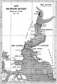
 Chart of the Arctic Coast, examined by J. Rae in 1851.png 4,541 × 2,096; 25.03 MB
-
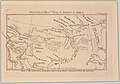 Discoveries of Messrs. Dease and Simpson in 1838-9 (14166789030).jpg 2,500 × 1,745; 1.78 MB
-

-
 Le Tour du monde-01-p260.jpg 1,940 × 2,848; 1.35 MB
_Chart_of_Parts_of_the_Arctic_Regions_-_as_known_in_1845.jpg)
_(14580238118).jpg)

.jpg)
.jpg)
