Category:19th-century maps of Somerset
Ceremonial counties of England: Bedfordshire · Berkshire · Buckinghamshire · Cambridgeshire · Cheshire · Cornwall · Cumbria · Derbyshire · Devon · Dorset · County Durham · East Riding of Yorkshire · East Sussex · Essex · Gloucestershire · London · Greater Manchester · Hampshire · Herefordshire · Hertfordshire · Isle of Wight · Kent · Lancashire · Leicestershire · Lincolnshire · Merseyside · Norfolk, England · North Yorkshire · Northamptonshire · Northumberland · Nottinghamshire · Oxfordshire · Rutland · Shropshire · Somerset · South Yorkshire · Staffordshire · Suffolk · Surrey · Tyne and Wear · Warwickshire · West Midlands (county) · West Sussex · West Yorkshire · Wiltshire · Worcestershire
City-counties: Bristol · City of London
Former historic counties: Cumberland · Huntingdonshire · County of London · Middlesex · North Riding of Yorkshire · Sussex · West Riding of Yorkshire · Westmorland · Yorkshire
Other former counties: Avon · Cambridgeshire and Isle of Ely · Cleveland · East Suffolk · Hereford and Worcester · Hexhamshire · Humberside · Huntingdon and Peterborough · Isle of Ely · Parts of Holland · Parts of Kesteven · Parts of Lindsey · Soke of Peterborough · West Suffolk
Media in category "19th-century maps of Somerset"
The following 13 files are in this category, out of 13 total.
-
 Aikin(1800) p394 - Somerset.jpg 1,910 × 1,104; 439 KB
-
 Ordnance Survey Drawings - Milverton (OSD 44-1).jpg 2,656 × 4,000; 5.05 MB
-

-
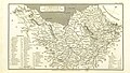 CAPPER(1825) p02.137 - Somerset.jpg 2,413 × 1,360; 1.01 MB
-

-
 CAPPER(1829) p798 - Somerset.jpg 2,464 × 1,394; 1,018 KB
-
 Pigot and Co (1842) p1.468 - Map of Somersetshire.jpg 2,160 × 1,293; 849 KB
-
 221 of 'Handbook to Bath' (11291356513).jpg 1,187 × 1,718; 356 KB
-
 387 of '(Our own country. Descriptive, historical, pictorial.)' (11209272384).jpg 1,911 × 1,747; 1.07 MB
-
 46 of 'Home Geography of England and Wales ... With ... maps, etc' (11223726854).jpg 1,284 × 2,087; 798 KB
-

-
 41 of '(Our own country. Descriptive, historical, pictorial.)' (11249133754).jpg 1,881 × 1,755; 1.14 MB
-

_p394_-_Somerset.jpg)
.jpg)
.jpg)
_p02.137_-_Somerset.jpg)
.jpg)
_p798_-_Somerset.jpg)
_p1.468_-_Map_of_Somersetshire.jpg)
.jpg)
%27_(11209272384).jpg)
.jpg)
%27_(11149787944).jpg)
%27_(11249133754).jpg)
%27_(11154515165).jpg)