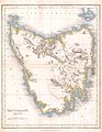
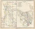
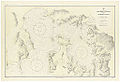
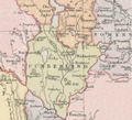
Category:19th-century maps of Tasmania
States of Australia: New South Wales · Queensland · South Australia · Tasmania · Victoria · Western Australia
Internal territories of Australia: Northern Territory
External territories of Australia:
Internal territories of Australia: Northern Territory
External territories of Australia:
Media in category "19th-century maps of Tasmania"
The following 36 files are in this category, out of 36 total.
-
 1837 Dower Map of Van Dieman's Land or Tasmania - Geographicus - Tazmania-dower-1837.jpg 2,551 × 3,288; 1.21 MB
-
-

-

-

-

-
 BOOTH(1873) 1.266 MAP OF TASMANIA.jpg 2,354 × 3,143; 1.56 MB
-

-

-
 1894 british survey.jpg 4,961 × 3,383; 3.6 MB
-

-

-

-
 211 of 'Pitman's Commercial Geography of the World' (11246899586).jpg 1,312 × 1,536; 579 KB
-
 Admiralty Chart No 105 Tasmania, River Derwent, Port Hobart, Published 1863.jpg 7,944 × 11,669; 25.69 MB
-
 Admiralty Chart No 1079 Tasmania, formerly Van Diemen Land, Australia, Published 1860.jpg 16,377 × 11,312; 67.13 MB
-

-
 Admiralty Chart No 1083 Burnett Harbour and Port Arthur, Published 1830.jpg 4,702 × 3,310; 3.25 MB
-
 Admiralty Chart No 1084 Kent's Group in Bass's Strait, Published 1803.jpg 3,005 × 4,019; 2.7 MB
-
 Admiralty Chart No 1475 Tasmania - South Coast. Port Arthur, Published 1893.jpg 6,046 × 8,083; 22.4 MB
-
 Admiralty Chart No 1629 Tasmania Macquarie Harbour, Surveyed 1819-1822.jpg 7,370 × 5,817; 7.44 MB
-

-
 Admiralty Chart No 1695b Bass Strait. Western sheet, Published 1868.jpg 8,288 × 12,058; 16.73 MB
-
 Admiralty Chart No 1706 Australia Bass Strait Banks Strait, Published 1845.jpg 5,830 × 7,834; 19.96 MB
-
 Admiralty Chart No 2102 Tasmania, Derwent River, Published 1851.jpg 5,592 × 7,411; 7.81 MB
-
 Admiralty Chart No 2130 Tasmania, Port Davey, Published 1852.jpg 5,800 × 7,602; 9.76 MB
-
 Barclay's Dictionary Van Dieman's Land.jpg 4,809 × 6,173; 18.5 MB
-
 Bass Strait 1898 nautical chart.jpg 8,461 × 12,407; 40.97 MB
-
 Map of Cornwall County, Tasmania 1886.png 477 × 281; 316 KB
-
 Map of Cumberland County (Tasmania) 1886.png 511 × 464; 389 KB
-
 Map of Lincoln County (Tasmanian) 1886.png 344 × 407; 318 KB
-
 Tasmania 1873.jpg 2,503 × 3,271; 1.33 MB
-

-
 Van Diemen's Land 1852.jpg 1,200 × 1,200; 211 KB
-
 WesternTasmania1865.jpg 1,248 × 1,534; 725 KB
-
 Westmoreland County (Tasmania) 1886.png 347 × 323; 280 KB


%27_(11038638054).jpg)
.jpg)

.jpg)
_1.266_MAP_OF_TASMANIA.jpg)
%27_(11099040193).jpg)
.jpg)

.jpg)
%27_(16403045280).jpg)
.jpg)
.jpg)


_1886.png)
_1886.png)

.jpg)


_1886.png)