Category:19th century maps of Ariège
Subcategories
This category has only the following subcategory.
1
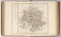
Media in category "19th century maps of Ariège"
The following 6 files are in this category, out of 6 total.
-

-

-

-

-
 Carte du département de l'Ariège - 1800.tif 11,572 × 7,165; 237.27 MB
-
 Dépt. de l'Ariège (région du sud) - Fonds Ancely - B315556101 A LEVASSEUR 012.jpg 3,045 × 2,045; 2.18 MB
%27_(11111894724).jpg)
%27_(11085925884).jpg)

_(La_France,_n%C2%B0_8)_-_Fonds_Ancely_-_B315556101_A_CARTES_2_001.jpg)
_-_Fonds_Ancely_-_B315556101_A_LEVASSEUR_012.jpg)