Category:19th century maps of Aude
Subcategories
This category has only the following subcategory.
1
Media in category "19th century maps of Aude"
The following 5 files are in this category, out of 5 total.
-

-

-
 1852 Levasseur Map of the Department L'Aude, France - Geographicus - Aude-levasseur-1852.jpg 3,500 × 2,543; 2.99 MB
-
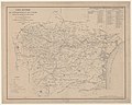 Carte routière du département de l'Aude - 1850.jpg 9,981 × 8,004; 10.98 MB
-
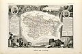 Dépt. de l'Aude (région du sud-est) - Fonds Ancely - B315556101 A LEVASSEUR 014.jpg 3,054 × 2,004; 1.99 MB
%27_(11113629504).jpg)
.jpg)


_-_Fonds_Ancely_-_B315556101_A_LEVASSEUR_014.jpg)