Category:2000s maps of Tennessee
| NO WIKIDATA ID FOUND! Search for 2000s maps of Tennessee on Wikidata | |
| Upload media |
States of the United States: Alabama · Alaska · Arizona · Arkansas · California · Delaware · Florida · Georgia · Hawaii · Idaho · Iowa · Louisiana · Maine · Maryland · Massachusetts · Michigan · Minnesota · Montana · Nebraska · New Hampshire · New Jersey · New York · North Carolina · Ohio · Pennsylvania · South Carolina · Tennessee · Texas · Utah · Virginia · West Virginia · Wyoming – Washington, D.C.
Media in category "2000s maps of Tennessee"
The following 8 files are in this category, out of 8 total.
-
 Appalachian-tennessee-arc-2003-status.jpg 344 × 160; 19 KB
-
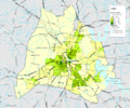 Nashville Population Density 2000.png 1,064 × 890; 112 KB
-
 Tennessee 2004.png 1,595 × 313; 367 KB
-
 Tennessee County Flips 2004.svg 810 × 206; 58 KB
-
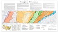 Tennessee Level IV ecoregions.pdf 5,400 × 3,000; 1.65 MB
-
 Tennessee ref 2001.jpg 710 × 207; 113 KB
-
 Tennessee wind resource map 50m 800.jpg 1,100 × 850; 421 KB
-
 TN06 109.gif 635 × 379; 39 KB


