Category:2003 aerial photographs of Canada
Media in category "2003 aerial photographs of Canada"
The following 24 files are in this category, out of 24 total.
-
 Aerial Halifax from NW.jpg 1,600 × 1,200; 362 KB
-
 Biencourt3.JPG 1,558 × 1,058; 204 KB
-
 Bloodvein River Manitoba.jpg 2,592 × 1,944; 1.6 MB
-
 Brigdenaerial.jpg 640 × 398; 99 KB
-
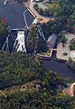
 Fort-Ingall.JPG 634 × 853; 116 KB
-
 Hastings County Archives 2017-91-20 (37110339713).jpg 2,344 × 1,588; 242 KB
-
 Hastings County Archives 2018-010 16 (26282016448).jpg 2,367 × 1,566; 380 KB
-

-
 Island Lake First Nations Community.jpg 2,592 × 1,944; 1.09 MB
-
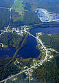
 Lac-des-Aigles.JPG 1,200 × 1,600; 242 KB
-
 Notre-Dame-du-Lac-1.JPG 1,200 × 1,600; 320 KB
-
 Notre-Dame-du-Lac.JPG 1,200 × 1,600; 181 KB
-
 Packington.JPG 1,154 × 1,528; 392 KB
-
 Red Sucker Lake First Nations.jpg 2,592 × 1,944; 1.3 MB
-
 Rivière-du-Loup-chutes.JPG 510 × 740; 99 KB
-
 Saint-Pierre-de-Lamy.JPG 1,433 × 1,054; 174 KB
-
 Squatec3.JPG 1,145 × 862; 121 KB
-
 St-Eusèbe.JPG 1,600 × 1,200; 293 KB
-
 St-Honoré-de-Témiscouata.JPG 1,537 × 845; 133 KB
-
 St-Marc.JPG 1,028 × 1,429; 1.22 MB
-
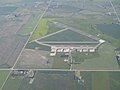 Swift Current Airport.jpg 2,048 × 1,536; 768 KB
-
 The Air Above Moncton (121641021).jpg 1,152 × 864; 114 KB
-
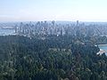 Vancouver from Air Stanley Park.jpg 2,048 × 1,536; 1.1 MB
-
 Yukon River 2003.jpg 1,600 × 1,200; 480 KB


.jpg)
.jpg)
.jpg)


.jpg)

