Category:2004 in the London Borough of Newham
Boroughs of London: City of London · City of Westminster · Barking and Dagenham · Barnet · Bexley · Brent · Bromley · Camden · Croydon · Ealing · Enfield · Greenwich · Hackney · Hammersmith and Fulham · Haringey · Harrow · Havering · Hillingdon · Hounslow · Islington · Kensington and Chelsea · Kingston · Lambeth · Lewisham · Merton · Newham · Redbridge · Richmond · Southwark · Sutton · Tower Hamlets · Waltham Forest · Wandsworth
Subcategories
This category has only the following subcategory.
C
- 2004 at London City Airport (7 F)
Media in category "2004 in the London Borough of Newham"
The following 19 files are in this category, out of 19 total.
-
 "Clean Snack Bar", Silvertown Way. Construction of DLR Extension, London E16 2004.jpg 1,716 × 1,175; 142 KB
-
 B90-25-RoyalAlbert-CIMG2192 (35816941403).jpg 2,304 × 1,712; 1.82 MB
-
 Clock Mill at Three Mills.jpg 800 × 600; 208 KB
-
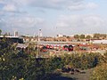
 DLR Viaduct, Gallions Reach - geograph.org.uk - 222773.jpg 640 × 447; 30 KB
-
 Gas holders at Beckton - geograph.org.uk - 89029.jpg 640 × 480; 133 KB
-
 Northwoolwichorigrear.jpg 597 × 396; 65 KB
-
 Prescott Channel, Bow Back Rivers - geograph.org.uk - 18073.jpg 640 × 480; 79 KB
-
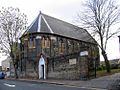
 St Matthew, Dyson Road, London E15 - geograph.org.uk - 1742813.jpg 1,000 × 704; 201 KB
-
 St Nicholas, Gladding Road, London E12 - geograph.org.uk - 1724110.jpg 1,000 × 749; 221 KB
-
 St Paul, Burges Road, London E6 - geograph.org.uk - 1742232.jpg 1,000 × 732; 228 KB
-
 St Paul, Burges Road, London E6 - geograph.org.uk - 1742235.jpg 1,000 × 760; 223 KB
-
 St Paul, Burges Road, London E6 - geograph.org.uk - 1742252.jpg 1,000 × 607; 161 KB
-
 St Paul, Burges Road, London E6 - geograph.org.uk - 1742257.jpg 849 × 1,000; 252 KB
-
 St Paul, Waddington Road, Stratford, London E15 - geograph.org.uk - 1747854.jpg 1,000 × 648; 197 KB
-
 St Paul, Waddington Road, Stratford, London E15 - geograph.org.uk - 1747856.jpg 1,000 × 767; 188 KB
-

-
-
 Tube train at Plaistow - geograph.org.uk - 913125.jpg 640 × 480; 90 KB
-
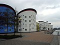 UEL Docklands Campus - geograph.org.uk - 89027.jpg 640 × 480; 99 KB

.jpg)


_-_geograph.org.uk_-_925903.jpg)

