Category:2006 maps of New Zealand
Media in category "2006 maps of New Zealand"
The following 12 files are in this category, out of 12 total.
-
 CanterburyRegionPopulationDensity.png 2,236 × 2,176; 255 KB
-
 New Zealand - DPLA - ac1e3b37458bf574a76d0d3b549cd790.jpg 2,556 × 3,252; 5.48 MB
-
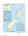
 New Zealand administrative divisions. LOC 2006628167.jpg 2,525 × 3,235; 653 KB
-
 New Zealand administrative divisions. LOC 2006628167.tif 2,525 × 3,235; 23.37 MB
-
 New Zealand Physiography.jpg 1,981 × 2,596; 1 MB
-
 New Zealand Transportation.jpg 1,981 × 2,596; 951 KB
-
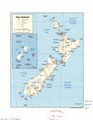
 New Zealand. LOC 2006628166.jpg 2,502 × 3,239; 718 KB
-
 New Zealand. LOC 2006628166.tif 2,502 × 3,239; 23.19 MB
-
 New Zealand. LOC 2006628337.jpg 2,524 × 3,250; 822 KB
-
 New Zealand. LOC 2006628337.tif 2,524 × 3,250; 23.47 MB
-
 NewZealandPopulationDensity.png 4,369 × 6,360; 1.46 MB
-
 TaranakiRegionPopulationDensity.png 665 × 792; 66 KB


