Category:2007 in the London Borough of Havering
Boroughs of London: City of London · City of Westminster · Barking and Dagenham · Barnet · Bexley · Brent · Bromley · Camden · Croydon · Ealing · Enfield · Greenwich · Hackney · Hammersmith and Fulham · Haringey · Harrow · Havering · Hillingdon · Hounslow · Islington · Kensington and Chelsea · Kingston · Lambeth · Lewisham · Merton · Newham · Redbridge · Richmond · Southwark · Sutton · Tower Hamlets · Waltham Forest · Wandsworth
Media in category "2007 in the London Borough of Havering"
The following 23 files are in this category, out of 23 total.
-
 Bedfords Park, Havering-atte-Bower - geograph.org.uk - 408237.jpg 640 × 480; 119 KB
-
 Bedfords Park, Havering-atte-Bower - geograph.org.uk - 408247.jpg 640 × 480; 112 KB
-
 Cotleigh Road - geograph.org.uk - 367629.jpg 640 × 480; 86 KB
-
 Gas Works, Nursery Walk - geograph.org.uk - 336388.jpg 640 × 480; 91 KB
-
 Gorse - geograph.org.uk - 408272.jpg 480 × 640; 120 KB
-
 Main Road, Gidea Park in 2007.jpg 640 × 493; 82 KB
-
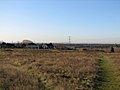
 Overlooking Jermains Wood - geograph.org.uk - 628154.jpg 640 × 480; 89 KB
-
 Queen Street - geograph.org.uk - 367642.jpg 640 × 480; 86 KB
-
 Queens theatre hornchurch roof.jpg 1,024 × 768; 160 KB
-
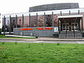 Queens theatre hornchurch.jpg 1,024 × 768; 148 KB
-
 Rainham Church 2007.jpg 2,048 × 1,536; 1.08 MB
-
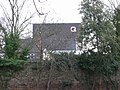
 Rainham Hall 2007.jpg 1,536 × 2,048; 1.37 MB
-
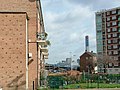
 Romford Brewery Chimney - geograph.org.uk - 340318.jpg 480 × 640; 37 KB
-

-
 Site of the former Hornchurch bus garage - geograph.org.uk - 441378.jpg 640 × 539; 100 KB
-
 Spring woodland - geograph.org.uk - 408260.jpg 480 × 640; 108 KB
-
 St Andrew's Church - geograph.org.uk - 367624.jpg 640 × 480; 98 KB
-
 St Andrew's Hornchurch.jpg 2,304 × 3,072; 881 KB
-
-
-
 Upminster Station geograph-4045561-by-Ben-Brooksbank.jpg 2,360 × 1,297; 2.97 MB
-
 Upminster tithe barn west.jpg 768 × 1,024; 83 KB
-
 Whitehall Woods Lake - geograph.org.uk - 607623.jpg 640 × 480; 77 KB


