Category:2008 in the London Borough of Hammersmith and Fulham
Boroughs of London: City of London · City of Westminster · Barking and Dagenham · Barnet · Bexley · Brent · Bromley · Camden · Croydon · Ealing · Enfield · Greenwich · Hackney · Hammersmith and Fulham · Haringey · Harrow · Havering · Hillingdon · Hounslow · Islington · Kensington and Chelsea · Kingston · Lambeth · Lewisham · Merton · Newham · Redbridge · Richmond · Southwark · Sutton · Tower Hamlets · Waltham Forest · Wandsworth
Subcategories
This category has the following 2 subcategories, out of 2 total.
C
Media in category "2008 in the London Borough of Hammersmith and Fulham"
The following 200 files are in this category, out of 266 total.
(previous page) (next page)-

-
 13 Lilac Street, W12 - geograph.org.uk - 682395.jpg 640 × 480; 61 KB
-
 1973 stock at Barons Court.JPG 1,600 × 1,200; 490 KB
-
 The Andover Arms, W6 - geograph.org.uk - 850456.jpg 640 × 480; 74 KB
-
 51 Masbro' Road, W14 - geograph.org.uk - 908416.jpg 480 × 640; 92 KB
-
 A3220 - West Cross Route, W12 - geograph.org.uk - 1026756.jpg 640 × 480; 52 KB
-
 Adelaide Grove III, W12 - geograph.org.uk - 850058.jpg 640 × 480; 78 KB
-
 Adelaide Grove IV, W12 - geograph.org.uk - 850069.jpg 640 × 480; 85 KB
-

-
 Aldine Street, W12 - geograph.org.uk - 688427.jpg 640 × 480; 74 KB
-
 Aldine Street, W12 - geograph.org.uk - 688449.jpg 640 × 480; 67 KB
-
 All Saint's Church - geograph.org.uk - 1088482.jpg 640 × 480; 81 KB
-
 All Saints Church, Fulham, Doorway - geograph.org.uk - 1039063.jpg 466 × 622; 178 KB
-
 All Saints Church, Fulham, Doorway - geograph.org.uk - 1039070.jpg 480 × 640; 196 KB
-
 All Saints Church, Fulham, Sign - geograph.org.uk - 1039060.jpg 640 × 480; 164 KB
-
-
 Apollo, Hammersmith, W6 (2477001686).jpg 1,280 × 960; 287 KB
-
 Arch in Tudor brick wall, Fulham Palace - geograph.org.uk - 835785.jpg 480 × 640; 112 KB
-
 Ariel Way I, W12 - geograph.org.uk - 1021899.jpg 640 × 480; 83 KB
-
 Arminger Road, W12 - geograph.org.uk - 836822.jpg 640 × 480; 78 KB
-
 Askew Crescent, W12 - geograph.org.uk - 710718.jpg 640 × 480; 71 KB
-
 Askham Court, W12 - geograph.org.uk - 824328.jpg 640 × 480; 77 KB
-
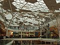 Atrium roof of Westfield - geograph.org.uk - 1041046.jpg 640 × 480; 110 KB
-
 Auckland House - White City estate - geograph.org.uk - 680283.jpg 640 × 480; 83 KB
-
 Australia Road 2 - White City Estate - geograph.org.uk - 679703.jpg 640 × 480; 100 KB
-
 Australia Road, White City Estate - geograph.org.uk - 835520.jpg 640 × 480; 136 KB
-
 Australia Road, White City Estate - geograph.org.uk - 849089.jpg 640 × 480; 76 KB
-

-

-
 Australian bar at Shepherd's Bush - geograph.org.uk - 725313.jpg 640 × 480; 76 KB
-
 Avonmore Hotel, W14 - geograph.org.uk - 655344.jpg 463 × 640; 79 KB
-
 Avonmore Road, W14 - geograph.org.uk - 655337.jpg 640 × 480; 99 KB
-
 Batman Close - geograph.org.uk - 680236.jpg 640 × 480; 93 KB
-

-
 Bentworth Road - geograph.org.uk - 680240.jpg 640 × 480; 74 KB
-
 Bishop Kings Road, W14 - geograph.org.uk - 655385.jpg 640 × 480; 81 KB
-
 Bishops-park.JPG 743 × 1,049; 323 KB
-
 Blue Peter garden.JPG 2,816 × 2,112; 1.53 MB
-
 Blue Plaque - geograph.org.uk - 655353.jpg 640 × 501; 96 KB
-
 Books for Amnesty, Hammersmith.jpg 1,600 × 1,200; 346 KB
-
 Boom, boom, boom, Esso Blue - geograph.org.uk - 917070.jpg 640 × 480; 114 KB
-
-
 Brook Green, W6 - geograph.org.uk - 860600.jpg 640 × 480; 101 KB
-
 Bus Stop - Westway - geograph.org.uk - 681825.jpg 480 × 640; 63 KB
-
 Bush Hall - geograph.org.uk - 710764.jpg 640 × 480; 61 KB
-
 Cafe Continente - geograph.org.uk - 655295.jpg 640 × 461; 90 KB
-
 Camera Clinic - geograph.org.uk - 655314.jpg 640 × 473; 93 KB
-

-
 Centaur Lodge Hotel - geograph.org.uk - 655359.jpg 480 × 640; 85 KB
-
 Central Line - geograph.org.uk - 892637.jpg 640 × 480; 94 KB
-
 Charing Cross Hospital - geograph.org.uk - 1039605.jpg 640 × 480; 161 KB
-

-
 Charing Cross Hospital, W6 - geograph.org.uk - 860573.jpg 640 × 480; 75 KB
-
 Chelsea Harbour Lock - geograph.org.uk - 863313.jpg 640 × 480; 92 KB
-
 Church of God - Loftus Road - geograph.org.uk - 681759.jpg 640 × 512; 85 KB
-
 Church, Westway - geograph.org.uk - 697094.jpg 480 × 640; 57 KB
-
 Cineworld cinema, King Street, W6 - geograph.org.uk - 822911.jpg 640 × 480; 59 KB
-
 Clematis Street, W12 - geograph.org.uk - 835554.jpg 480 × 640; 59 KB
-
 Cleverley Estate, W12 - geograph.org.uk - 849092.jpg 640 × 480; 64 KB
-

-

-

-
 Council Tow Truck - geograph.org.uk - 681789.jpg 640 × 512; 70 KB
-
 Craven Cottages, Hofland Road, W14 - geograph.org.uk - 859165.jpg 640 × 480; 89 KB
-

-
 Crocus, Wormholt Park - geograph.org.uk - 674853.jpg 640 × 480; 150 KB
-

-
 Do you want to know a secret^ - geograph.org.uk - 850419.jpg 640 × 480; 72 KB
-
 Dovecot in Bishop's Park - geograph.org.uk - 835683.jpg 480 × 640; 159 KB
-
 East Acton stn roundel.JPG 1,600 × 1,200; 620 KB
-
 East Acton Tube station - geograph.org.uk - 2255072.jpg 1,600 × 1,200; 569 KB
-

-
 Esso garage - Wood Lane, W12 - geograph.org.uk - 680857.jpg 640 × 480; 77 KB
-
 Ethelden Road, W12 - geograph.org.uk - 710838.jpg 640 × 480; 92 KB
-
 Exhibition Close - White City Road - geograph.org.uk - 679046.jpg 640 × 480; 116 KB
-

-
 Faroe Road, W14 - geograph.org.uk - 861806.jpg 640 × 480; 84 KB
-

-
 Filling station, Goldhawk Road - geograph.org.uk - 789006.jpg 640 × 480; 87 KB
-
 Fish and Chips, 1 St Elmo Road W12 - geograph.org.uk - 1076787.jpg 640 × 480; 67 KB
-
 Fishmonger, Askew Road - geograph.org.uk - 789023.jpg 640 × 479; 81 KB
-

-
 Fulham Broadway - geograph.org.uk - 2218709.jpg 1,600 × 1,200; 602 KB
-
 Fulham Broadway and Fulham Town Hall - geograph.org.uk - 864136.jpg 640 × 480; 81 KB
-
 Fulham Broadway stn high eastbound.JPG 1,600 × 1,200; 523 KB
-
 Fulham Broadway stn look eastbound.JPG 1,600 × 1,200; 512 KB
-
 Fulham Broadway stn look eastbound2.JPG 1,600 × 1,200; 514 KB
-
 Fulham Broadway stn look westbound2.JPG 1,600 × 1,200; 513 KB
-
 Fulham Broadway stn roundel.JPG 1,200 × 1,600; 610 KB
-

-
 Fulham Palace Meadow allotments - geograph.org.uk - 1088492.jpg 640 × 480; 120 KB
-
 Fulham Palace Road Cemetery, Chapel - geograph.org.uk - 1039594.jpg 470 × 628; 195 KB
-

-
 Fulham Palace, lawn by entrance - geograph.org.uk - 835675.jpg 640 × 480; 119 KB
-
 Fulham Town Hall, SW6 - geograph.org.uk - 1036256.jpg 640 × 480; 67 KB
-

-
 Fulham, Cedarne Road, SW6 - geograph.org.uk - 864349.jpg 640 × 480; 97 KB
-
 Fulham, The Gallery, SW6 - geograph.org.uk - 863378.jpg 640 × 480; 70 KB
-
 Fulham, West London Coroner's Court - geograph.org.uk - 863065.jpg 640 × 480; 96 KB
-

-
 Gate, Hammersmith, London (3103865539).jpg 1,600 × 1,200; 989 KB
-
 Goldhawk Rd London Underground Tube Station (1).jpg 1,600 × 1,200; 322 KB
-
 Halsbury Road and Ormiston Grove - geograph.org.uk - 711368.jpg 640 × 480; 92 KB
-
 Hammersmith (old) Fire Station, W6 - geograph.org.uk - 1020397.jpg 640 × 480; 112 KB
-
 Hammersmith Broadway 2008 06 19.jpg 3,632 × 2,428; 2.71 MB
-
 Hammersmith Flyover - geograph.org.uk - 1091630.jpg 640 × 480; 87 KB
-
 Hammersmith Flyover III, W6 - geograph.org.uk - 892594.jpg 640 × 480; 80 KB
-
 Hammersmith Flyover, W6 - geograph.org.uk - 890726.jpg 640 × 480; 75 KB
-
 Hammersmith Ram, Hammersmith, W6 (2447318284).jpg 960 × 1,280; 326 KB
-
 Hammersmith Town Hall - geograph.org.uk - 800792.jpg 640 × 480; 64 KB
-
 Hammersmith Town Hall in daylight - geograph.org.uk - 800796.jpg 640 × 480; 133 KB
-
-
-
 Harris's CafeRest.jpg 2,272 × 1,704; 1.46 MB
-
 Hart, Hammersmith, W6 (2447324098).jpg 1,280 × 960; 360 KB
-
 Hogarth Industrial Estate - geograph.org.uk - 787938.jpg 640 × 427; 62 KB
-

-
 Houses on Rivercourt Road, W6 - geograph.org.uk - 841297.jpg 640 × 480; 101 KB
-
 Imre Close, W12 - geograph.org.uk - 836866.jpg 640 × 480; 62 KB
-
 Imre Close, W12 - geograph.org.uk - 887188.jpg 640 × 480; 70 KB
-
 Joslings Close, W12 - geograph.org.uk - 849090.jpg 640 × 480; 58 KB
-
 King Street, W6 (1) - geograph.org.uk - 849106.jpg 640 × 480; 85 KB
-
 King Street, W6 (2) - geograph.org.uk - 849107.jpg 640 × 480; 72 KB
-
 King Street, W6 - geograph.org.uk - 822988.jpg 640 × 480; 56 KB
-
 King Street, W6 - geograph.org.uk - 965646.jpg 640 × 480; 68 KB
-
-
 La Piccola Cafe, King Street, W6 - geograph.org.uk - 849108.jpg 640 × 480; 96 KB
-
 Latymer Upper Playing Fields - geograph.org.uk - 681326.jpg 640 × 480; 56 KB
-
 Latymer Upper School, Hammersmith - geograph.org.uk - 841305.jpg 640 × 480; 97 KB
-

-
 Leigh Court, Avonmore Road - geograph.org.uk - 655371.jpg 480 × 640; 78 KB
-
 Lillie Road, SW6 - geograph.org.uk - 915665.jpg 640 × 446; 90 KB
-
 Linacre Court, W6 - geograph.org.uk - 861729.jpg 480 × 640; 69 KB
-
 Local corner shop - geograph.org.uk - 655290.jpg 640 × 491; 76 KB
-
 Loftus Road 4.jpg 3,072 × 2,304; 2.55 MB
-
 Loftus Road School End Sign.jpg 2,848 × 2,136; 2.91 MB
-
 Loftus Road shop.jpg 2,848 × 2,136; 3 MB
-
 Loftus Road Stadium, London - Shepherd's Bush.jpg 3,552 × 2,368; 4.02 MB
-
 Loftus road.jpg 1,024 × 768; 205 KB
-
 Lower Mall, W6 - geograph.org.uk - 841307.jpg 640 × 480; 79 KB
-
 Lugard House, W12 - geograph.org.uk - 889514.jpg 640 × 480; 83 KB
-
 Lycett Place, W12 - geograph.org.uk - 710794.jpg 640 × 480; 82 KB
-
 Maisonettes over garages, Hammersmith - geograph.org.uk - 934344.jpg 640 × 480; 100 KB
-

-
-
 Melville Court, Hammersmith - geograph.org.uk - 789002.jpg 640 × 480; 82 KB
-
 Mini roundabout - geograph.org.uk - 710885.jpg 640 × 480; 72 KB
-
 Modern flats on Uxbridge Road - geograph.org.uk - 699070.jpg 640 × 480; 83 KB
-
 New Testament Church of God Inc - geograph.org.uk - 872486.jpg 640 × 480; 89 KB
-

-

-
 Offices in Hammersmith Road, W14 - geograph.org.uk - 871296.jpg 640 × 480; 74 KB
-
 Oil tanks, Wandsworth Bridge - geograph.org.uk - 773902.jpg 480 × 640; 61 KB
-
 Old City Arms Hammersmith W6.jpg 960 × 1,280; 354 KB
-
 Ollgar Close, W12 - geograph.org.uk - 710681.jpg 640 × 480; 81 KB
-
 Olympia Rooms BandB - geograph.org.uk - 655334.jpg 640 × 494; 72 KB
-
 Orchard House - Sawley Road, W12 - geograph.org.uk - 679768.jpg 640 × 480; 86 KB
-
 Orchid Street - geograph.org.uk - 848741.jpg 640 × 480; 93 KB
-
 Paddington Arm, Grand Union Canal - geograph.org.uk - 787929.jpg 640 × 427; 61 KB
-
 Parsons Green station, 2008 - geograph.org.uk - 5620099.jpg 2,340 × 1,301; 3.11 MB
-
 Parsons Green stn roundel.JPG 1,600 × 1,200; 263 KB
-
 Parsons Green Underground Station - geograph.org.uk - 732425.jpg 640 × 480; 87 KB
-
 Pavement on King Street, W6 - geograph.org.uk - 849105.jpg 640 × 480; 99 KB
-

-

-
 Poor Hammersmith Palais, W6 - geograph.org.uk - 1021189.jpg 640 × 480; 112 KB
-
 Poplar Mews, W12 - geograph.org.uk - 922636.jpg 640 × 480; 78 KB
-
 Pryors Bank Cafe, Bishops Park - geograph.org.uk - 1038574.jpg 640 × 480; 210 KB
-
 Pulley, Townmead Road - geograph.org.uk - 773911.jpg 527 × 640; 111 KB
-
 Putney Bridge stn westbound platforms Fulham FC access closed.JPG 1,600 × 1,200; 499 KB
-
 Putney Bridge Underground Station - geograph.org.uk - 685230.jpg 640 × 480; 83 KB
-
 QPR FC - home end upper - geograph.org.uk - 836934.jpg 640 × 480; 56 KB
-
 QPR FC away end - geograph.org.uk - 833254.jpg 640 × 480; 61 KB
-
 QPR FC, Ellerslie Road stand - geograph.org.uk - 833245.jpg 640 × 480; 62 KB
-

-
 Queen's Club Gardens, W14 - geograph.org.uk - 860562.jpg 640 × 480; 82 KB
-
 Queens Park Rangers FC - geograph.org.uk - 836905.jpg 640 × 480; 79 KB
-
 Queensmill Road (where we parked) - panoramio.jpg 600 × 450; 31 KB
-
 Ravenscourt Arms, Hammersmith, W6 (2447322496).jpg 1,280 × 960; 334 KB
-
 Ravenscourt Park station Hammersmith.jpg 640 × 480; 52 KB
-
 Ravenscourt Park station II, W6 - geograph.org.uk - 1025108.jpg 640 × 480; 115 KB
-
 Ravenscourt Park station III, W6 - geograph.org.uk - 1025117.jpg 640 × 480; 117 KB
-
 River Thames by Bishop's Park - geograph.org.uk - 1088471.jpg 640 × 480; 102 KB
-
 Riverside Studios front windows.jpg 600 × 400; 112 KB
-
 Ruby Grand, King Street, W6 - geograph.org.uk - 849102.jpg 640 × 480; 85 KB
-
 Sands End Gasworks - geograph.org.uk - 863076.jpg 640 × 480; 61 KB
-
 Sands End Gasworks - geograph.org.uk - 937971.jpg 640 × 492; 61 KB
-

-
 Shared path - geograph.org.uk - 1039078.jpg 640 × 480; 157 KB
-
 Shepherd's Bush Green - geograph.org.uk - 688481.jpg 640 × 480; 98 KB
-
 Shepherd's Bush Market station II - geograph.org.uk - 1026788.jpg 640 × 427; 46 KB
-
 Shepherd's Bush Market stn roundel.JPG 1,200 × 1,600; 206 KB
-
 Shepherd's Bush Overground stn roundel.JPG 1,600 × 1,200; 608 KB
-

-
 Shepherd's Bush tube stn escalators.JPG 1,600 × 1,200; 605 KB
-
 Shepherd's Bush tube stn roundel.JPG 1,600 × 1,200; 603 KB
-
-

-

-
 Shops in Askew Road - geograph.org.uk - 711322.jpg 640 × 480; 91 KB
_Tube_Station_-_geograph.org.uk_-_872621.jpg)


.jpg)


.jpg)
.jpg)

_Fire_Station,_W6_-_geograph.org.uk_-_1020397.jpg)


.jpg)


_platforms_-_geograph.org.uk_-_960962.jpg)


.jpg)


_-_geograph.org.uk_-_849106.jpg)
_-_geograph.org.uk_-_849107.jpg)


_-_panoramio.jpg)
.jpg)


_-_geograph.org.uk_-_917101.jpg)


_-_geograph.org.uk_-_846443.jpg)


