Category:2009 in Pocklington
Subcategories
This category has only the following subcategory.
Media in category "2009 in Pocklington"
The following 57 files are in this category, out of 57 total.
-
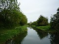 Above Giles Lock - geograph.org.uk - 1415118.jpg 640 × 480; 139 KB
-
 All Saints Church - geograph.org.uk - 1417313.jpg 640 × 480; 126 KB
-
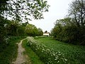 Approaching Top Lock - geograph.org.uk - 1415216.jpg 640 × 480; 190 KB
-
 B1246 towards Pocklington - geograph.org.uk - 1563722.jpg 640 × 480; 131 KB
-
 Burnby Hall Gardens lake - geograph.org.uk - 1363985.jpg 640 × 408; 90 KB
-
 Burnby Lane, near Pocklington - geograph.org.uk - 1568827.jpg 640 × 447; 199 KB
-
 Burnby Lane, near Pocklington - geograph.org.uk - 1568856.jpg 640 × 426; 204 KB
-
 Canal Head - geograph.org.uk - 1415493.jpg 640 × 480; 124 KB
-
 Canal Lane, Pocklington - geograph.org.uk - 1571510.jpg 640 × 426; 190 KB
-
 Come on me ducks - geograph.org.uk - 1363949.jpg 530 × 640; 80 KB
-
 Dean's Lane, Pocklington - geograph.org.uk - 1363977.jpg 640 × 480; 86 KB
-
 Downstream at Silburn Lock - geograph.org.uk - 1415155.jpg 640 × 480; 148 KB
-
 Dragon fly pond, Burnby Hall Gardens - geograph.org.uk - 1363933.jpg 640 × 437; 87 KB
-

-

-
 Entrance to Wood House - geograph.org.uk - 1416901.jpg 640 × 480; 115 KB
-
 George Street, Pocklington - geograph.org.uk - 1568840.jpg 640 × 426; 197 KB
-
 Giles Lock - geograph.org.uk - 1415125.jpg 640 × 480; 166 KB
-
 Grey Wagtail On Silburn Lock - geograph.org.uk - 1263140.jpg 640 × 480; 107 KB
-

-
 Old Courthouse, Pocklington - geograph.org.uk - 1568834.jpg 640 × 418; 208 KB
-
 Church of St Mary and St Joseph Pocklington.jpg 640 × 480; 73 KB
-
 Pocklington - geograph.org.uk - 1613778.jpg 640 × 480; 87 KB
-
 Pocklington Beck - geograph.org.uk - 1417009.jpg 480 × 640; 116 KB
-
 Pocklington Canal at Giles Lock - geograph.org.uk - 1569978.jpg 426 × 640; 172 KB
-
 Pocklington Canal from Top Lock - geograph.org.uk - 1415277.jpg 640 × 480; 196 KB
-
 Pocklington Fire Station.jpg 640 × 427; 198 KB
-

-
 Pocklington Market Place - geograph.org.uk - 1417322.jpg 640 × 480; 112 KB
-
 Pocklington Marketplace - geograph.org.uk - 1363966.jpg 640 × 512; 62 KB
-
 Pocklington railway station (site), Yorkshire (geograph 3578137).jpg 1,024 × 768; 137 KB
-
 Pocklington School - geograph.org.uk - 1417306.jpg 640 × 480; 196 KB
-
 Pond, Pocklington - geograph.org.uk - 1571513.jpg 426 × 640; 192 KB
-
 Rape growing next to The Mile - geograph.org.uk - 1417333.jpg 640 × 480; 104 KB
-
 Regent Street, Pocklington - geograph.org.uk - 1571538.jpg 640 × 593; 195 KB
-
 Silburn Lock - geograph.org.uk - 1415186.jpg 640 × 480; 186 KB
-
 Silburn Lock on Pocklington Canal - geograph.org.uk - 1569977.jpg 640 × 426; 181 KB
-

-
 The Chalkland Way - geograph.org.uk - 1250417.jpg 480 × 640; 169 KB
-
 The Chalkland Way - geograph.org.uk - 1250423.jpg 640 × 480; 105 KB
-
 The Chalkland Way at Pocklington Wood - geograph.org.uk - 1416917.jpg 640 × 480; 129 KB
-
 The Chalkland Way into Pocklington - geograph.org.uk - 1416963.jpg 640 × 480; 90 KB
-

-

-
 The end of the Pocklington canal - geograph.org.uk - 1415499.jpg 640 × 480; 152 KB
-

-
 Top Lock - geograph.org.uk - 1415253.jpg 640 × 480; 172 KB
-
 Top Lock and Canal Head - geograph.org.uk - 1415476.jpg 640 × 480; 181 KB
-
 Top Lock, Pocklington Canal - geograph.org.uk - 1569807.jpg 467 × 640; 212 KB
-
 Upstream of Silburn Lock - geograph.org.uk - 1415196.jpg 640 × 480; 150 KB
-
 View across to Pocklington - geograph.org.uk - 1416958.jpg 640 × 441; 56 KB
-
 View from Chapel Hill, Pocklington - geograph.org.uk - 1416956.jpg 640 × 480; 79 KB
-

-
 Wellington Oak - geograph.org.uk - 1415505.jpg 640 × 480; 180 KB
-
 Wellington Oak, Pocklington - geograph.org.uk - 1569979.jpg 640 × 426; 197 KB
-
 West Green - geograph.org.uk - 1417303.jpg 640 × 480; 186 KB
-
 Woodhouse Lane - geograph.org.uk - 1417337.jpg 640 × 480; 134 KB


_Arts_Centre.jpg)


,_Yorkshire_(geograph_3578137).jpg)


