Category:2009 maps of South America
Temperate regions: North America · South America · Africa · Europe · Asia · Oceania – Polar regions: – Other regions:
| ← 2000 2001 2002 2003 2004 2005 2006 2007 2008 2009 → |
Subcategories
This category has the following 2 subcategories, out of 2 total.
A
- 2009 maps of Argentina (8 F)
C
- 2009 maps of Chile (9 F)
Media in category "2009 maps of South America"
The following 5 files are in this category, out of 5 total.
-
Colias cesonia range map.PNG 501 × 666; 21 KB
-
Dakar-Rally-2009-stages.jpg 510 × 653; 66 KB
-
EVS map Robinson Crusoe Island.jpg 1,276 × 885; 351 KB
-
Unasur gross domestic product producto interno bruto.svg 11,178 × 9,938; 3.97 MB
-
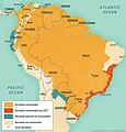
Yellow fever South America 2009.jpeg 1,222 × 1,280; 970 KB


