Category:2010 Chile earthquake maps
Media in category "2010 Chile earthquake maps"
The following 40 files are in this category, out of 40 total.
-
 2010 Arica earthquake.jpg 612 × 721; 120 KB
-
 2010 Biobío Shakemap.jpg 612 × 715; 103 KB
-
 2010 Chile earthquake epicenter.png 269 × 589; 112 KB
-
 2010 Chile earthquake NOAA tsunami projection 2010-02-27.png 1,005 × 726; 159 KB
-
 2010 Chile earthquake NOAA tsunami travel time projection 2010-02-27.jpg 900 × 894; 157 KB
-
 2010 chile shake map.jpg 612 × 713; 110 KB
-
 2010 Maule earthquake intensity USGS cropped.png 366 × 460; 317 KB
-
 2010 Maule earthquake intensity USGS v3.jpg 612 × 721; 103 KB
-
 2010 Maule earthquake intensity USGS-2.jpg 467 × 461; 246 KB
-
 2010 Maule earthquake intensity USGS.jpg 612 × 719; 110 KB
-
 2010 Maule earthquake location USGS-b.jpg 287 × 586; 65 KB
-
 2010 Maule earthquake location USGS.png 415 × 538; 93 KB
-
 2011 Araucanía earthquake shakemap.jpg 612 × 721; 105 KB
-
 4,9 Maule aftershock, March 24, 2010.jpg 414 × 537; 74 KB
-
 5.8 Pichilemu aftershock May 2 2010.jpg 612 × 707; 106 KB
-
 6.5 Bio Bio earthquake 14 July 2010.jpg 612 × 719; 110 KB
-
 Calama 2010 earthquake.jpg 411 × 481; 62 KB
-
 Chile 2010 tectonic2.JPG 248 × 227; 11 KB
-
 Chile provinces earthquake dead.png 3,236 × 3,512; 516 KB
-
 Chile Quake Warning Area 2010-Easter Island partially evacuated.svg 940 × 477; 1.66 MB
-
 Chile Quake Warning Area 2010.svg 940 × 477; 1.67 MB
-
Chile-tsunami-20100227-NCTR-wave-propagation-small.ogv 1 min 15 s, 320 × 280; 3.63 MB
-
Chile-tsunami-20100227-NCTR-wave-propagation.ogv 1 min 15 s, 713 × 632; 18.84 MB
-
 Haze Over Santiago Following 8,8 Earthquake.jpg 3,640 × 4,552; 2.14 MB
-
 Intensity 6.4 Tirúa.jpg 612 × 720; 104 KB
-
 March 11 2010 aftershocks.gif 460 × 499; 36 KB
-
 March 2010 Calama earthquake intensity USGS.jpg 612 × 712; 126 KB
-
 March 2010 Chile earthquake intensity USGS.jpg 612 × 712; 107 KB
-
 Offshore Biobio Chile 20110211 2005 shakemap.jpg 612 × 716; 105 KB
-
 PAGER report example.jpg 630 × 809; 260 KB
-
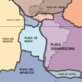
 Placas Sudamericanas.png 588 × 579; 1,000 KB
-
 Shakemap BíoBío Chile, 23 April 2010.jpg 612 × 715; 113 KB
-
 South American plates zh.png 588 × 579; 101 KB
-
 South American plates-es.png 1,440 × 1,423; 506 KB
-
 South American plates.png 1,440 × 1,423; 699 KB
-
 Terremoto de Chile de 2010.svg 600 × 583; 181 KB
-
 Toque de queda por terremoto de 2010.svg 350 × 800; 1.65 MB
-
 Tsunami en Constitución.svg 950 × 774; 111 KB
-
 Víctimas del terremoto de Chile de 2010.svg 800 × 350; 1.37 MB
-
 Zh South-American-plates.png 588 × 579; 28 KB


