Category:2010 in the Royal Borough of Kingston upon Thames
Boroughs of London: City of London · City of Westminster · Barking and Dagenham · Barnet · Bexley · Brent · Bromley · Camden · Croydon · Ealing · Enfield · Greenwich · Hackney · Hammersmith and Fulham · Haringey · Harrow · Havering · Hillingdon · Hounslow · Islington · Kensington and Chelsea · Kingston · Lambeth · Lewisham · Merton · Newham · Redbridge · Richmond · Southwark · Sutton · Tower Hamlets · Waltham Forest · Wandsworth
Media in category "2010 in the Royal Borough of Kingston upon Thames"
The following 28 files are in this category, out of 28 total.
-
 Kingston railway station MMB 01 455716.jpg 3,863 × 2,505; 2.44 MB
-
 Aldridge Rise, Old Malden - geograph.org.uk - 1985660.jpg 640 × 480; 77 KB
-
 Anglesea Road, Kingston upon Thames - geograph.org.uk - 2147052.jpg 4,320 × 3,240; 3.52 MB
-
 Bandstand, Canbury Gardens - geograph.org.uk - 2140736.jpg 640 × 430; 157 KB
-
 Bentalls Shopping Centre interior.jpg 2,459 × 3,688; 1.99 MB
-
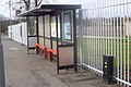 Bus shelter on Garrison Lane - geograph.org.uk - 1692316.jpg 2,186 × 1,458; 781 KB
-
 Chessington Methodist Church - geograph.org.uk - 1701117.jpg 2,848 × 2,144; 1.53 MB
-
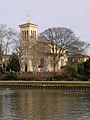
 St Mary's Church, Chessington - geograph.org.uk - 1692309.jpg 2,848 × 2,144; 1.52 MB
-
 Copt Gilder - geograph.org.uk - 1692304.jpg 2,848 × 2,144; 1.52 MB
-

-
 Disused petrol station on the Leatherhead Road - geograph.org.uk - 1690760.jpg 2,848 × 2,144; 1.52 MB
-
 Fast train through New Malden - geograph.org.uk - 1820921.jpg 640 × 480; 194 KB
-
 Garrison Lane, Chessington - geograph.org.uk - 1692313.jpg 2,848 × 2,144; 1.5 MB
-
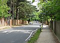 George Road - geograph.org.uk - 1861364.jpg 640 × 464; 246 KB
-
 Ladderstile Ride in snow - geograph.org.uk - 2186415.jpg 768 × 1,024; 190 KB
-
 Norbiton railway station - geograph.org.uk - 2062126.jpg 2,048 × 1,536; 1.12 MB
-
 Norbiton station signage 2010.JPG 2,592 × 1,944; 1.18 MB
-
 Rushett Farm and Telegraph Hill - geograph.org.uk - 1652466.jpg 640 × 480; 78 KB
-

-
 South Park Grove - geograph.org.uk - 1659089.jpg 640 × 480; 62 KB
-
 St Mary's C of E Primary School - geograph.org.uk - 1735423.jpg 640 × 480; 69 KB
-
 St Raphael's Church, Surbiton - geograph.org.uk - 1690471.jpg 1,536 × 2,048; 593 KB
-
 St. Pauls Church, Alexandra Road, Kingston Hill (geograph 1968765).jpg 800 × 600; 114 KB
-
 Surbiton station signage 2010.JPG 2,592 × 1,944; 1.25 MB
-

-
 The Harrow public house on the Leatherhead Road - geograph.org.uk - 1690756.jpg 1,939 × 2,841; 1.16 MB
-
 Tolworth tower gigapixel panorama.jpg 28,000 × 4,762; 32.22 MB
-
 Woodlands Avenue - geograph.org.uk - 1861306.jpg 640 × 401; 155 KB


.jpg)


.jpg)


