Category:2010s maps of England
Media in category "2010s maps of England"
The following 46 files are in this category, out of 46 total.
-
 African Sheffield 2011 census.png 25,490 × 17,669; 13.15 MB
-
 Arab Sheffield 2011 census.png 25,406 × 17,611; 13.05 MB
-
 Asian Sheffield 2011 census.png 25,490 × 17,670; 13.08 MB
-
 Bangladeshi Sheffield 2011 census.png 25,406 × 17,611; 13 MB
-
 Barton ward in Canterbury 2015.svg 1,076 × 1,266; 503 KB
-
 Beltinge ward in Canterbury 2015.svg 1,076 × 1,266; 504 KB
-
 Black Sheffield 2011 census.png 25,406 × 17,611; 12.64 MB
-
 Blean Forest ward in Canterbury 2015.svg 1,076 × 1,266; 504 KB
-
 British Sheffield 2011 census.png 25,490 × 17,669; 11.93 MB
-
 Buddhism Sheffield 2011 census.png 25,322 × 17,553; 13.3 MB
-
 Canterbury UK local election 2011 map.svg 1,076 × 1,266; 459 KB
-
 Canterbury UK local election 2015 map.svg 1,076 × 1,266; 505 KB
-
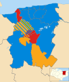 Canterbury UK local election 2019 map.svg 1,076 × 1,266; 505 KB
-
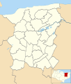 Canterbury UK parish map 2011 (blank).svg 1,076 × 1,266; 461 KB
-
 Canterbury UK ward map 2010 (blank).svg 1,076 × 1,266; 455 KB
-
 Canterbury UK ward map 2015 (blank).svg 1,076 × 1,266; 503 KB
-
 Canterbury unparished area UK locator map.svg 1,076 × 1,266; 453 KB
-
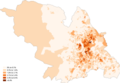 Caribbean Sheffield 2011 census.png 25,406 × 17,611; 13.33 MB
-
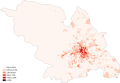 Chinese Sheffield 2011 census.png 25,406 × 17,611; 13.12 MB
-
 Christianity Sheffield 2011 census.png 25,574 × 17,727; 13.07 MB
-
 City of York Council election 2011 map.svg 1,376 × 1,345; 383 KB
-
 City of York Council election 2015 map.svg 1,516 × 1,483; 468 KB
-
 Gleadless Valley OSM.png 721 × 790; 186 KB
-
 Hinduism Sheffield 2011 census.png 25,406 × 17,611; 13.14 MB
-
 Indian Sheffield 2011 census.png 25,406 × 17,611; 13.24 MB
-
 Sheaf Square OSM.png 459 × 307; 53 KB
-
 Sheffield City Council election, 2018.svg 1,425 × 996; 683 KB
-
 Sheffield City Council election, 2019.svg 1,425 × 996; 683 KB
-
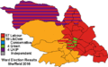
 Sheffield City Council New Wards 2016.png 660 × 455; 15 KB
-
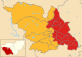
 Sheffield City Region map.svg 1,108 × 1,345; 502 KB
-
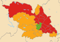
 Sheffield local election map 2016.gif 512 × 320; 7 KB
-
 Sheffield UK local election 2010 map.svg 1,425 × 996; 641 KB
-
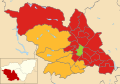 Sheffield UK local election 2011 map.svg 1,425 × 996; 641 KB
-
 Sheffield UK ward map 2010 (blank).svg 1,425 × 996; 641 KB
-
 Sheffield UK ward map 2016 (blank).svg 1,425 × 996; 722 KB
-
 Sheffield unparished area UK locator map.svg 1,425 × 996; 415 KB
-
 Sheffield-Green-Belt.svg 1,717 × 1,043; 2.18 MB
-
 SheffieldUrbanArea.svg 712 × 615; 125 KB
-
 Southampton UK local election 2010 map.svg 1,425 × 1,226; 269 KB
-
 Southampton UK local election 2011 map.svg 1,425 × 1,226; 269 KB
-
 Southampton UK local election 2012 map.svg 1,425 × 1,226; 271 KB
-
 Southampton UK local election 2014 map.svg 1,425 × 1,226; 268 KB
-
 Southampton UK local election 2016 map.svg 1,425 × 1,226; 269 KB
-
 Southampton UK local election 2018 map.svg 1,425 × 1,226; 268 KB
-
 Southampton UK local election 2019 map.svg 1,425 × 1,226; 271 KB
-
 Whitstable and Herne Bay unparished area UK locator map.svg 1,076 × 1,266; 453 KB


.svg)
.svg)
.svg)
.svg)
.svg)