Category:2011 aerial photographs of Canada
Media in category "2011 aerial photographs of Canada"
The following 200 files are in this category, out of 245 total.
(previous page) (next page)-
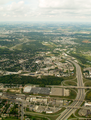
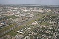 16 Avenue N Barlow Calgary.jpg 1,728 × 1,152; 548 KB
-
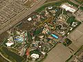 Aerial Canadas Wonderland May 2011.jpg 4,608 × 3,456; 4.27 MB
-
 Aerial picture of Canwood, Saskatchewan, Canada 23-apr-2011.jpg 2,500 × 1,388; 1.18 MB
-
 Aerial Wonderland May 2011.jpg 4,608 × 3,456; 4.6 MB
-
 Agassiz ice cap.jpg 2,640 × 1,980; 503 KB
-
 Agricultural Patterns, Quebec - NASA Earth Observatory.jpg 720 × 480; 244 KB
-
 Airplane approaching Toronto skyline.jpg 2,800 × 1,867; 387 KB
-
 Alberta, Canada, spring, 23 April 2011 - Flickr - PhillipC (1).jpg 4,288 × 2,848; 4.63 MB
-
 Alberta, Canada, spring, 23 April 2011 - Flickr - PhillipC.jpg 4,288 × 2,848; 3.94 MB
-
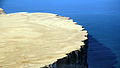
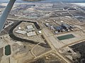 ALBIAN SANDS 2011 (5743426517).jpg 4,288 × 3,216; 1.83 MB
-
 Amadjuak Bay.jpg 2,400 × 1,880; 2.66 MB
-
 Approaching Pangnirtung by air.jpg 1,500 × 1,125; 801 KB
-
 Approaching Runway 31 Arctic Bay.jpg 2,592 × 1,833; 3.71 MB
-
 Approche à Baie-Comeau (CYBC) (5953456076) (2).jpg 2,592 × 1,456; 523 KB
-
 Approche à Mont-Joli (CYYY) (5948334821) (2).jpg 2,592 × 1,456; 499 KB
-
 Approche à Mont-Joli (CYYY) (5948335471) (2).jpg 2,592 × 1,456; 536 KB
-
 Approche à Mont-Joli (CYYY) (5948336115) (2).jpg 2,592 × 1,456; 451 KB
-
 Approche à Mont-Joli (CYYY) (5948336727) (2).jpg 2,592 × 1,456; 456 KB
-
 Arctic bay townsite.jpg 2,592 × 1,944; 3.5 MB
-
 Area north of Shelburne, Nova Scotia.JPG 2,592 × 1,944; 1.93 MB
-
 ASTER Fundy National Park.jpg 1,122 × 737; 891 KB
-
 Attawapiskat Town between Attawapiskat River.jpg 640 × 480; 28 KB
-
 Aéroport de Trois-Rivières vu des airs.jpg 1,871 × 1,243; 401 KB
-
 BC forestry (6997952937).jpg 4,288 × 2,848; 4.79 MB
-
 BC forestry (6998035791).jpg 3,789 × 2,526; 4.35 MB
-
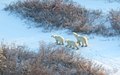 Bears (6357719805).jpg 1,937 × 1,216; 670 KB
-
 Beautiful Arctic (5878501402).jpg 2,880 × 2,160; 590 KB
-
 Beechey Island (5878501408).jpg 2,880 × 2,160; 536 KB
-
 Bella Coola trip - Hunlen falls & Turner Lake from the air (5892383171).jpg 5,616 × 3,744; 13.28 MB
-
 Bending the Country.jpg 2,339 × 1,417; 1.25 MB
-
 Brookwood camp (5975574123).jpg 4,288 × 3,216; 6.79 MB
-
 Brookwood camp (5975579133).jpg 4,288 × 3,216; 6.12 MB
-
 Bulkley River.jpg 4,288 × 2,848; 3.56 MB
-
 Buttonville airport aerial view.jpg 1,920 × 1,080; 606 KB
-
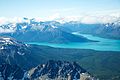
 Canadian Rockies (6450213743).jpg 4,272 × 2,848; 1.74 MB
-
 Cherry Point.jpg 1,600 × 1,200; 766 KB
-
 Chilko Lake 1.jpg 4,288 × 2,848; 2.42 MB
-
 Chilko Lake 2 (6852085144).jpg 4,288 × 2,848; 2.51 MB
-
 Chilko Lake 4.jpg 4,288 × 2,848; 2.9 MB
-
 Citadel hill.jpg 897 × 504; 93 KB
-
 Citadelle qc aerien.JPG 3,648 × 2,736; 2.33 MB
-
 Cliffs near Arctic Bay.jpg 2,592 × 1,944; 5.24 MB
-
 Closeup of the cliffs.jpg 5,136 × 2,928; 3.28 MB
-
 CloverleafMountain.jpg 4,109 × 2,739; 4.57 MB
-
 CN Tower and Rogers Centre May 2011.jpg 531 × 800; 310 KB
-
 Collège champigny aerien.JPG 3,648 × 2,736; 2.44 MB
-
 Comox BC aerial view.jpg 1,806 × 614; 305 KB
-
 Conestoga and Freeport interchange Aerial (6235760469).png 3,264 × 2,448; 10.76 MB
-
 Conestoga Parkway North.png 2,448 × 3,215; 9.37 MB
-
 Copper Estates, Terrace.jpg 2,848 × 3,693; 4.15 MB
-
 CrossIrons Mills.JPG 640 × 480; 144 KB
-
 Cruise ship moored in Kimmirut Harbour.jpg 2,400 × 1,751; 1.88 MB
-
 CYQI Rwy24.jpg 990 × 618; 168 KB
-
 Deerfoot Trail at 17 Ave SE 2.jpg 1,728 × 1,152; 547 KB
-
 Deerfoot Trail at 17 Ave SE.jpg 1,395 × 847; 383 KB
-
 Denman Island from Comox.jpg 506 × 264; 137 KB
-
 Dorthy Lake and Chilko Lake.jpg 2,790 × 4,201; 2.7 MB
-
 Downsview Airport 2011.jpg 3,648 × 2,736; 2.95 MB
-
 Downtown Waterloo.png 3,264 × 2,448; 9.93 MB
-
 Dundalk Ontario.jpg 4,503 × 3,002; 3.98 MB
-

-
 Enderby, BC (5509577763).jpg 4,272 × 2,848; 10.51 MB
-
 Eureka station.jpg 2,640 × 1,980; 871 KB
-
 FangPeakGlacier.jpg 4,288 × 2,848; 2.91 MB
-
 Final for Resolute Bay Airport.jpg 2,592 × 1,944; 1.44 MB
-
 Final Runway 32.jpg 3,648 × 2,736; 3.73 MB
-
 Five Finger Rapids Yukon River 110808-2.jpg 3,648 × 1,531; 5.91 MB
-
 Flight from Charlottetown to Halifax. Over Prince Edward Island (471472) (9448058949).jpg 3,410 × 1,918; 1.46 MB
-
 Fort mcmurray (5743874131).jpg 4,288 × 3,216; 1.84 MB
-
 Fort McMurray (5756907865).jpg 3,216 × 4,288; 3.29 MB
-
 Fort Mcmurray (5756909423).jpg 4,288 × 3,216; 2.33 MB
-
 Fort mcmurray 2011 (5743864187).jpg 4,288 × 3,216; 1.73 MB
-
 Fort mcmurray 2011 (5744414972).jpg 4,288 × 3,216; 2.23 MB
-
 Fort Mcmurray.jpg 4,288 × 3,216; 1.92 MB
-
 Fort Nelson Airport, BC.jpg 1,850 × 1,425; 1.67 MB
-
 Fox 5 North Warning Site.jpg 2,592 × 1,944; 1.05 MB
-
 Garibaldi Park.JPG 2,592 × 1,936; 1.76 MB
-
 Glacial rebound on Southhampton Island, Nunavut.jpg 1,818 × 2,400; 2.42 MB
-

-
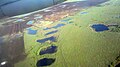
 Glaciofluvial.jpg 2,400 × 2,119; 2.09 MB
-
 Grand River north of Waterloo.png 3,264 × 2,448; 10.86 MB
-
 Hanging out, waiting for the sea ice to form (6360200363).jpg 5,184 × 3,456; 7.59 MB
-
 Hanlon Parkway interchange.png 3,264 × 1,014; 4.34 MB
-
 Headwaters of Dean River 1.jpg 1,600 × 1,200; 683 KB
-
 Headwaters of Dean River 2.jpg 1,600 × 1,200; 1.12 MB
-
 Headwaters of Dean River 3.jpg 4,288 × 2,848; 4.74 MB
-
 Hespeler Bypass.png 2,448 × 3,264; 10.09 MB
-
 Highway 24 west of Guelph.png 3,264 × 2,448; 10.26 MB
-
 Highway 401 and Freeport Diversion facing east.png 3,264 × 2,448; 10.64 MB
-
 Highway 401 at Yonge St. (6403115507).jpg 2,500 × 1,625; 3.76 MB
-
 Highway 8 and Freeport Diversion facing south.png 2,350 × 3,095; 8.42 MB
-
 Highway 85 southbound into Conestoga Parkway.png 2,448 × 2,877; 7.68 MB
-
 Hillsdale Ontario.jpg 3,072 × 2,304; 2.16 MB
-
 In flight (5447130403).jpg 1,936 × 2,592; 3.28 MB
-
 In flight (5447149567).jpg 1,936 × 2,592; 3.23 MB
-
 In flight (5447150275).jpg 1,936 × 2,592; 3.43 MB
-
 In flight (5447151685).jpg 1,936 × 2,592; 2.79 MB
-
 In flight (5447154577).jpg 1,936 × 2,592; 2.77 MB
-
 In flight (5447156145).jpg 1,200 × 1,200; 817 KB
-
 In flight (5447161147).jpg 1,936 × 2,592; 3.36 MB
-
 In flight (5447752336).jpg 1,936 × 2,592; 3.05 MB
-
 In flight (5447754272).jpg 1,936 × 2,592; 3.2 MB
-
 In flight (5447758352).jpg 2,592 × 1,936; 3.01 MB
-
 In flight (5447758866).jpg 1,936 × 2,592; 2.48 MB
-
 In flight (5447759668).jpg 1,936 × 2,592; 2.74 MB
-
 In flight (5447763548).jpg 1,936 × 2,592; 2.88 MB
-
 In flight (5447764842).jpg 2,592 × 1,936; 3.63 MB
-
 In flight (5447765258).jpg 1,936 × 2,592; 2.95 MB
-
 In flight (5447766002).jpg 1,936 × 2,592; 3.6 MB
-
 In flight (5447770726).jpg 2,592 × 1,936; 1.73 MB
-
 Installations sportives culturelles Caraquet.jpg 3,648 × 2,431; 1.92 MB
-
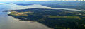
 Islands Off of Labrador.jpg 4,320 × 3,240; 4.64 MB
-
 J27839 LuckyLakeSK 20110926-150231.jpg 1,125 × 1,669; 184 KB
-
 J27996 TemiscamingQC 20110926-173301.jpg 1,500 × 1,174; 452 KB
-
 Kearl lake.jpg 4,288 × 3,216; 1.86 MB
-
 Knight Inlet 1.jpg 4,020 × 2,680; 2.76 MB
-
 Knight Inlet 3.jpg 3,852 × 2,558; 2.36 MB
-
 Knight Inlet 4.jpg 2,570 × 3,855; 3.27 MB
-
 Knight Inlet 5.jpg 4,266 × 2,834; 3.03 MB
-
 La Citadelle de Québec, vue du ciel.JPG 4,288 × 2,848; 2.11 MB
-
 La rencontre de deux rivières.JPG 3,648 × 2,736; 2.28 MB
-
 La Vérendrye du ciel.png 2,021 × 1,357; 4.52 MB
-
 Lac Brûlé (Alberta).jpg 845 × 730; 274 KB
-
 Lac Saint-Pierre dans le fleuve Saint-Laurent.jpg 2,805 × 1,863; 826 KB
-
 Lagunes Caraquet.jpg 3,648 × 2,736; 2.66 MB
-
 Lansdowne Ariel.jpg 878 × 313; 81 KB
-
 Leopold Island looking west.jpg 4,920 × 2,984; 6.61 MB
-
 London Ontario Urban Sprawl.jpg 768 × 1,024; 792 KB
-
 Mackenzie Mountains - aerial - P1040561.JPG 2,048 × 1,536; 1.21 MB
-
 Mackenzie Mountains - north of Backbone Peak - detail - P1040560.JPG 2,048 × 1,536; 1.22 MB
-
 Mackenzie Mountains - north of Backbone Peak - P1040559.JPG 2,048 × 1,536; 1.13 MB
-
 Mackenzie Mountains - not far from Sayunei Peak - detail - P1040555.JPG 2,048 × 1,536; 1.34 MB
-
 Mackenzie Mountains - not far from Sayunei Peak - P1040554.JPG 2,048 × 1,536; 1.42 MB
-
 Martin Lake1.jpg 4,288 × 2,848; 3.45 MB
-
 Martin Lake2.jpg 4,288 × 2,848; 2.96 MB
-
 Maryhill, Ontario.png 3,264 × 2,448; 14.13 MB
-
 May 2011 Wildfires in Alberta, Canada.jpg 5,560 × 4,448; 5.26 MB
-
 Mississauga downtown.jpg 1,920 × 1,080; 819 KB
-
 Mississauga Valleys Park.jpg 1,920 × 1,080; 806 KB
-
 Moncton & Fundy National Park.jpg 879 × 738; 661 KB
-
 Moricetown1.jpg 4,288 × 2,848; 4.87 MB
-
 Moricetown2.jpg 4,288 × 2,848; 4.03 MB
-
 Mt Tuam.jpg 1,600 × 1,200; 566 KB
-
 Nanaimo Airport YCD arial.jpg 3,872 × 2,450; 2.74 MB
-
 Near Clyde River.jpg 2,538 × 1,689; 3.39 MB
-
 Neebish Island, Michigan.JPG 1,936 × 2,608; 6.03 MB
-
 New Arctic Bay Airport.jpg 2,430 × 1,752; 3.65 MB
-
 Nexon (5975510863).jpg 4,288 × 3,216; 6.31 MB
-
 Nexon (5976131382).jpg 4,288 × 3,216; 4.28 MB
-
 Nexon plant (5975529273).jpg 3,216 × 4,288; 6.4 MB
-
 Nexon plant (5975545797).jpg 4,288 × 3,216; 6.94 MB
-
 Nexon plant (5975565915).jpg 4,288 × 3,216; 4.59 MB
-
 Nexon plant (5976077206).jpg 4,288 × 3,216; 5.33 MB
-
 Nexon plant (5976081182).jpg 4,288 × 3,216; 4.88 MB
-
 Nexon plant (5976086516).jpg 4,288 × 3,216; 6.45 MB
-
 Nexon plant (5976097074).jpg 4,288 × 3,216; 6.73 MB
-
 Nexon plant (5976102270).jpg 4,288 × 3,216; 6.37 MB
-
 Nexon plant site (5975558699).jpg 4,288 × 3,216; 4.25 MB
-
 Nexon plantsite (5976113816).jpg 4,288 × 3,216; 6.92 MB
-
 Nexon plantsite (5976117392).jpg 4,288 × 3,216; 4.3 MB
-
 Niakwa Country Club - panoramio.jpg 4,320 × 3,240; 5.53 MB
-
 Niakwa Country Club and sky line - panoramio.jpg 4,320 × 3,240; 5.08 MB
-
 Norman Wells, NWT.JPG 4,912 × 3,264; 3.9 MB
-
 Nunavut dyke.jpg 3,008 × 2,000; 3.05 MB
-
 Nunavut set fra flyet - 2.jpg 1,920 × 1,280; 1.35 MB
-
 Nunavut set fra flyet - 3.jpg 1,920 × 1,280; 1.97 MB
-
 Nunavut set fra flyet.jpg 1,920 × 1,280; 1.27 MB
-
 Ogilvie Mountains east of Boundary, YK - P1040576.JPG 2,048 × 1,536; 1.38 MB
-
 Ontario Highway 400 and 401 interchange.JPG 3,648 × 2,736; 3.45 MB
-
 P1000273 (7041383933).jpg 3,517 × 2,010; 5.7 MB
-
 P1000278 (6895288136).jpg 2,036 × 2,377; 3.29 MB
-
 P1000290 (6895289866).jpg 3,227 × 2,097; 4.71 MB
-
 P1000598 (7041523599).jpg 3,648 × 2,736; 7.19 MB
-
 P1000601 (7041528209).jpg 2,736 × 3,106; 7.01 MB
-
 P1000602 (6895433324).jpg 3,648 × 2,736; 6.76 MB
-
 P1000612 (6895434874).jpg 3,648 × 2,090; 3.98 MB
-
 P1000614 (7041533901).jpg 3,648 × 2,097; 3.98 MB
-
 P1000619 (7041536393).jpg 3,648 × 2,308; 7.11 MB
-
 P1000627 (7041538021).jpg 3,648 × 2,010; 4.42 MB
-
 Pangnirtung Nu 4.jpg 2,048 × 1,536; 803 KB
-
 Pangnirtung Nu 5.jpg 2,048 × 1,382; 596 KB
-
 Parc industriel Caraquet.jpg 3,648 × 2,736; 2.15 MB
-
 Patterson Lake.jpg 4,136 × 2,756; 2.79 MB
-
 Play time (6360309789).jpg 1,954 × 2,493; 1.98 MB
-
 Pointe-Rocheuse Caraquet.jpg 3,648 × 2,736; 2.05 MB
-
 Port de Caraquet 12.jpg 3,179 × 2,116; 1.16 MB
-
 Port Huron and Sarnia from United 643 (6304785099).jpg 1,600 × 1,200; 221 KB
-
 Preserving energy (6360538253).jpg 3,001 × 1,969; 2.44 MB
-
 Prince Leopold Island.jpg 4,932 × 3,180; 2.83 MB
-
 River valley east of Ogilvie Mountains - Dempster Hwy - P1040569.JPG 2,048 × 1,536; 1.34 MB
-
 River valley east of Ogilvie Mountains - P1040570.JPG 2,048 × 1,536; 1.37 MB
-
 Road to Mary River.jpg 2,475 × 1,944; 3.93 MB
-
 Rogers Centre May 2011.jpg 800 × 531; 248 KB
-
 Sault Ste Marie, Ontario and Michigan.JPG 2,848 × 4,288; 8.47 MB
-
 Shawinigan aerial 2011.jpg 4,005 × 2,254; 2.81 MB
-
 Skeena River at Dorreen, BC.jpg 3,402 × 2,268; 2.93 MB
-
 Sorel-Tracy (vue aérienne) – 1.jpg 1,871 × 1,243; 482 KB
-
 Sorel-Tracy (vue aérienne) – 2.jpg 1,871 × 1,243; 396 KB
-
 Southwest Nova Scotia.JPG 2,592 × 1,944; 1.92 MB
-
 Steinbachblumenortair2011.png 712 × 556; 633 KB


.jpg)

.jpg)


_(5953456076)_(2).jpg)
_(5948334821)_(2).jpg)
_(5948335471)_(2).jpg)
_(5948336115)_(2).jpg)
_(5948336727)_(2).jpg)


.jpg)
.jpg)
.jpg)
.jpg)
.jpg)
.jpg)

.jpg)
.jpg)


.jpg)


.jpg)


.png)


.jpg)


_(9448058949).jpg)
.jpg)
.jpg)
.jpg)
.jpg)
.jpg)


.jpg)


.jpg)


.jpg)
.jpg)
.jpg)
.jpg)
.jpg)
.jpg)
.jpg)
.jpg)
.jpg)
.jpg)
.jpg)
.jpg)
.jpg)
.jpg)
.jpg)
.jpg)
.jpg)


.jpg)


.jpg)
.jpg)
.jpg)
.jpg)
.jpg)
.jpg)
.jpg)
.jpg)
.jpg)
.jpg)
.jpg)
.jpg)
.jpg)


.jpg)
.jpg)
.jpg)
.jpg)
.jpg)
.jpg)
.jpg)
.jpg)
.jpg)
.jpg)


.jpg)


.jpg)
.jpg)


_%E2%80%93_1.jpg)
_%E2%80%93_2.jpg)

