Category:2011 in Barry, Vale of Glamorgan
Media in category "2011 in Barry, Vale of Glamorgan"
The following 45 files are in this category, out of 45 total.
-
 Abandoned log-flume, Barry Island - geograph.org.uk - 2590971.jpg 1,024 × 768; 168 KB
-
 American Diner, Barry Docks.jpg 2,048 × 1,536; 463 KB
-
 Amusements, Padget Road, Barry Island - geograph.org.uk - 2589448.jpg 1,024 × 768; 188 KB
-
 Arriva train leaves Barry Island for Aberdare - geograph.org.uk - 2589502.jpg 1,024 × 768; 219 KB
-
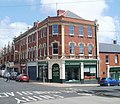
 Barringtons, Barry - geograph.org.uk - 2499240.jpg 640 × 544; 100 KB
-
 Barry Castle - geograph.org.uk - 2583757.jpg 2,816 × 2,112; 1.7 MB
-
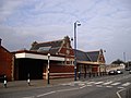 Barry Island railway station - geograph.org.uk - 2321884.jpg 4,000 × 3,000; 1.91 MB
-
 Barry Island Railway Station - geograph.org.uk - 2589474.jpg 1,024 × 768; 169 KB
-
 Barry Island Viaduct - geograph.org.uk - 2583699.jpg 2,816 × 2,112; 1.47 MB
-
 Barry railway station - geograph.org.uk - 2347558.jpg 640 × 480; 116 KB
-
 Barry railway station - geograph.org.uk - 2347566.jpg 640 × 464; 109 KB
-
 Bell St, Barry - geograph.org.uk - 2316587.jpg 4,000 × 3,000; 1.8 MB
-
 Bethel Baptist Church, Barry - geograph.org.uk - 2316659.jpg 4,000 × 3,000; 2.47 MB
-
 Boating Lake, The Knap, Barry - geograph.org.uk - 2583729.jpg 2,816 × 2,112; 1.61 MB
-
 Broad Street, Barry - geograph.org.uk - 2499729.jpg 640 × 478; 70 KB
-
 Cadoxton Methodist Church - geograph.org.uk - 2293950.jpg 4,000 × 3,000; 2.66 MB
-
 Castle St, Barry - geograph.org.uk - 2316614.jpg 4,000 × 3,000; 1.61 MB
-
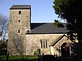 Church of St Cadoc, Cadoxton - geograph.org.uk - 2293989.jpg 4,000 × 3,000; 2.54 MB
-
 Floating on grass? (6116126529).jpg 1,156 × 766; 214 KB
-
 Former Methodist Church, Porthkerry Rd, Barry - geograph.org.uk - 2316686.jpg 4,000 × 3,000; 2.29 MB
-
 Harmony Furnishings, Barry - geograph.org.uk - 2499356.jpg 640 × 553; 90 KB
-
 High St, Barry, at the junction with Island Rd - geograph.org.uk - 2316759.jpg 4,000 × 3,000; 1.97 MB
-
 High Street post office, Barry - geograph.org.uk - 2499251.jpg 640 × 480; 87 KB
-
 Holy Trinity Presbyterian Church, Barry - geograph.org.uk - 2316766.jpg 3,000 × 4,000; 2.83 MB
-
 Hoping for pre-season customers, Barry Island - geograph.org.uk - 2321875.jpg 4,000 × 3,000; 2.6 MB
-
 Junction of Romilly Rd, Park Rd and Porthkerry Rd, Barry - geograph.org.uk - 2316644.jpg 4,000 × 3,000; 2.22 MB
-
 Lifeboat Station, Barry Island - geograph.org.uk - 2320200.jpg 4,000 × 3,000; 2.14 MB
-
 Phyllis St, Barry Island - geograph.org.uk - 2320128.jpg 4,000 × 3,000; 2.07 MB
-

-
 Queen St, Barry - geograph.org.uk - 2316746.jpg 4,000 × 3,000; 2.13 MB
-
 St Oswald's Rd, Cadoxton - geograph.org.uk - 2294099.jpg 4,000 × 3,000; 2.11 MB
-
 Terraced houses, Coldbrook Rd East, Cadoxton - geograph.org.uk - 2293969.jpg 4,000 × 3,000; 2.65 MB
-
 The Admiral, Vere St, Barry - geograph.org.uk - 2294110.jpg 4,000 × 3,000; 1.98 MB
-
 The Admiral, Vere St, Barry - geograph.org.uk - 2294118.jpg 4,000 × 3,000; 2.43 MB
-
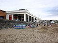 The beach, Barry Island - geograph.org.uk - 2590982.jpg 1,024 × 768; 156 KB
-

-
 The Marine, Barry Island - geograph.org.uk - 2320226.jpg 4,000 × 3,000; 2.37 MB
-
 The Park, Park Crescent, Barry - geograph.org.uk - 2316625.jpg 4,000 × 3,000; 1.98 MB
-
 The Ship, Harbour Rd, Barry - geograph.org.uk - 2320093.jpg 4,000 × 3,000; 2.17 MB
-
 The Three Bells and St Cadoc's Church tower, Cadoxton - geograph.org.uk - 2294052.jpg 4,000 × 3,000; 2.8 MB
-
 The Three Bells, Cadoxton - geograph.org.uk - 2294044.jpg 4,000 × 3,000; 3.08 MB
-
 Trinity St, Barry - geograph.org.uk - 2318397.jpg 4,000 × 3,000; 2.08 MB
-
 Trinity Street, Barry - geograph.org.uk - 2499408.jpg 640 × 480; 75 KB
-
 Vere St, Barry - geograph.org.uk - 2294127.jpg 4,000 × 3,000; 1.82 MB
-
 Whacky Funhouse, at Barry Docks (Geograph-2590891-by-Roger-Cornfoot).jpg 1,024 × 768; 228 KB


.jpg)


.jpg)