Category:2011 in Stamford Bridge, East Riding of Yorkshire
Media in category "2011 in Stamford Bridge, East Riding of Yorkshire"
The following 24 files are in this category, out of 24 total.
-
 Bay Horse - Main Street (geograph 2530049).jpg 640 × 480; 62 KB
-
 Bridge Rolls - Square (geograph 2530037).jpg 480 × 640; 88 KB
-
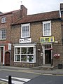
 Chris Clubley Estate Agents - Square (geograph 2530031).jpg 480 × 640; 90 KB
-
 Dental Surgery - Viking Road (geograph 2529372).jpg 640 × 480; 66 KB
-
 Electricity Substation - Viking Rd (geograph 2529364).jpg 640 × 557; 117 KB
-
 Fish & Chip Shop - Main Street (geograph 2530493).jpg 640 × 480; 72 KB
-
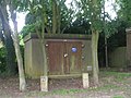 Gas Installation - off Viking Road (geograph 2529369).jpg 640 × 480; 85 KB
-
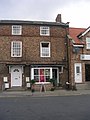
 Homecare - Square (geograph 2530034).jpg 640 × 480; 59 KB
-
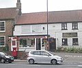 Post Office - Church Road (geograph 2530047).jpg 640 × 527; 81 KB
-
 School - Church Road (geograph 2530560).jpg 640 × 480; 52 KB
-
 St John the Baptist - Chancel (geograph 2530552).jpg 485 × 640; 64 KB
-
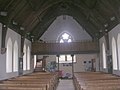
 St John the Baptist - Nave (geograph 2530550).jpg 480 × 640; 60 KB
-
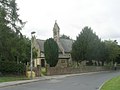
 St John the Baptist - viewed from Church Road (geograph 2530555).jpg 640 × 480; 62 KB
-
 St John the Baptist - West End (geograph 2530553).jpg 640 × 480; 59 KB
-
-
 Stamford Bridge Pharmacy - Square (geograph 2530035).jpg 640 × 480; 72 KB
-
 StamfordBridge1066.JPG 3,456 × 2,592; 3.84 MB
-
 Strensall Medical Practice - Square (geograph 2530029).jpg 640 × 480; 51 KB
-
 Take a Leaf - Square (geograph 2530033).jpg 480 × 640; 79 KB
-
 The co-operative food - Square (geograph 2530032).jpg 640 × 590; 89 KB
-
 The Pottery Craft Centre - Square (geograph 2530030).jpg 480 × 640; 95 KB
-
 The Stamford - Square (geograph 2530044).jpg 640 × 480; 54 KB
-
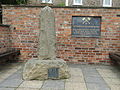
 War Memorial - St John the Baptist Church (geograph 2530512).jpg 413 × 640; 56 KB
-
 Wesleyan Chapel - viewed from Viking Road (geograph 2529376).jpg 640 × 480; 63 KB
.jpg)
.jpg)
.jpg)
.jpg)
.jpg)
.jpg)
.jpg)
.jpg)
.jpg)
.jpg)
.jpg)
.jpg)
.jpg)
.jpg)
.jpg)
.jpg)

.jpg)
.jpg)
.jpg)
.jpg)
.jpg)
.jpg)
.jpg)