Category:2011 in Truro
Media in category "2011 in Truro"
The following 39 files are in this category, out of 39 total.
-
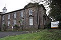
 'House of Fabrics' , ^81 Lemon Street - geograph.org.uk - 2697719.jpg 1,024 × 683; 138 KB
-
-

-
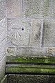
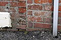
 Benchmark at bottom of steps Malpas Road - geograph.org.uk - 2697820.jpg 1,024 × 683; 257 KB
-
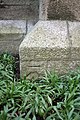
 Benchmark at entrance to ^4 Strangways Villas - geograph.org.uk - 2697551.jpg 683 × 1,024; 276 KB
-
 Benchmark at entrance to ^56 Daniell Road - geograph.org.uk - 2695164.jpg 683 × 1,024; 270 KB
-
 Benchmark on gatepost on Dobbs Road - geograph.org.uk - 2692959.jpg 1,024 × 683; 276 KB
-
 Benchmark on milestone, Highertown - geograph.org.uk - 2692267.jpg 683 × 1,024; 239 KB
-
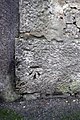
 Benchmark on St Johns Church, Lemon Street - geograph.org.uk - 2695504.jpg 683 × 1,024; 289 KB
-
 Benchmark on the Coinage Hall - geograph.org.uk - 2697756.jpg 683 × 1,024; 216 KB
-
 Benchmark on the Fire ^ Rescue Service HQ - geograph.org.uk - 2692252.jpg 683 × 1,024; 251 KB
-
 Benchmark on the front of ^10 Kenwyn Road - geograph.org.uk - 2717657.jpg 683 × 1,024; 128 KB
-
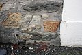
 Benchmark on the wall of Green Lane - geograph.org.uk - 2693664.jpg 683 × 1,024; 316 KB
-
 Benchmark on the wall of ^1 Station Road - geograph.org.uk - 2692226.jpg 1,024 × 683; 286 KB
-
 Benchmark on Truro Cathedral - geograph.org.uk - 2696537.jpg 683 × 1,024; 239 KB
-
 Benchmark on Truro High School, Falmouth Road - geograph.org.uk - 2697517.jpg 683 × 1,024; 292 KB
-

-
 Benchmark on ^2 Daniell Terrace - geograph.org.uk - 2696875.jpg 683 × 1,024; 309 KB
-
 Benchmark on ^26 Daniell Street - geograph.org.uk - 2696853.jpg 1,024 × 683; 215 KB
-
-
 Benchmark on ^31 Lemon Street - geograph.org.uk - 2697638.jpg 1,024 × 683; 220 KB
-
 Benchmark on ^38 Falmouth Road - geograph.org.uk - 2696910.jpg 1,024 × 683; 313 KB
-
 Benchmark on ^47 Treyew Road - geograph.org.uk - 2693600.jpg 683 × 1,024; 263 KB
-
 Benchmark on ^81 Lemon Street - geograph.org.uk - 2697694.jpg 1,024 × 683; 192 KB
-
-
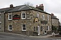
 Fire ^ Rescue Service HQ, Station Road - geograph.org.uk - 2693632.jpg 1,024 × 683; 216 KB
-
 Junction of Lemon Street and Fairmantle Street - geograph.org.uk - 2697660.jpg 683 × 1,024; 138 KB
-
 Junction of Penwethers Lane and Highertown - geograph.org.uk - 2693789.jpg 1,024 × 683; 143 KB
-
-
 Open area between Lemon Quay and Back Quay - geograph.org.uk - 2695724.jpg 1,024 × 683; 156 KB
-
 Shops on north side of Princes Street - geograph.org.uk - 2695779.jpg 683 × 1,024; 154 KB
-
 STAGS estate agents, Lemon Street - geograph.org.uk - 2695573.jpg 1,024 × 683; 116 KB
-
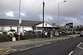
 Truro Bus Station - First 40958 (S334TJX).jpg 1,366 × 820; 255 KB
-
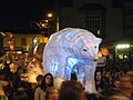
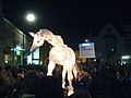 Truro City of Lights Parade - geograph.org.uk - 2704586.jpg 640 × 480; 64 KB
-
 Truro in the sun.jpg 4,134 × 1,818; 1.99 MB
-
 Truro Victoria Square Western Greyhound 208 WK10AZU.jpg 1,024 × 768; 246 KB
-
 Warrens the Bakers, Truro - geograph.org.uk - 2386560.jpg 1,143 × 1,600; 482 KB
-
 ^56 Daniell Road and a GR letter box - geograph.org.uk - 2695165.jpg 1,024 × 683; 166 KB
-
 ‘Magic ‘ Roundabout, Higher Town, Truro - geograph.org.uk - 2602089.jpg 2,816 × 2,112; 1.24 MB


_-_geograph.org.uk_-_2695378.jpg)


.jpg)


