Category:2011 in the London Borough of Wandsworth
Boroughs of London: City of London · City of Westminster · Barking and Dagenham · Barnet · Bexley · Brent · Bromley · Camden · Croydon · Ealing · Enfield · Greenwich · Hackney · Hammersmith and Fulham · Haringey · Harrow · Havering · Hillingdon · Hounslow · Islington · Kensington and Chelsea · Kingston · Lambeth · Lewisham · Merton · Newham · Redbridge · Richmond · Southwark · Sutton · Tower Hamlets · Waltham Forest · Wandsworth
Subcategories
This category has only the following subcategory.
C
Media in category "2011 in the London Borough of Wandsworth"
The following 45 files are in this category, out of 45 total.
-
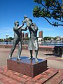 'In Town' sculpture by the southern end of Battersea Bridge.jpg 480 × 640; 96 KB
-
 Unit 375803 at Wandsworth Road.jpg 2,560 × 1,920; 1.1 MB
-
 Alma, Wandsworth, London (6014240992).jpg 3,776 × 2,520; 3.37 MB
-
 Alton Estate, Roehampton - geograph.org.uk - 2396372.jpg 1,280 × 960; 653 KB
-
 Avenue in Wandsworth Park in Autumn.jpg 800 × 533; 241 KB
-
 Battersea Park - geograph.org.uk - 2322583.jpg 557 × 640; 215 KB
-
 Battersea Park - geograph.org.uk - 2322724.jpg 640 × 480; 163 KB
-
 Battersea Park - geograph.org.uk - 2322745.jpg 480 × 640; 212 KB
-
 Battersea Park bandstand - geograph.org.uk - 2322644.jpg 640 × 480; 204 KB
-
 Battersea Park bandstand - geograph.org.uk - 2323962.jpg 640 × 480; 221 KB
-
 Battersea Park Peace Pagoda 1.JPG 2,048 × 1,529; 318 KB
-
 Battersea Park Peace Pagoda.JPG 2,048 × 1,529; 621 KB
-
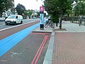 Bicycle station, Balham high Road - geograph.org.uk - 2480866.jpg 640 × 480; 87 KB
-
 Brown Dog Statue, Battersea Park - geograph.org.uk - 2740563.jpg 4,000 × 3,000; 3.7 MB
-
 Bus stop, Putney Heath - geograph.org.uk - 2263867.jpg 4,320 × 3,240; 4.68 MB
-
 Buses in Roehampton - geograph.org.uk - 2509816.jpg 4,320 × 3,240; 4.62 MB
-
 Cedar, St James's Drive - geograph.org.uk - 2926197.jpg 640 × 511; 202 KB
-
 Cement mixer trucks, Kirtling Street, London SW8.jpg 3,264 × 2,448; 872 KB
-
 Football in Wandsworth Park.jpg 800 × 558; 68 KB
-
 Former Channel Tunnel link viaduct, Battersea - geograph.org.uk - 2448979.jpg 1,024 × 756; 145 KB
-
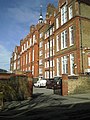 Honeywell Schools - geograph.org.uk - 2330247.jpg 960 × 1,280; 577 KB
-
 Hotham Primary School - geograph.org.uk - 2377263.jpg 1,280 × 960; 645 KB
-
 Jews Row, Wandsworth - geograph.org.uk - 2663684.jpg 640 × 480; 81 KB
-
 Lifebuoy on chain in London.jpg 3,264 × 2,448; 847 KB
-
 London plane trees, Wandsworth Park - geograph.org.uk - 2619305.jpg 680 × 1,024; 296 KB
-
 Marco Polo House (brighter cropped version).jpg 3,797 × 2,848; 3.08 MB
-
 Marco Polo House.jpg 4,288 × 2,848; 3.79 MB
-
 Melanzana, Battersea, SW11 (8737448875).jpg 3,776 × 2,520; 3.43 MB
-
 Mist in Wandsworth Park.jpg 800 × 533; 59 KB
-
 Peace Pagoda, Battersea Park - geograph.org.uk - 2619689.jpg 680 × 1,024; 236 KB
-
 Peace Pagoda, Battersea Park - geograph.org.uk - 2619692.jpg 680 × 1,024; 232 KB
-
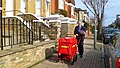 Postman on Wandle Rd, SW17 (5479444030).jpg 4,164 × 2,344; 4.39 MB
-
 Putney Railway Station at dusk - March 2011.jpg 4,228 × 3,596; 3.87 MB
-
 Railway lines and Chelsea Bridge Wharf apartments from Battersea Park Road, London SW8.jpg 3,264 × 2,448; 1.71 MB
-
 Seats around the bandstand, Battersea Park - geograph.org.uk - 2656020.jpg 4,000 × 3,000; 4.37 MB
-
 Shops on Garratt Lane (2) - geograph.org.uk - 2350130.jpg 1,024 × 768; 292 KB
-
 St Gregory's RC Church - geograph.org.uk - 2551692.jpg 3,872 × 2,592; 4.07 MB
-
 Taxi on Kirtling Street, London SW8 (2).jpg 3,264 × 2,448; 999 KB
-
 Taxi on Kirtling Street, London SW8.jpg 3,264 × 2,448; 907 KB
-
 The Pumphouse Gallery - geograph.org.uk - 2322740.jpg 640 × 480; 150 KB
-
 Tooting Broadway station - geograph.org.uk - 2661590.jpg 640 × 480; 63 KB
-
 Wandsworth Cemetery.jpg 4,209 × 2,369; 5.95 MB
-
 Wandsworth Common Station - entrance - geograph.org.uk - 2479614.jpg 640 × 430; 85 KB
-
 Wandsworth Town station - geograph.org.uk - 2316152.jpg 640 × 494; 63 KB
-
 Waste collection truck on Kirtling Street, London SW8.jpg 3,264 × 2,448; 1.11 MB


.jpg)


.jpg)

.jpg)


.jpg)


_-_geograph.org.uk_-_2350130.jpg)

.jpg)


