Category:2014 maps
| ← · 2010 · 2011 · 2012 · 2013 · 2014 · 2015 · 2016 · 2017 · 2018 · 2019 · → |
Deutsch: Karten mit Bezug zum Jahr 2014
English: Maps related to the year 2014
Español: Mapas relativos al año 2014
Français : Cartes concernant l’an 2014
Русский: Карты 2014 года
Subcategories
This category has the following 12 subcategories, out of 12 total.
!
- Maps created in 2014 (2 F)
*
- 2014 maps of the world (179 F)
A
E
- ECHO Daily Maps of 2014 (242 F)
- ECHO Situation Maps of 2014 (24 F)
M
N
O
S
Media in category "2014 maps"
The following 200 files are in this category, out of 209 total.
(previous page) (next page)-
 130503 Mapa Ferroviario.pdf 1,500 × 1,125; 200 KB
-
 2014 Lebanon Battle 3D (30249978553).jpg 3,939 × 2,827; 4.54 MB
-
 2014 Turkish Presidential Election-İhsanoğlu.PNG 1,012 × 448; 18 KB
-
 2014-Waterschappen-1250.png 1,250 × 1,660; 322 KB
-
 Auslandseinsätze der Bundeswehr.2014-07-14.svg 1,277 × 979; 1.14 MB
-
 Bombay Hook National Wildlife Refuge LOC 2016585152.jpg 12,164 × 5,292; 7.52 MB
-
 Bombay Hook National Wildlife Refuge LOC 2016585152.tif 12,164 × 5,292; 184.17 MB
-
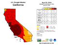 California Drought Status Apr 22nd 2014.png 1,056 × 816; 48 KB
-
 California Drought status for Dec 9th 2014.png 816 × 816; 18 KB
-
 California español por condados.png 596 × 676; 18 KB
-
 CapeFLYER 2014 map.svg 1,080 × 1,080; 431 KB
-
 Crosstown bus map.svg 990 × 765; 940 KB
-
 EBOV Outbreak in West Africa with USA.png 2,087 × 1,005; 97 KB
-
 ECHO Andorra Editable A4 Landscape.pdf 1,754 × 1,239; 174 KB
-
 ECHO Andorra Editable A4 Landscape.png 1,123 × 794; 182 KB
-
 ECHO Antigua and Barbuda Editable A4 Portrait.pdf 1,239 × 1,754; 164 KB
-
 ECHO Antigua and Barbuda Editable A4 Portrait.png 794 × 1,123; 153 KB
-
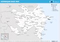 ECHO Azerbaijan Editable A4 Landscape.pdf 1,754 × 1,239; 411 KB
-
 ECHO Azerbaijan Editable A4 Landscape.png 1,123 × 794; 356 KB
-
 ECHO Bahamas Editable A4 Portrait.pdf 1,239 × 1,754; 302 KB
-
 ECHO Bahrain Editable A4 Portrait.pdf 1,239 × 1,754; 103 KB
-
 ECHO Bahrain Editable A4 Portrait.png 793 × 1,122; 182 KB
-
 ECHO Barbados Editable A4 Portrait.pdf 1,239 × 1,754; 188 KB
-
 ECHO Barbados Editable A4 Portrait.png 794 × 1,123; 179 KB
-
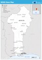
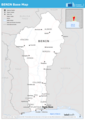
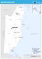 ECHO Belize Editable A4 Portrait.pdf 1,239 × 1,754; 212 KB
-
 ECHO Benin Editable A4 Portrait.pdf 1,239 × 1,754; 317 KB
-
 ECHO Benin Editable A4 Portrait.png 793 × 1,122; 294 KB
-
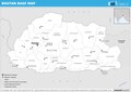 ECHO Bhutan Editable A4 Landscape.pdf 1,754 × 1,239; 264 KB
-
 ECHO Bhutan Editable A4 Landscape.png 1,123 × 794; 260 KB
-
 ECHO Bolivia Basemap Editable A4 Landscape.pdf 1,754 × 1,239; 309 KB
-
 ECHO Bolivia Basemap Editable A4 Landscape.png 1,123 × 794; 290 KB
-
 ECHO Botswana Editable A4 Landscape.png 1,123 × 794; 308 KB
-
 ECHO Brunei Darussalam Editable A4 Landscape.pdf 1,754 × 1,239; 232 KB
-
 ECHO Brunei Darussalam Editable A4 Landscape.png 1,123 × 794; 255 KB
-
 ECHO Cabo Verde Editable A4 Landscape.pdf 1,754 × 1,239; 234 KB
-
 ECHO Cabo Verde Editable A4 Landscape.png 1,123 × 794; 188 KB
-
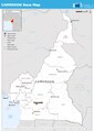 ECHO Cameroon Editable A4 Portrait.pdf 1,239 × 1,754; 388 KB
-
 ECHO Cameroon Editable A4 Portrait.png 793 × 1,122; 333 KB
-
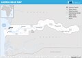
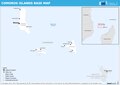 ECHO Comoros Editable A4 Landscape.pdf 1,754 × 1,239; 178 KB
-
 ECHO Comoros Editable A4 Landscape.png 1,123 × 794; 146 KB
-
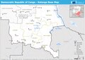
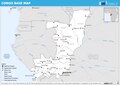 ECHO Congo Editable A4 Landscape.pdf 1,754 × 1,239; 431 KB
-
 ECHO Congo Editable A4 Landscape.png 1,123 × 794; 372 KB
-
 ECHO Cyprus Editable A4 Landscape.pdf 1,754 × 1,239; 201 KB
-
 ECHO Cyprus Editable A4 Landscape.png 1,123 × 794; 185 KB
-
 ECHO Dominica Editable A4 Portrait.pdf 1,239 × 1,754; 211 KB
-
 ECHO Dominica Editable A4 Portrait.png 793 × 1,122; 165 KB
-
 ECHO Dominican Republic Editable A4 Landscape.pdf 1,754 × 1,239; 360 KB
-
 ECHO Dominican Republic Editable A4 Landscape.png 1,123 × 794; 302 KB
-
 ECHO DRC Katanga Editable A4 Landscape.pdf 1,754 × 1,239; 447 KB
-
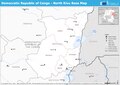 ECHO DRC North Kivu Editable A4 Landscape.pdf 1,754 × 1,239; 324 KB
-
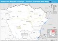 ECHO DRC Province Orientale Editable A4 Landscape.pdf 1,754 × 1,239; 411 KB
-
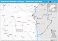 ECHO DRC South Kivu Editable A4 Landscape.pdf 1,754 × 1,239; 372 KB
-
 ECHO DRC Équateur Editable A4 Landscape.pdf 1,754 × 1,239; 407 KB
-
 ECHO Ecuador Editable A4 Landscape.pdf 1,754 × 1,239; 343 KB
-
 ECHO Ecuador Editable A4 Landscape.png 1,123 × 794; 283 KB
-
 ECHO El Salvador Editable A4 Landscape.pdf 1,754 × 1,239; 281 KB
-
 ECHO El Salvador Editable A4 Landscape.png 1,123 × 794; 277 KB
-
 ECHO Equatorial Guinea Editable A4 Portrait.pdf 1,239 × 1,754; 231 KB
-
 ECHO Equatorial Guinea Editable A4 Portrait.png 794 × 1,123; 248 KB
-
 ECHO Gabon Editable A4 Portrait.pdf 1,239 × 1,754; 327 KB
-
 ECHO Gabon Editable A4 Portrait.png 794 × 1,123; 335 KB
-
 ECHO Gambia Editable A4 Landscape.pdf 1,754 × 1,239; 264 KB
-
 ECHO Gambia Editable A4 Landscape.png 1,123 × 794; 312 KB
-
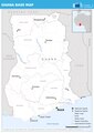 ECHO Ghana Editable A4 Portrait.pdf 1,239 × 1,754; 321 KB
-
 ECHO Ghana Editable A4 Portrait.png 794 × 1,123; 324 KB
-
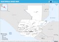 ECHO Guatemala Editable A4 Landscape.pdf 1,754 × 1,239; 359 KB
-
 ECHO Guatemala Editable A4 Landscape.png 1,123 × 794; 358 KB
-
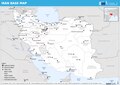 ECHO Iran Editable A4 Landscape.pdf 1,754 × 1,239; 533 KB
-
 ECHO Iran Editable A4 Landscape.png 1,123 × 794; 465 KB
-
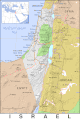
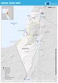 ECHO Israel Editable A4 Portrait.pdf 1,239 × 1,754; 722 KB
-
 ECHO Israel Editable A4 Portrait.png 2,481 × 3,509; 680 KB
-
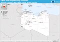 ECHO Libya & Neighbouring Editable A4 Landscape.pdf 1,754 × 1,239; 326 KB
-
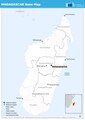 ECHO Madagascar Editable A4 Portrait.pdf 1,239 × 1,754; 271 KB
-
 ECHO Madagascar Editable A4 Portrait.png 793 × 1,122; 217 KB
-
 ECHO Maldives Editable A4 Portrait.pdf 1,239 × 1,754; 202 KB
-
 ECHO Maldives Editable A4 Portrait.png 793 × 1,122; 171 KB
-
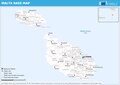 ECHO Malta Editable A4 Landscape.pdf 1,754 × 1,239; 295 KB
-
 ECHO Malta Editable A4 Landscape.png 1,123 × 794; 274 KB
-
 ECHO Mauritius Editable A4 Landscape.pdf 1,754 × 1,239; 241 KB
-
 ECHO Mauritius Editable A4 Landscape.png 1,123 × 794; 236 KB
-
 ECHO Monaco Editable A4 Portrait.pdf 1,239 × 1,754; 321 KB
-
 ECHO Monaco Editable A4 Portrait.png 794 × 1,123; 361 KB
-
 ECHO Morocco Editable A4 Landscape.pdf 1,754 × 1,239; 341 KB
-
 ECHO Morocco Editable A4 Landscape.png 1,123 × 794; 266 KB
-
 ECHO Oman Editable A4 Portrait.pdf 1,239 × 1,754; 247 KB
-
 ECHO Oman Editable A4 Portrait.png 794 × 1,123; 256 KB
-
 ECHO Palestine Editable A4 Landscape.pdf 1,754 × 1,239; 291 KB
-
 ECHO Paraguay Editable A4 Landscape.pdf 1,754 × 1,239; 354 KB
-
 ECHO Paraguay Editable A4 Landscape.png 1,123 × 794; 351 KB
-
 ECHO Peru Editable A4 Portrait.pdf 1,239 × 1,754; 406 KB
-
 ECHO Peru Editable A4 Portrait.png 794 × 1,123; 365 KB
-
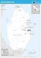 ECHO Qatar Editable A4 Portrait.pdf 1,239 × 1,754; 218 KB
-
 ECHO Qatar Editable A4 Portrait.png 794 × 1,123; 235 KB
-
 ECHO Republic of Korea Editable A4 Portrait.pdf 1,239 × 1,754; 342 KB
-
 ECHO Republic of Korea Editable A4 Portrait.png 794 × 1,123; 347 KB
-
 ECHO Sanaa Editable A3 Portrait.png 1,008 × 1,344; 557 KB
-
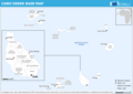
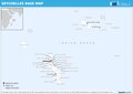 ECHO Seychelles Editable A4 Landscape.pdf 1,754 × 1,239; 208 KB
-
 ECHO Seychelles Editable A4 Landscape.png 1,123 × 794; 207 KB
-
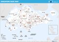 ECHO Singapore Editable A4 Landscape.pdf 1,754 × 1,239; 230 KB
-
 ECHO Singapore Editable A4 Landscape.png 1,123 × 794; 383 KB
-
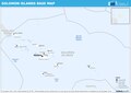 ECHO Solomon Islands Editable A4 Landscape.pdf 1,754 × 1,239; 194 KB
-
 ECHO Solomon Islands Editable A4 Landscape.png 1,123 × 794; 194 KB
-
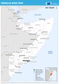 ECHO Somalia Editable A4 Portrait.pdf 1,239 × 1,754; 341 KB
-
 ECHO Somalia Editable A4 Portrait.png 793 × 1,122; 307 KB
-
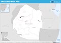 ECHO Swaziland Editable A4 Landscape.pdf 1,754 × 1,239; 265 KB
-
 ECHO Swaziland Editable A4 Landscape.png 1,123 × 794; 294 KB
-
 ECHO Timor-Leste Editable A4 Landscape.pdf 1,754 × 1,239; 243 KB
-
 ECHO Timor-Leste Editable A4 Landscape.png 1,123 × 794; 213 KB
-
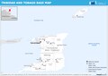 ECHO Trinidad and Tobago Editable A4 Landscape.pdf 1,754 × 1,239; 225 KB
-
 ECHO Trinidad and Tobago Editable A4 Landscape.png 1,123 × 794; 217 KB
-
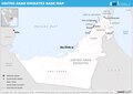 ECHO United Arab Emirates Editable A4 Landscape.pdf 1,754 × 1,239; 270 KB
-
 Geologic Map of Mars figure2.pdf 1,725 × 1,752; 370 KB
-
 Geologic Map of Mars.pdf 8,383 × 6,404; 34.46 MB
-
 Gough Island - EVS Precision Map (1-52,000).png 1,276 × 900; 98 KB
-
 Gough Island EVS Precision Map 1 52000-sepia.png 1,276 × 900; 3.29 MB
-
 Hammer retroazimuthal projection combined1.jpg 2,376 × 2,200; 1.33 MB
-
 Hammer retroazimuthal projection combined2.jpg 4,188 × 2,118; 1.75 MB
-
 Hammer retroazimuthal projection full SW.JPG 2,060 × 2,060; 664 KB
-
 Houbara map.svg 1,539 × 1,080; 168 KB
-

-

-
 Lappajärvi Islands map.svg 532 × 1,008; 76 KB
-
 Latin America homosexuality laws.svg 700 × 826; 328 KB
-
 Location map Santa Monica.svg 1,531 × 1,285; 3.01 MB
-
 Location map Santa Monica2.png 964 × 648; 401 KB
-
 Map of Azerbaijanis in Georgia.png 1,285 × 667; 33 KB
-
 Map of Endo incident.jpg 1,246 × 895; 155 KB
-
 Mexico total fertility rate by state 2014.png 2,029 × 1,326; 477 KB
-
 Mitiaro Island topo map 2014 (cropped).jpg 3,461 × 3,593; 2.08 MB
-
 Mitiaro Island topo map 2014.jpg 9,438 × 12,343; 6.87 MB
-
 Nevada español por condados.png 450 × 514; 9 KB
-
 Niue-topo50-maps.jpg 5,671 × 8,505; 5.28 MB
-
 PAT - Afghanistan.gif 920 × 920; 371 KB
-
 PAT - Anguilla.gif 800 × 1,025; 47 KB
-
 PAT - Antigua and Barbuda.gif 860 × 975; 53 KB
-
 PAT - Azerbaijan.gif 875 × 1,000; 310 KB
-
 PAT - Bahrain.gif 860 × 975; 60 KB
-
 PAT - Barbados.gif 750 × 850; 62 KB
-
 PAT - Belize.gif 800 × 1,035; 191 KB
-
 PAT - Bermuda.gif 900 × 700; 40 KB
-
 PAT - Bhutan.gif 1,035 × 800; 358 KB
-
 PAT - British Indian Ocean Territory.gif 800 × 1,035; 34 KB
-
 PAT - British Virgin Islands.gif 1,035 × 800; 61 KB
-
 PAT - Brunei.gif 875 × 975; 227 KB
-
 PAT - Christmas Island.gif 800 × 800; 46 KB
-
 PAT - Cocos (Keeling) Islands.gif 800 × 1,035; 34 KB
-
 PAT - Comoros.gif 975 × 860; 65 KB
-
 PAT - Cook Islands.gif 860 × 975; 36 KB
-
 PAT - Costa Rica.gif 920 × 920; 188 KB
-
 PAT - Cyprus.gif 1,065 × 800; 163 KB
-
 PAT - Dominica.gif 800 × 1,035; 67 KB
-
 PAT - Dominican Republic.gif 1,090 × 775; 179 KB
-
 PAT - East Timor.gif 1,035 × 800; 116 KB
-
 PAT - El Salvador.gif 1,060 × 800; 304 KB
-
 PAT - Faroe Islands.gif 800 × 1,035; 80 KB
-
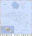 PAT - French Polynesia.gif 860 × 975; 53 KB
-
 PAT - French Southern and Antarctic Lands.gif 800 × 1,020; 104 KB
-
 PAT - Georgia.gif 975 × 860; 337 KB
-
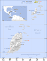 PAT - Grenada.gif 800 × 1,035; 62 KB
-
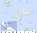 PAT - Guadeloupe.gif 975 × 860; 58 KB
-
 PAT - Guatemala.gif 860 × 975; 348 KB
-
 PAT - Haiti.gif 1,000 × 830; 186 KB
-
 PAT - Hong Kong and Macau.gif 1,090 × 775; 136 KB
-
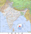 PAT - India.gif 970 × 1,060; 357 KB
-
 PAT - Iran.gif 920 × 920; 305 KB
-
 PAT - Israel.gif 750 × 1,120; 272 KB
-
 PAT - Jamaica.gif 1,150 × 690; 125 KB
-
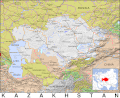 PAT - Kazakhstan.gif 1,100 × 900; 395 KB
-
 PAT - Kuwait.gif 860 × 975; 76 KB
-
 PAT - Lebanon.gif 800 × 1,035; 261 KB
-
 PAT - Liechtenstein.gif 700 × 900; 203 KB
-
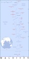 PAT - Maldives.gif 690 × 1,380; 34 KB
-
 PAT - Malta.gif 800 × 800; 65 KB
-
 PAT - Martinique.gif 800 × 1,035; 68 KB
-
 PAT - Mauritius.gif 885 × 920; 86 KB
-
 PAT - Mayotte.gif 860 × 975; 70 KB
-
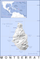 PAT - Montserrat.gif 650 × 950; 48 KB
-
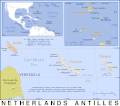 PAT - Netherlands Antilles.gif 975 × 860; 58 KB
-
 PAT - North Korea.gif 860 × 975; 298 KB
-
 PAT - Oman.gif 800 × 1,035; 150 KB
-
 PAT - Pakistan.gif 855 × 1,000; 334 KB
-
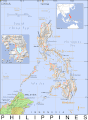 PAT - Philippines.gif 800 × 1,090; 120 KB
-
 PAT - Pitcairn.gif 1,000 × 650; 26 KB
-
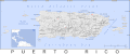 PAT - Puerto Rico.gif 1,380 × 575; 104 KB
-
 PAT - Reunion.gif 920 × 920; 136 KB
-
 PAT - Saint Kitts and Nevis.gif 850 × 800; 55 KB
-
 PAT - Saint Lucia.gif 750 × 1,120; 61 KB
-
 PAT - Saint Pierre and Miquelon.gif 950 × 920; 88 KB
-
 PAT - Saint Vincent and Grenadines.gif 765 × 1,120; 51 KB
-
 PAT - Seychelles.gif 975 × 920; 39 KB
-
 PAT - Singapore.gif 1,035 × 800; 115 KB
-
 PAT - South Georgia and South Sandwich Islands.gif 1,035 × 800; 66 KB
-
 PAT - South Korea.gif 830 × 1,000; 169 KB
-
 PAT - Sri Lanka.gif 800 × 1,035; 138 KB
-
 PAT - Syria.gif 975 × 860; 300 KB
-
 PAT - U.S. Virgin Islands.gif 920 × 950; 56 KB
-
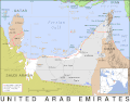 PAT - United Arab Emirates.gif 1,025 × 800; 145 KB
-
 Prime Hook NWR, public use area. LOC 2016585166.jpg 5,968 × 3,320; 2.22 MB
-
 Prime Hook NWR, public use area. LOC 2016585166.tif 5,968 × 3,320; 56.69 MB
-
 Rarotonga topo map 2014.jpg 9,438 × 12,343; 24.89 MB
.jpg)


.png)


.jpg)


_Islands.gif)


