Category:2015 Georgia (U.S. state) photos by Mjrmtg taken with Sony DSC-WX80
Subcategories
This category has only the following subcategory.
Media in category "2015 Georgia (U.S. state) photos by Mjrmtg taken with Sony DSC-WX80"
The following 155 files are in this category, out of 155 total.
-
 Argyle city limit, US84 EB.JPG 4,608 × 3,456; 5.07 MB
-
 Atkinson limit, US82EB.JPG 4,608 × 3,456; 5.67 MB
-
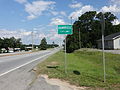 Bainbridge city limit, US84EB.JPG 4,608 × 3,456; 5.87 MB
-
 Brantley County line, US82WB.JPG 4,608 × 3,456; 5.27 MB
-
 Cecil Grocery 2015.JPG 4,608 × 3,456; 5.7 MB
-
 Charlton County border, US1 SB.JPG 4,608 × 3,456; 5.96 MB
-
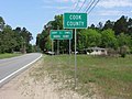 Cook County limit, US41NB.JPG 4,608 × 3,456; 6.07 MB
-
 Cordele City limit, Georgia I75nb.JPG 4,608 × 3,456; 3.57 MB
-
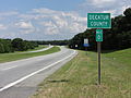 Decatur County line, US84EB.JPG 4,608 × 3,456; 5.07 MB
-
 Domino's, Northside Dr, Valdosta, 2015.jpg 4,608 × 3,456; 5.06 MB
-
 Donalsonville city limit, US84EB.JPG 4,608 × 3,456; 5.88 MB
-
 Early County line, Georgia State border, US84EB.JPG 4,608 × 3,456; 5.45 MB
-
 Family Dollar, Nashville.JPG 4,608 × 3,456; 5.24 MB
-
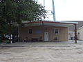 Folkston Police Department.JPG 4,608 × 3,456; 4.34 MB
-
 Former King St RR Crossing, Cecil.JPG 4,608 × 3,456; 6.43 MB
-
 Former Travelodge b, Dock Junction.JPG 4,608 × 3,456; 5.81 MB
-
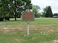
 Fort Saint Simons marker.JPG 4,608 × 3,456; 6.02 MB
-
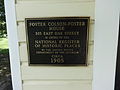 Foster Colson-Foster House, Woodbine NRHP Plaque.JPG 4,608 × 3,456; 3.97 MB
-
 Franks Creek Rd Overpass (Guardrail end on bridge and date).JPG 4,608 × 3,456; 5.53 MB
-
 Franks Creek Rd Overpass (Southwest face).JPG 4,608 × 3,456; 4.83 MB
-
 Gascoigne Bluff historical marker.JPG 4,608 × 3,456; 6.64 MB
-
 Geodetic Survey Benchmark on Berrien County Courthouse.JPG 4,608 × 3,456; 5.13 MB
-
 Georgia Coast Rail-Trail a.JPG 4,608 × 3,456; 6.02 MB
-
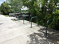 Georgia Coast Rail-Trail, bicycle racks.JPG 4,608 × 3,456; 5.9 MB
-
 Georgia Coast Rail-Trail, boardwalk.jpg 4,608 × 3,456; 6.48 MB
-
 Georgia Coast Rail-Trail, GDOT ISTEA marker.JPG 4,608 × 3,456; 6.54 MB
-
 Georgia Coast Rail-Trail, Hobos marker.JPG 4,608 × 3,456; 5.67 MB
-
 Georgia Coast Rail-Trail, looking back at boardwalk.JPG 4,608 × 3,456; 5.32 MB
-
 Georgia Coast Rail-Trail, pier over Satilla River.JPG 4,608 × 3,456; 5.97 MB
-
 Georgia Coast Rail-Trail, Railroad marker.JPG 4,608 × 3,456; 6.24 MB
-
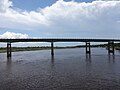 Georgia Coast Rail-Trail, Satilla River bridge b.JPG 4,608 × 3,456; 4.66 MB
-
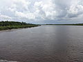 Georgia Coast Rail-Trail, Satilla River.JPG 4,608 × 3,456; 4.63 MB
-
 Georgia Department of Labor, Waycross.JPG 4,608 × 3,456; 4.59 MB
-
 Georgia Experiment Station historical marker.JPG 4,608 × 3,456; 5.65 MB
-
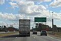
 Georgia I75nb Exit 101 .5 mile.JPG 4,608 × 3,456; 3.72 MB
-
 Georgia I75nb Exit 101 1 mile.JPG 4,608 × 3,456; 3.74 MB
-
 Georgia I75nb Exit 101.JPG 4,608 × 3,456; 3.8 MB
-
 Georgia I75nb Exit 99 .5 mile.JPG 4,608 × 3,456; 3.69 MB
-
 Georgia I75nb Exit 99.JPG 4,608 × 3,456; 4.32 MB
-
 Georgia I75nb Mile Marker 100.JPG 4,608 × 3,456; 3.61 MB
-
 Georgia I75nb, Valdosta city limit.JPG 4,608 × 3,456; 3.5 MB
-
 Georgia I75sb Exit 11 .5 mile.JPG 5,184 × 3,456; 4.76 MB
-
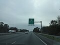
 Georgia I75sb Exit 11 1 mile.JPG 4,608 × 3,456; 3.47 MB
-
 Georgia I75sb Exit 11.JPG 4,608 × 3,456; 3.57 MB
-
 Georgia I75sb Exit 13 .5 mile.JPG 5,184 × 3,456; 4.74 MB
-
 Georgia I75sb Exit 13 1 mile.JPG 5,184 × 3,456; 4.42 MB
-
 Georgia I75sb Exit 13.JPG 5,184 × 3,456; 4.72 MB
-
 Georgia I75sb Exit 2 .5 mile.JPG 4,608 × 3,456; 3.41 MB
-
 Georgia I75sb Exit 2 1 mile.JPG 4,608 × 3,456; 3.36 MB
-
 Georgia I75sb Exit 2.JPG 4,608 × 3,456; 3.37 MB
-
 Georgia I75sb Exit 5 .5 mile.JPG 4,608 × 3,456; 3.59 MB
-
 Georgia I75sb Exit 5 1 mile.JPG 4,608 × 3,456; 3.57 MB
-
 Georgia I75sb Exit 5.JPG 4,608 × 3,456; 3.46 MB
-
 Georgia I75sb GA31 Overpass.JPG 4,608 × 3,456; 3.75 MB
-
 Georgia I75sb GA376 Overpass.JPG 4,608 × 3,456; 3.36 MB
-
 Georgia I75sb Loch Laurel Rd Overpass.JPG 4,608 × 3,456; 3.5 MB
-
 Georgia I75sb Old Clyattville Rd Overpass.JPG 4,608 × 3,456; 3.38 MB
-
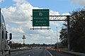
 Georgia I95nb Exit 22.JPG 4,608 × 3,456; 4.16 MB
-
 Georgia I95nb Exit 26 .5 mile.JPG 4,608 × 3,456; 3.78 MB
-
 Georgia I95nb Exit 26 1 mile.JPG 4,608 × 3,456; 3.63 MB
-
 Georgia I95nb Exit 26.JPG 4,608 × 3,456; 3.75 MB
-
 Georgia I95nb Exit 29 .5 mile.JPG 4,608 × 3,456; 3.66 MB
-
 Georgia I95nb Exit 29 1 mile.JPG 4,608 × 3,456; 3.64 MB
-
 Georgia I95nb Exit 29.JPG 4,608 × 3,456; 3.55 MB
-
 Georgia I95nb Glynn County line.JPG 4,608 × 3,456; 3.58 MB
-
 Georgia I95nb Turtle River.JPG 4,608 × 3,456; 3.5 MB
-
 Georgia I95sb Exit 29 .5 mile.JPG 4,608 × 3,456; 3.52 MB
-
 Georgia I95sb Exit 29 1 mile.JPG 4,608 × 3,456; 3.47 MB
-
 Georgia I95sb Exit 29.JPG 4,608 × 3,456; 3.96 MB
-
 Georgia National Guard Armory, Griffin.JPG 4,608 × 3,456; 5.89 MB
-
 Georgia Ports Authority, Brunswick.JPG 4,608 × 3,456; 4.28 MB
-
 Georgia State Route 31 bridge Brooks County NB 01.JPG 4,608 × 3,456; 3.65 MB
-
 Georgia State Route 31 bridge Brooks County NB 02.JPG 4,608 × 3,456; 3.96 MB
-
 Georgia State Route 31 bridge Brooks County NB 03.JPG 4,608 × 3,456; 3.68 MB
-
 Georgia State Route 31 bridge Brooks County NB 04.JPG 4,608 × 3,456; 3.66 MB
-
 Georgia State Route 31 bridge Brooks County NB 05.JPG 4,608 × 3,456; 4.01 MB
-
 Georgia State Route 31 bridge Brooks County NB 06.JPG 4,608 × 3,456; 3.54 MB
-
 Georgia State Route 31 bridge Brooks County SB 01.JPG 4,608 × 3,456; 3.48 MB
-
 Georgia State Route 31 bridge Brooks County SB 03.JPG 4,608 × 3,456; 3.39 MB
-
 Georgia State Route 31 bridge Brooks County SB 04.JPG 4,608 × 3,456; 3.49 MB
-
 Georgia State Route 31 bridge Brooks County SB 05.JPG 4,608 × 3,456; 3.54 MB
-
 Georgia State Route 31 bridge Brooks County SB 06.JPG 4,608 × 3,456; 3.36 MB
-
 Georgia State Route 31 bridge Brooks County SB 07.JPG 4,608 × 3,456; 3.62 MB
-
 Georgia Welcome sign, US84EB.JPG 4,608 × 3,456; 5.11 MB
-
 Gleneagles Apartments, Griffin.jpg 4,608 × 3,456; 6.49 MB
-
 Global War on Terror memorial (front), Griffin.JPG 4,608 × 3,456; 6.31 MB
-
 Glynn Academy bell.JPG 4,608 × 3,456; 6.19 MB
-
 Glynn Academy Building 5 auditorium entrance.JPG 4,608 × 3,456; 6.23 MB
-
 Glynn Academy Building 5.JPG 4,608 × 3,456; 5.89 MB
-
 Glynn Academy concrete sign.JPG 4,608 × 3,456; 6.1 MB
-
 Glynn Academy New Gym.JPG 4,608 × 3,456; 5.2 MB
-
 Glynn Academy Prep Building 4.JPG 4,608 × 3,456; 6.48 MB
-
 Glynn Academy Science Building 1.JPG 4,608 × 3,456; 4.88 MB
-
 Glynn Academy Vietnam Veterans marker.JPG 4,608 × 3,456; 5.92 MB
-
 Glynn Academy, A.V. Wood Gymnasium discus art.JPG 4,608 × 3,456; 5.29 MB
-
 Glynn Academy, A.V. Wood Gymnasium girls.JPG 4,608 × 3,456; 4.64 MB
-
 Glynn Academy, A.V. Wood Gymnasium.JPG 4,608 × 3,456; 5.79 MB
-
 Glynn County Courthouse (South face).JPG 4,608 × 3,456; 3.96 MB
-
 Glynn County Courthouse (Southeast face).JPG 4,608 × 3,456; 3.64 MB
-
 Glynn County Fire Department, Brunswick Golden Isles Airport.JPG 4,608 × 3,456; 5.21 MB
-
 Glynn County former courthouse (East face).JPG 4,608 × 3,456; 4.83 MB
-
 Glynn County former courthouse (South face).JPG 4,608 × 3,456; 4.73 MB
-
 Glynn County former courthouse (Southwest face).JPG 4,608 × 3,456; 4.87 MB
-
 Glynn County line, US82EB.JPG 4,608 × 3,456; 4.81 MB
-
 Go karts curve, Fun Park.JPG 4,608 × 3,456; 5.25 MB
-
 Golden Isles Welcome Center.JPG 4,608 × 3,456; 5.1 MB
-
 Golf Carts on St. Simons.JPG 4,608 × 3,456; 6.27 MB
-
 Good City Chinese Restaurant, Spalding Village.JPG 4,608 × 3,456; 4.73 MB
-
 Grady County Courthouse, 1985 corner stone.JPG 4,608 × 3,456; 5.64 MB
-
 Grady County line, US84EB.JPG 4,608 × 3,456; 5.85 MB
-
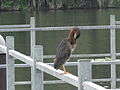
 Green Heron a, Grassy Pond.JPG 4,608 × 3,456; 3.2 MB
-
 Green Heron b, Grassy Pond.JPG 4,608 × 3,456; 3.19 MB
-
 Green Heron d, Grassy Pond.JPG 4,608 × 3,456; 3.15 MB
-
 Greyhound building, Gloucester St, Brunswick.JPG 4,608 × 3,456; 5.43 MB
-
 Griffin Campus, Ellis Rd entrance.JPG 4,608 × 3,456; 4.73 MB
-
 Griffin City Golf Course sign, City Park (Griffin).JPG 4,608 × 3,456; 6.34 MB
-
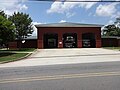 Griffin Fire Station 1 (South face).JPG 4,608 × 3,456; 5.26 MB
-
 Griffin Regional Welcome Center (North face).JPG 4,608 × 3,456; 5.71 MB
-
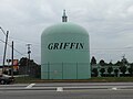 Griffin Water tank.JPG 4,608 × 3,456; 4.36 MB
-
 Henry County border, US19.JPG 4,608 × 3,456; 5.36 MB
-
 Homeland city limit, US1SB.JPG 4,608 × 3,456; 6.27 MB
-
 Homerville city limit, US84 EB.JPG 4,608 × 3,456; 4.85 MB
-
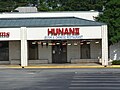 Hunan II, Griffin.JPG 4,608 × 3,456; 4.91 MB
-
 King Buffet, Tifton Corners.JPG 4,608 × 3,456; 4.05 MB
-
 King's Wok, The Mall at Waycross.JPG 4,608 × 3,456; 4.02 MB
-
 Lanier County border, US84 EB.JPG 4,608 × 3,456; 4.04 MB
-
 Looking North up US17 at GA110, Woodbine.JPG 4,608 × 3,456; 5.22 MB
-
 Lowndes County limit, US41SB.JPG 4,608 × 3,456; 5.6 MB
-
 Lowndes County line, US84EB.JPG 4,608 × 3,456; 5.82 MB
-
 Lulaton limit, US82EB.JPG 4,608 × 3,456; 5.44 MB
-
 Marion Ave, Davis St intersection, Nashville.JPG 4,608 × 3,456; 4.57 MB
-
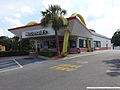
 McDonald's sign, GA25, Brunswick.JPG 4,608 × 3,456; 6.07 MB
-
 McDonald's, GA25, Brunswick.JPG 4,608 × 3,456; 5.19 MB
-
 New Hong Kong Restaurant, Waycross.JPG 4,608 × 3,456; 5.04 MB
-
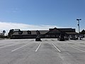
 NS 7520 train under 6th St Overpass, Griffin.JPG 4,608 × 3,456; 6.42 MB
-
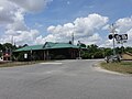 Ochlocknee depot 1.JPG 4,608 × 3,456; 5.07 MB
-
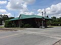 Ochlocknee depot 2.JPG 4,608 × 3,456; 4.9 MB
-
 Okefenokee National Wildlife Refuge, Kingfisher Landing.jpg 4,608 × 3,456; 5.92 MB
-
 Old gas station, US41, County line Rd, Lowndes County.JPG 4,608 × 3,456; 4.57 MB
-
 Plant Park, fountain.JPG 4,608 × 3,456; 5.55 MB
-
 Ryan's, Griffin.JPG 4,608 × 3,456; 4.89 MB
-
 Seminole County line, US84EB.JPG 4,608 × 3,456; 4.92 MB
-
 Shane's Rib Shack, Spalding Village.JPG 4,608 × 3,456; 4.74 MB
-
 Side view of skeletal remains, Martin drive-in theater.JPG 4,608 × 3,456; 5.48 MB
-
 Spalding County border, US19.JPG 4,608 × 3,456; 5.59 MB
-
 Subway, Tifton Mall.JPG 4,608 × 3,456; 4.26 MB
-
 The Packhouse Restaurant, Valdosta.JPG 4,608 × 3,456; 5.38 MB
-
 U.S. Route 82 and McDonald St Intersection, Waycross.JPG 4,608 × 3,456; 4.39 MB
-
 Walgreens, Dawson Rd, Albany.JPG 4,608 × 3,456; 4.93 MB
-
 Ware County border, US82WB.JPG 4,608 × 3,456; 4.39 MB
-
 Ware County border, US84 EB.JPG 4,608 × 3,456; 5.56 MB
-
 Waycross city limit, US84 EB.JPG 4,608 × 3,456; 4.51 MB
-
 Whigham city limit, US84EB.JPG 4,608 × 3,456; 5.85 MB
-
 Woodbine City Hall.JPG 4,608 × 3,456; 5.7 MB
-
 Zaxbys, Griffin.JPG 4,608 × 3,456; 4.58 MB


.JPG)
.JPG)


,_Griffin.JPG)


.JPG)
.JPG)

.JPG)
.JPG)
.JPG)


.JPG)
.JPG)
.JPG)


