Category:2015 aerial photographs of Canada
Media in category "2015 aerial photographs of Canada"
The following 131 files are in this category, out of 131 total.
-
 2015-09-06 01 Flat terrain coming into Gjoa Haven Airport (YHK).jpg 6,000 × 4,000; 11.95 MB
-
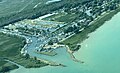
 A clear view of the Canadian side and Goat Island (27861102076).jpg 4,928 × 3,264; 3.97 MB
-

-
 A View of the Frozen Waterways and Tundra as Secretary Kerry Arrives in Iqaluit, Canada.jpg 4,910 × 3,268; 4.18 MB
-
 Aerial view of Dorval Island.jpg 3,979 × 2,652; 2.12 MB
-
 Aerial view of Lac du Chevreuil.jpg 3,981 × 2,654; 3.58 MB
-
 Amherstburg, Ontario (21514585500).jpg 4,000 × 3,000; 2.75 MB
-
 Amherstburg, Ontario (21676451896).jpg 2,950 × 2,210; 2.58 MB
-
 Amherstburg, Ontario (21702556395).jpg 4,000 × 3,000; 3.03 MB
-
 Amherstburg, Ontario (21711771721) (cropped 3-5).jpg 3,300 × 1,980; 1.71 MB
-
 Amherstburg, Ontario (21711771721) (cropped).jpg 3,300 × 1,100; 961 KB
-
 Amherstburg, Ontario (21711771721).jpg 4,000 × 3,000; 2.9 MB
-
 Approaching the Niagara River (27861128816).jpg 4,928 × 3,264; 3.33 MB
-
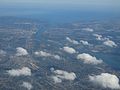
 As far as the eye can see (16453301680).jpg 2,500 × 1,875; 1.28 MB
-
 BC from the Sky (19065271298).jpg 1,672 × 2,816; 885 KB
-
 Bridge leading from Canada to the USA (27819348811).jpg 4,928 × 3,264; 3.96 MB
-
 British Mountains Vuntut NP.jpg 1,600 × 1,200; 1.72 MB
-
 Burnaby BC Aerial view 2015.jpg 4,928 × 3,264; 8.23 MB
-
 BVSC RESORT OVERVIEW AERIAL lo.jpg 300 × 136; 80 KB
-
 Canadian Coast Guard Ship Griffon breaks ice in Lake Erie 150219-G-ZZ999-006.jpg 1,024 × 768; 287 KB
-
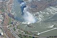
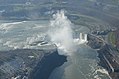
 Canadian side of the Niagara Falls (27794907712).jpg 4,928 × 3,264; 3.91 MB
-
 Caribou in British Mountains.jpg 1,600 × 1,200; 1.82 MB
-
 Central Alberta.JPG 4,912 × 3,264; 5.8 MB
-
 Detroit River Draining Into Lake Erie, Michigan (21691142062).jpg 4,000 × 3,000; 2.85 MB
-
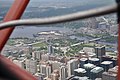
 Downtown Toronto, Ontario (506141) (26317558435).jpg 3,726 × 2,482; 4.07 MB
-
 Edmonton conservatory.jpg 1,280 × 720; 459 KB
-
 Essex County, Ontario (21514674370).jpg 4,000 × 3,000; 2.11 MB
-
 Essex County, Ontario (21514760668).jpg 4,000 × 3,000; 2.21 MB
-
 Exercise Vigilant Shield 16 (7).jpg 4,928 × 3,280; 7.89 MB
-
 Fighting Island, LaSalle, Ontario (21079792884).jpg 3,720 × 2,790; 5.3 MB
-
 Flight from YVR to YKA - (22812778145).jpg 8,080 × 5,387; 21.57 MB
-

-
 Flying over fields- it was pretty hot in there (27617837520).jpg 4,928 × 3,264; 4.15 MB
-
 Foggy Morning Aerial - Leduc AB (28537075683).jpg 1,200 × 800; 651 KB
-
 Fraser Valley Panorama 4.jpg 13,750 × 4,770; 28.87 MB
-
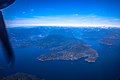
 Galiano Island from above.jpg 3,405 × 2,282; 726 KB
-
 Galiano Island WV banner.jpg 3,405 × 487; 241 KB
-
 Game over- back to base (27861078456).jpg 4,928 × 3,264; 4.55 MB
-
 Holy Sepulchre Catholic Cemetery (20491714812).jpg 2,902 × 1,708; 4.08 MB
-
 Humber College North Campus From The Air - 2.jpg 2,448 × 3,264; 2.2 MB
-
 Inuvik town center.jpg 3,264 × 1,958; 5.56 MB
-
 It took some time to get used to the vertical takeoff! (27283617263).jpg 4,928 × 3,264; 4.64 MB
-
 Knox Church - Waterdown Ontario (20574093956).jpg 3,412 × 2,466; 6.47 MB
-
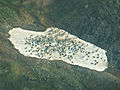
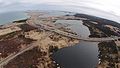
 Lac à Paul Future Mine Site.jpeg 2,816 × 1,880; 1.87 MB
-
 Lake in Old Crow Flats Vuntut NP.jpg 1,600 × 1,200; 2.12 MB
-
 Light Fog and Snow Aerial - Outside Edmonton (29078193531).jpg 2,400 × 1,600; 1.74 MB
-
 Lufa Farms Aerial view of Montreal rooftop greenhouse3zoom.jpg 1,280 × 847; 416 KB
-
 Lévis, Québec - panoramio.jpg 3,636 × 2,101; 1.63 MB
-
 MacDonald Turkey Point Marina.jpeg 2,992 × 1,823; 967 KB
-
 Mississauga Lakeshore (22878577912).jpg 3,990 × 2,241; 4.53 MB
-
 Mississauga Waterfront (23044820826).jpg 3,992 × 2,242; 5.48 MB
-
 Mississauga, Ontario (506137) (26280046956).jpg 3,967 × 2,231; 2.82 MB
-
 Mississauga, Ontario (506138) (26280041426).jpg 3,946 × 2,222; 3.66 MB
-
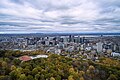 Montreal from above Mont Royal.jpg 3,992 × 2,661; 3.78 MB
-
 Montreal – Beauharnois - panoramio.jpg 3,992 × 2,424; 3.39 MB
-
 Nearing St. John's, Nfl (26985015874).jpg 4,608 × 3,456; 3.56 MB
-
 Niagara Falls come into view- Wow! (27617805220).jpg 4,928 × 3,264; 3.95 MB
-
 Niagara Falls- another aerial view (27617814850).jpg 4,928 × 3,264; 4.45 MB
-
 Niagara town on the Canadian side (27283451504).jpg 4,928 × 3,264; 3.94 MB
-
 North of Old Crow Flats.jpg 2,643 × 1,585; 3.17 MB
-
 North Saskatchewan River Foggy Aerial (28534086854).jpg 2,400 × 1,600; 1.03 MB
-
 Northern Alberta Forests Aerial (28534083144).jpg 2,400 × 1,600; 2.67 MB
-
 Not sure if that is Prince Edward Island (27595241215).jpg 4,608 × 3,456; 4.41 MB
-
 Now you see why they sometimes call it the horse shoe falls (27896077725).jpg 4,928 × 3,264; 3.99 MB
-
 ON400sAtON401ewTorontoAerial (27839427733).jpg 1,200 × 1,800; 901 KB
-
 ON401 Exit 357 - Weston Road (28455423675).jpg 1,200 × 800; 651 KB
-
 ON401DixonRoadTorontoAerial (27839419623).jpg 1,200 × 800; 648 KB
-
 ON401ewON404nsInterchangesToronto-Aerial-May2015 (27839429063).jpg 1,200 × 800; 759 KB
-
 ON401nearWestonRoad-FacingSouthAerial (28172578200).jpg 1,200 × 800; 694 KB
-
 ON427sCurveAtYYZlandingAerial (27839426543).jpg 1,200 × 800; 586 KB
-
 Ontario Farmland (18632603183).jpg 1,920 × 1,080; 133 KB
-
 Ontario Highway 407 Construction at Harmony Road.JPG 3,264 × 2,448; 1.2 MB
-
 Peter A. Allard School of Law.jpg 4,928 × 3,280; 11.11 MB
-
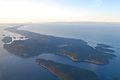
 Port of Argentia and adjacent upland property.jpg 4,384 × 2,466; 2.36 MB
-
 Pycon 2015 (17072145577).jpg 1,920 × 2,560; 1.7 MB
-
 Québec - Pont de l'Île-d'Orléans - panoramio (1).jpg 4,000 × 3,000; 2.14 MB
-
 Québec - Pont de l'Île-d'Orléans - panoramio.jpg 4,000 × 3,000; 1.91 MB
-
 Québec - Saint-Pierre-de-l'Île-d'Orléans - panoramio.jpg 4,000 × 3,000; 2.3 MB
-
 Québec City - Aéroport international Jean-Lesage - panoramio.jpg 4,000 × 3,000; 2.3 MB
-
 Québec City - Cap-Rouge Railroad Trestle - panoramio.jpg 4,000 × 2,655; 3.18 MB
-
 Québec City - Institut Universitaire en santé mentale de Québec - panoramio (1).jpg 3,635 × 2,017; 1.69 MB
-
 Québec City - Institut Universitaire en santé mentale de Québec - panoramio.jpg 4,000 × 3,000; 3.89 MB
-
 Québec City - Lac Saint-Augustin – Nord - panoramio.jpg 4,000 × 3,000; 3.03 MB
-
 Québec City - Les Grands-Déserts - panoramio.jpg 4,000 × 3,000; 2.78 MB
-
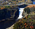 Québec City - Montmorency-Fall - panoramio (1).jpg 3,397 × 2,859; 2.16 MB
-
 Québec City - Syndicat des Employés du Centre Hospitalier St-Augustin - panoramio.jpg 4,000 × 3,000; 2.83 MB
-
 Québec City – Autoroute Felix-Leclerc - Boulevard des Chutes - panoramio.jpg 2,374 × 1,437; 927 KB
-
 Québec City – Centre Vidéotron - panoramio (1).jpg 4,000 × 3,000; 1.64 MB
-
 Rankin Inlet From Air.jpg 3,264 × 2,448; 804 KB
-
 Riverdale (21997753533).jpg 3,482 × 1,469; 2.88 MB
-
 Rogers Centre and CN Tower, Toronto (506142) (26317543735).jpg 1,237 × 1,649; 1.01 MB
-
 Skirting Halifax, I think? (27522606161).jpg 4,608 × 3,456; 4.42 MB
-
 Skylon Tower (21962790880).jpg 1,600 × 1,247; 714 KB
-
 Soaring high above the fields (27861130866).jpg 4,928 × 3,264; 3.91 MB
-
 Source of the Detroit River at Lake St. Clair, Detroit Michigan (21514444320).jpg 3,540 × 2,660; 5.03 MB
-
 STMFIeld.jpg 960 × 522; 56 KB
-
 Stunning views made us forget the cramped interior (27861096366).jpg 4,928 × 3,264; 4.02 MB
-
 Sunset (22630165341).jpg 3,865 × 2,653; 4.92 MB
-
 Sunset above Canada.jpg 6,016 × 4,000; 2.31 MB
-
 Taking off over the delightful greenery around Ottawa (26985063514).jpg 4,608 × 3,456; 3.54 MB
-
 The Centre of the Universe (18536544902).jpg 3,840 × 2,160; 4.47 MB
-
 The Detroit River Between Detroit, Michigan and Windsor, Ontario (21702477435).jpg 3,000 × 4,000; 2.46 MB
-
 The Detroit River Between Detroit, Michigan and Windsor, Ontario (21711721771).jpg 2,950 × 3,940; 6.69 MB
-
 The Gatineau District in the distance.jpg 4,288 × 2,848; 2.95 MB
-
 The Mississaugua Golf and Country Club, Mississauga (506140) (26280052746).jpg 3,037 × 1,904; 2.81 MB
-
 The spray rises up like a dragon (27283772264).jpg 4,928 × 3,264; 3.15 MB
-
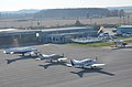
 Thunder Bay International Airport (YQT) (25351928376).jpg 5,760 × 3,840; 12.43 MB
-
 To the left is Goat Island- and you can see the Hornblower boat in there! (27617817980).jpg 4,928 × 3,264; 3.91 MB
-
 Toronto (22807829302).jpg 3,985 × 2,238; 6.82 MB
-
 Toronto From The Sky (18883555268).jpg 2,816 × 2,112; 2.83 MB
-
 Toronto From The Sky (19071243795).jpg 2,816 × 2,112; 2.84 MB
-
 Toronto From The Sky (25112368891).jpg 2,816 × 2,112; 4.51 MB
-
 TorontoLesterPearsonAirportAerial-May2015 (28172581550).jpg 1,200 × 800; 561 KB
-
 Upwards Aircraft Sculpture YMM (29122634766).jpg 1,200 × 800; 611 KB
-
 Vineyards and the road we came on (27861133686).jpg 4,928 × 3,264; 4.42 MB
-
 We are almost over the falls now (27283603973).jpg 4,928 × 3,264; 4.09 MB
-
 We are descending, but can't see land at all! (27318215660).jpg 4,608 × 3,456; 2.56 MB
-
 We now fly over the town of Niagara Falls on the Canadian side (27896090585).jpg 4,928 × 3,264; 3.88 MB
-
 We now take a full turn to face the Niagara Falls head-on (27794909592).jpg 4,928 × 3,264; 4.38 MB
-
 Windsor, Ontario (21079796834).jpg 4,000 × 3,000; 2.75 MB
-
 Windsor, Ontario (21514642888).jpg 4,000 × 3,000; 2.67 MB
-
 Windsor, Ontario (21711660971).jpg 4,000 × 3,000; 2.94 MB
-
 Windsor, Ontario (21711728411).jpg 3,590 × 2,690; 4.16 MB
-
 YKA KAMLOOPS AIRPORT FROM 777 F-GSPJ FLIGHT YVR-CDG (18081326575).jpg 3,341 × 2,227; 3.62 MB
-
 Yonge Street Highrises (27839431513).jpg 1,200 × 800; 912 KB
-
 Yonge Street Toronto (28172580350).jpg 1,200 × 1,800; 1.49 MB
-
 YRM ROCKY MOUNTAINS HOUSE AIRPORT FROM 777 F-GSPJ FLIGHT YVR-CDG (17460764433).jpg 3,647 × 2,429; 6.36 MB
-
 YSN AIRPORT SALMON ARM CANADA FROM A330 N853NW DELTA FLIGHT CDG-SEA (17237108515).jpg 3,837 × 2,558; 6.63 MB
-
 Yukon Valley (16453314570).jpg 2,500 × 1,889; 1.23 MB
-
 YVC LA RONGE AIRPORT FROM 777 F-GSPJ FLIGHT YVR-CDG (17893367938).jpg 3,782 × 2,521; 5.82 MB
-
 Île d'Orléans (WV banner).jpg 4,000 × 571; 508 KB
.jpg)
.jpg)


.jpg)
.jpg)
.jpg)
_(cropped_3-5).jpg)
.jpg)
.jpg)
.jpg)
.jpg)
.jpg)


.jpg)


.jpg)
_(26317558435).jpg)

.jpg)
.jpg)
.jpg)
.jpg)
.jpg)
.jpg)
.jpg)
.jpg)

.jpg)
.jpg)


.jpg)
.jpg)


.jpg)


.jpg)
.jpg)
_(26280046956).jpg)
_(26280041426).jpg)


.jpg)
.jpg)
.jpg)
.jpg)

.jpg)
.jpg)
.jpg)
.jpg)
.jpg)
.jpg)
.jpg)
.jpg)
.jpg)
.jpg)
.jpg)


.jpg)
.jpg)


.jpg)


.jpg)


.jpg)

.jpg)
_(26317543735).jpg)
.jpg)
.jpg)
.jpg)
.jpg)

.jpg)
.jpg)

.jpg)
.jpg)
.jpg)
.jpg)

_(26280052746).jpg)
.jpg)
_(25351928376).jpg)
.jpg)
.jpg)
.jpg)
.jpg)
.jpg)
.jpg)
.jpg)
.jpg)
.jpg)
.jpg)
.jpg)
.jpg)
.jpg)
.jpg)
.jpg)
.jpg)
.jpg)
.jpg)
.jpg)
.jpg)
.jpg)
.jpg)
.jpg)
.jpg)
_(cropped).jpg)
.jpg)