Category:2017 maps of California
Media in category "2017 maps of California"
The following 15 files are in this category, out of 15 total.
-
 BART app map, September 2017.png 2,059 × 1,971; 4.49 MB
-
 BART web map effective March 2017.gif 500 × 500; 47 KB
-
 BART-WS-extension-map (updated).png 521 × 537; 135 KB
-
 Bayshore Cutoff map.svg 1,200 × 1,900; 3.66 MB
-
 Central Subway - Phases 2-4.svg 3,000 × 1,950; 5.37 MB
-
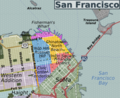 Downtown San Francisco Locator Map.png 359 × 293; 164 KB
-
 DTX Map.svg 1,800 × 3,200; 4.59 MB
-
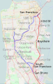
 Location Map San Francisco Bay Area.gif 972 × 1,003; 40 KB
-

-

-
 Oakland Wye.svg 1,500 × 800; 10 KB
-
 San Francisco and San Jose public transport system map (with stations).png 12,859 × 17,508; 65.68 MB
-
 Shasta Trinity National Forest Map.png 1,895 × 1,693; 3.8 MB
-
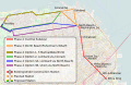
 Silicon Valley BART Extension.png 1,852 × 1,446; 168 KB
-
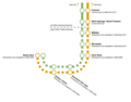
 WSX-SVX Schematic.svg 750 × 950; 12 KB


.png)


.png)