Category:2020 U.S. presidential election maps, county subdivisions
Media in category "2020 U.S. presidential election maps, county subdivisions"
The following 10 files are in this category, out of 10 total.
-
 2020 Presidential Election by County (Red-Blue-Purple View).svg 990 × 627; 981 KB
-
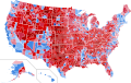
 2020 Presidential Election by County.svg 990 × 627; 1 MB
-
 2020 Republican Presidential Primary Map by County.svg 560 × 361; 673 KB
-

-
 2020 United States presidential election results map by county.svg 555 × 352; 1.45 MB
-
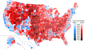 2020 US presidential margins by county.svg 600 × 352; 1.12 MB
-
 Democratic Party presidential primaries results by county, 2020.svg 512 × 325; 1.45 MB
-

-
 South carolina 2020.png 3,000 × 3,000; 1.22 MB
-
 U.S. 2016 to 2020 presidential election swing.svg 555 × 352; 1,018 KB
.svg)


