Category:2020 maps of Europe
Temperate regions: North America · South America · Africa · Europe · Asia · Oceania – Polar regions: – Other regions:
English: 2020 maps of Europe
Español: Mapas de Europa en 2020
Suomi: Euroopan kartat vuodelta 2020
Română: Hărți ale Europei din 2020
Subcategories
This category has the following 23 subcategories, out of 23 total.
A
- 2020 maps of Albania (3 F)
- 2020 maps of Austria (5 F)
B
- 2020 maps of Belgium (1 F)
- 2020 maps of Bulgaria (4 F)
C
- 2020 maps of Croatia (6 F)
E
- 2020 maps of Estonia (2 F)
F
G
- 2020 maps of Georgia (1 F)
I
- 2020 maps of Italy (6 F)
L
- 2020 maps of Lithuania (1 F)
N
- 2020 maps of the Netherlands (1 F)
P
- 2020 maps of Portugal (2 F)
R
- 2020 maps of Romania (22 F)
- 2020 maps of Russia (6 F)
S
- 2020 maps of Serbia (3 F)
T
- Tour de France maps 2020 (3 F)
U
Media in category "2020 maps of Europe"
The following 89 files are in this category, out of 89 total.
-
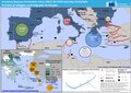
 20200116 DM CivilProtectionPool offered.pdf 1,754 × 1,239; 1.18 MB
-
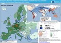
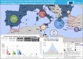
 20200121 DailyMap migration crisis.pdf 1,754 × 1,239; 1.07 MB
-
 20200206 DM CoronoVirusOutbreak EUresponse repatriation.pdf 1,754 × 1,239; 1.37 MB
-
 20200211 DM CoronoVirusOutbreak EUresponse repatriation v2.pdf 1,754 × 1,239; 448 KB
-
 20200227 DM CoronoVirusOutbreak EUresponse repatriation.pdf 1,754 × 1,239; 655 KB
-
 20200302 CoronoVirusOutbreak DM Europa.pdf 1,754 × 1,239; 1.41 MB
-
 20200305 DailyMap migration crisis.pdf 1,754 × 1,239; 1.3 MB
-
 20200306 DM CivilProtectionPool offered.pdf 1,754 × 1,239; 1.19 MB
-
 20200306 DM CoronoVirusOutbreak EEAS Europa.pdf 1,754 × 1,239; 883 KB
-
 20200310 CoronoVirusOutbreak EEAS Europa.pdf 1,754 × 1,239; 758 KB
-
 20200311 CoronoVirusOutbreak Europa.pdf 1,754 × 1,239; 948 KB
-
 20200312 CoronoVirusOutbreak Europa DM.pdf 1,754 × 1,239; 1.1 MB
-
 20200316 DM CoronaVirusOutbreak Europa EEAS.pdf 1,754 × 1,239; 1.17 MB
-
 20200318 DM CoronoVirusOutbreak EUresponse repatriation.pdf 1,754 × 1,239; 743 KB
-
 20200324 CoronoVirusOutbreak EUresponse repatriation.pdf 1,754 × 1,239; 690 KB
-
 20200330 CoronoVirusOutbreak DM EUresponse repatriation2.pdf 1,754 × 1,239; 1.01 MB
-
 20200401 DM CoronaVirusOutbreak Europa EEAS.pdf 1,754 × 1,239; 1.16 MB
-
 20200403 DM CoronoVirusOutbreak EUresponse repatriation.pdf 1,754 × 1,239; 1.18 MB
-
 20200407 DM CoronoVirusOutbreak EUresponse repatriation.pdf 1,754 × 1,239; 1.23 MB
-
 20200414 DM CoronaVirusOutbreak Europa EEAS.pdf 1,754 × 1,239; 855 KB
-
 20200416 DM CoronoVirusOutbreak EUresponse repatriation.pdf 1,754 × 1,239; 1.17 MB
-
 20200423 DM CoronoVirusOutbreak EUresponse repatriation.pdf 1,754 × 1,239; 1.2 MB
-
 20200428 DM CoronaVirusOutbreak Europa EEAS corr.pdf 1,754 × 1,239; 926 KB
-
 20200429 DM CoronoVirusOutbreak EUresponse repatriation.pdf 1,754 × 1,239; 1.2 MB
-
 20200515 DM CoronoVirusOutbreak EUresponse repatriation.pdf 1,754 × 1,239; 1.21 MB
-
 20200520 DM COVID EU Solidarity.pdf 1,754 × 1,239; 1,023 KB
-
 20200529 DM FF Modules RescEU.pdf 1,500 × 1,062; 761 KB
-
 20200604 DM CoronoVirusOutbreak EUresponse repatriation.pdf 1,754 × 1,239; 1.19 MB
-
 20200618 DM CoronoVirusOutbreak EUresponse repatriation.pdf 1,754 × 1,239; 1.19 MB
-
 20200625 DM CivilProtectionPool offered.pdf 1,754 × 1,239; 1.09 MB
-
 20200708 DailyMap migration crisis.pdf 1,754 × 1,239; 1.07 MB
-
 20200715 DM CoronaVirusOutbreak Europa EEAS.pdf 1,754 × 1,239; 1,015 KB
-
 20200729 DM CoronaVirusOutbreak Europa EEAS.pdf 1,754 × 1,239; 1,021 KB
-
 20200731 DM CoronoVirusOutbreak EUresponse repatriation.pdf 1,754 × 1,239; 1.2 MB
-
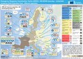
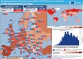
 20200827 EU27 EUCPM Covid measures.pdf 1,625 × 1,125; 883 KB
-
 20200828 DailyMap migration crisis.pdf 1,754 × 1,239; 1.07 MB
-
 20200904 DM CivilProtectionPool offered.pdf 1,754 × 1,239; 1.24 MB
-
 20200915 DM CoronoVirusOutbreak EUresponse repatriation.pdf 1,754 × 1,239; 1.23 MB
-
 20200922 DM Modules RescEU.pdf 1,500 × 1,062; 774 KB
-
 20200928 DM CoronaVirusOutbreak Europa.pdf 1,754 × 1,239; 1.14 MB
-
 20201016 DailyMap migration crisis.pdf 1,754 × 1,239; 1.14 MB
-
 20201021 DM CoronaVirusOutbreak Europa.pdf 1,754 × 1,239; 1.21 MB
-
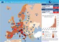
 20201026 DM COVID EU Solidarity woUCPM.pdf 1,754 × 1,239; 1.14 MB
-
 20201030 DM COVID UCPM.pdf 1,754 × 1,239; 1.35 MB
-
 20201110 DM CoronaVirusOutbreak Europa EEAS.pdf 1,754 × 1,239; 1.53 MB
-
 20201113 DM COVID UCPM.pdf 1,754 × 1,239; 1.41 MB
-
 20201120 DM MedicalStockpile v2.pdf 1,754 × 1,239; 749 KB
-
 20201124 DM CoronaVirusOutbreak Europa.pdf 1,754 × 1,239; 1.57 MB
-
 20201203 DM CivilProtectionPool offered.pdf 1,754 × 1,239; 1.24 MB
-
 20201207 CoronoVirusOutbreak EUresponse repatriation.pdf 1,754 × 1,239; 1.29 MB
-
 20201210 DM CoronaVirusOutbreak Europa.pdf 1,754 × 1,239; 1.56 MB
-
 20201211 DM Modules RescEU.pdf 1,500 × 1,062; 840 KB
-
 20201222 DM CoronaVirusOutbreak EEAS Europa.pdf 1,754 × 1,239; 1.04 MB
-

-
 Change in flights.jpg 1,136 × 852; 121 KB
-

-
 COVID-19 death per infected in Europe.svg 680 × 520; 761 KB
-
 COVID-19 Outbreak Cases Map in Europe.svg 680 × 520; 669 KB
-
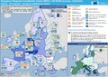
 ECDM 20200212 Europe Severe-weather.pdf 1,625 × 1,125; 1.05 MB
-
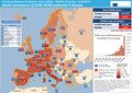
 ECDM 20200420 EU Covid measures.pdf 1,625 × 1,125; 947 KB
-
 ECDM 20200427 EUCPM Covid measures.pdf 1,625 × 1,125; 470 KB
-
 ECDM 20200505 EUCPM Covid measures.pdf 1,625 × 1,125; 699 KB
-
 ECDM 20200511 EUCPM Covid measures.pdf 1,625 × 1,125; 1.03 MB
-
 ECDM 20200611 EUCPM Covid measures.pdf 1,625 × 1,125; 438 KB
-
 ECDM 20200616 EUCPM Covid measures.pdf 1,625 × 1,125; 509 KB
-
 ECDM 20200623 EUCPM Covid measures.pdf 1,625 × 1,125; 555 KB
-
 ECDM 20200707 EUCPM Covid measures.pdf 1,625 × 1,125; 512 KB
-
 ECDM 20200911 Forestfires Europe.pdf 1,625 × 1,125; 701 KB
-
 ECDM 20200925 EU27 EUCPM Covid measures.pdf 1,625 × 1,125; 733 KB
-
 ECDM 20201002 Tsunami EWS.pdf 1,625 × 1,125; 626 KB
-
 ECDM 20201015 EU27 EUCPM Covid measures v2.pdf 1,625 × 1,125; 964 KB
-
 ECDM 20201106 EU27 EUCPM Covid measures.pdf 1,625 × 1,125; 1.04 MB
-
 ECDM 20201113 EQ Europe EUCPM(1).pdf 1,625 × 1,125; 542 KB
-
 ECDM 20201223 EU27 EUCPM Covid measures.pdf 1,625 × 1,125; 648 KB
-
 EU financial transaction tax.svg 512 × 392; 506 KB
-
 Europe topography map uk.png 1,473 × 1,198; 1.59 MB
-
 EuroVelo Routes 2020.svg 652 × 694; 263 KB
-
 EuroVelo Routes 2023.svg 652 × 694; 263 KB
-
 Future life expectancy projections, OWID.svg 850 × 600; 167 KB
-
 GDP per hour worked 2020 OECD.png 4,095 × 2,850; 4.02 MB
-
 GINI Europe 2020.svg 457 × 479; 965 KB
-
 HSL network around the Netherlands (June 2020).png 1,019 × 720; 265 KB
-
 Layout ECDM 20200723 Forestfires Europe.pdf 1,625 × 1,125; 591 KB
-
 Liechtenstein Population Density, 2000 (5457015371).jpg 2,513 × 3,194; 600 KB
-
 Percentage of GDP spent on education in 2020.png 1,414 × 1,546; 1,023 KB
-
 Right-wing populist parties in European national parliaments (Mai 2020).png 1,236 × 1,245; 101 KB
-
 Rural population in the EU, by country.png 1,414 × 1,583; 706 KB
-
 Türkvizyon 2020 map.svg 1,000 × 665; 768 KB
-
 Ukraine Map CIA 20201118.jpg 635 × 324; 56 KB
_Enlargement,_1949-Present_-_IMG_2327.jpg)

.svg)


.png)
.jpg)

.png)


