Category:2020 satellite pictures taken by CBERS-4
Media in category "2020 satellite pictures taken by CBERS-4"
The following 23 files are in this category, out of 23 total.
-
 Arquipélago de Mariauá.jpg 2,712 × 1,526; 2.32 MB
-
 Australia bush fires smoke above Argentina.jpg 1,080 × 1,080; 339 KB
-
 Bebedero Salt Pan, Argentina.jpg 2,992 × 1,683; 2.46 MB
-
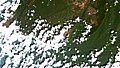 Cerro Guaiquinima, Venezuela.jpg 2,793 × 1,572; 2.11 MB
-
 Chapada Mine, Goias (cropped).jpg 844 × 647; 304 KB
-
 Chapada Mine, Goias.jpg 2,603 × 1,464; 2.15 MB
-
 Dahlak Archipelago, Red Sea.jpg 5,146 × 2,895; 4.04 MB
-
 Drygalski Glacier, Antártica.jpg 3,808 × 2,142; 3.01 MB
-
 El Fasher, Darfur do Norte, Sudão.jpg 3,632 × 2,043; 3.67 MB
-
 Essequibo River Mouth, Guiana.jpg 3,658 × 2,058; 2.78 MB
-
 Huaraz, Perú.jpg 2,292 × 2,292; 2.57 MB
-

-
 Inírida River, Colombian Amazon.jpg 2,731 × 1,537; 2.03 MB
-
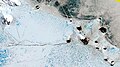
 King George Island, Antartica.jpg 1,137 × 2,021; 561 KB
-
 Nunataks Foca, Mar de Weddell, Antartica.jpg 2,969 × 1,670; 2.37 MB
-
 Peruvian Altiplano.jpg 3,080 × 1,733; 3.13 MB
-
 Punta Patache, Chile.jpg 2,610 × 1,468; 1.05 MB
-
 Rio Paraguai-Mirim.jpg 3,282 × 1,847; 2.91 MB
-
 Salto do Jacuí, RS.jpg 3,273 × 1,612; 3.1 MB
-
 San Vicente de Cañete, Perú.jpg 2,768 × 1,557; 1.12 MB
-
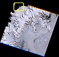
 Sjogren glacier, Antartica.jpg 7,946 × 7,713; 13.87 MB
-
 Sobral Cape, Antarctica.jpg 2,220 × 2,220; 1.94 MB
-
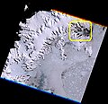
 Unnamed tidewater glacier at W Graham Land Davis Coast, Antártica.jpg 7,946 × 7,713; 13.96 MB


.jpg)


.jpg)


