Category:2023 maps of Boxberg (Baden)
Media in category "2023 maps of Boxberg (Baden)"
The following 10 files are in this category, out of 10 total.
-
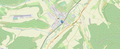
 Lage Bahnhof Boxberg-Wölchingen 1.png 1,863 × 764; 1.12 MB
-
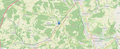
 Lage Bahnhof Boxberg-Wölchingen 2.png 1,862 × 764; 1.18 MB
-
 Lage Bahnhof Schweigern (Baden) bei Boxberg (Baden) 1.png 1,862 × 763; 1.03 MB
-
 Lage Bahnhof Schweigern (Baden) bei Boxberg (Baden) 2.png 1,857 × 756; 1.16 MB
-
 Lage Bahnhof Unterschüpf bei Boxberg (Baden) 1.png 1,865 × 767; 993 KB
-
 Lage Bahnhof Unterschüpf bei Boxberg (Baden) 2.png 1,859 × 757; 1.22 MB
-
 Lage Bahnhof Unterschüpf bei Boxberg (Baden) 3.png 1,863 × 764; 1.75 MB
-
 Lage Haltepunkt Uiffingen bei Boxberg (Baden) 1.png 1,862 × 767; 870 KB
-
 Lage Haltepunkt Uiffingen bei Boxberg (Baden) 2.png 1,859 × 762; 1.11 MB
-
 Lage Haltepunkt Uiffingen bei Boxberg (Baden) 3.png 1,859 × 759; 1.58 MB
_bei_Boxberg_(Baden)_1.png)
_bei_Boxberg_(Baden)_2.png)
_1.png)
_2.png)
_3.png)
_1.png)
_2.png)
_3.png)