Category:20 mph speed limit road signs in London
Media in category "20 mph speed limit road signs in London"
The following 37 files are in this category, out of 37 total.
-
 20 mph sign, Rosebery Avenue - Garnault Place, EC1 - geograph.org.uk - 6111278.jpg 1,024 × 1,024; 218 KB
-
 20 mph zone sign Stanmore 2024-04-15.jpg 4,032 × 3,024; 3.85 MB
-
 20 mph zone, Weir Hall Road - geograph.org.uk - 2869045.jpg 1,024 × 768; 101 KB
-
 Downhills Park Road, Haringey London 1.jpg 4,358 × 3,269; 13.17 MB
-
 20mph zone, Powerscroft Road, E5 April 2009.jpg 1,152 × 864; 181 KB
-
 A New Slant on Road Safety - geograph.org.uk - 1068855.jpg 427 × 640; 155 KB
-
 Another of my shops (7620693574).jpg 718 × 648; 237 KB
-
 Arsenal Tavern, Finsbury Park, N4 (2505268917).jpg 3,776 × 2,520; 3.55 MB
-
 Atfruitvec, White Horse Road E1 - geograph.org.uk - 2030486.jpg 640 × 480; 71 KB
-
 Belmont Hill, Lewisham.jpg 4,296 × 3,222; 10.12 MB
-
 Bizarre sign - geograph.org.uk - 555603.jpg 640 × 480; 58 KB
-
 Cow Bridge, E5.jpg 1,306 × 979; 328 KB
-
 Crossroads in Richmond Park - geograph.org.uk - 2415526.jpg 3,872 × 2,592; 4.33 MB
-
 Duke of Wellington, Hoxton, N1 (4228807681).jpg 3,118 × 2,079; 2.6 MB
-
 Former Woolwich Road post office - geograph.org.uk - 2508195.jpg 1,024 × 768; 214 KB
-
 Ghost sign - Motor & Cycle Works E17.jpg 2,133 × 1,600; 581 KB
-
 GOC Rickmansworth & Harefield 088 Harefield Village Centre (22882868774).jpg 3,494 × 2,617; 2.6 MB
-
 Graffiti on East London Line viaduct on Sclater Street - geograph.org.uk - 1700816.jpg 3,456 × 2,592; 3.19 MB
-
 Green Lanes, Harringay Festival.jpg 2,736 × 2,736; 1.45 MB
-
 Hadley Street blended junction.jpg 3,607 × 2,732; 2.64 MB
-
 Hammersmith Bridge - geograph.org.uk - 5182367.jpg 4,000 × 3,000; 3.01 MB
-
 Haringey - 20 mph Zone in Hanbury Road N17.jpg 3,700 × 3,300; 1.63 MB
-
 Hazel Alterations and Ghost Sign, Stoke Newington Church Street.jpg 2,592 × 1,944; 1.32 MB
-
 Notices, Robin Hood Gate - geograph.org.uk - 2170016.jpg 480 × 640; 78 KB
-
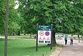
 Richmond park.JPG 1,200 × 1,600; 258 KB
-
 Shop and K2 telephone box, Rosebery Avenue - geograph.org.uk - 3947351.jpg 2,008 × 2,406; 1.23 MB
-
 Shops and flats, Haverstock Hill, London NW3 - geograph.org.uk - 2177781.jpg 4,320 × 3,240; 4.42 MB
-
 Snakes Lane, Oakwood, London, N14 - geograph.org.uk - 333553.jpg 640 × 480; 192 KB
-
 St. John's Road, Putney - geograph.org.uk - 4303610.jpg 1,600 × 1,409; 484 KB
-
 Stanhope Road - geograph.org.uk - 4928803.jpg 640 × 480; 102 KB
-
 Stoke Newington Church Street 2020-07-13.jpg 4,466 × 3,435; 12.01 MB
-
 The Conqueror, Boundary Street, E1.jpg 6,000 × 3,376; 5.91 MB
-
 Trinity Methodist Church, Plumstead - geograph.org.uk - 2666192.jpg 640 × 480; 53 KB
-
 Holy Trinity Church, Tulse Hill - geograph.org.uk - 282778.jpg 480 × 640; 72 KB
-

-
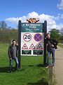
 Welcome to Richmond Park - geograph.org.uk - 2575571.jpg 640 × 430; 106 KB
-
 Wheelwright Street, N7 - geograph.org.uk - 413904.jpg 640 × 480; 128 KB


.jpg)
.jpg)


.jpg)


.jpg)


