Category:20th-century maps of Arabia
Subcategories
This category has the following 11 subcategories, out of 11 total.
1
- 1900s maps of Arabia (22 F)
- 1910s maps of Arabia (33 F)
- 1930s maps of Arabia (2 F)
- 1960s maps of Arabia (3 F)
O
S
U
Y
Media in category "20th-century maps of Arabia"
The following 3 files are in this category, out of 3 total.
-
 052912100531tztuo4bj0oz.jpg 327 × 600; 39 KB
-
 1952 map of the Near East by the United States Army Map Service.tif 12,212 × 9,972; 348.44 MB
-
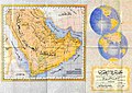 Saudi map of Persian gulf 1952.jpg 623 × 442; 127 KB

