Category:20th-century maps of Jamaica
Countries of North America: The Bahamas · Barbados · Belize · Canada · Costa Rica · Cuba · Dominican Republic · Guatemala · Haiti · Honduras · Jamaica · Mexico · Nicaragua · Panama · Saint Kitts and Nevis · Saint Vincent and the Grenadines · United States of America‡
Other territories: Bermuda · Greenland · Guadeloupe · Martinique · Puerto Rico
‡: partly located in North America
Other territories: Bermuda · Greenland · Guadeloupe · Martinique · Puerto Rico
‡: partly located in North America
Subcategories
This category has the following 2 subcategories, out of 2 total.
- 1900s maps of Jamaica (4 F)
Media in category "20th-century maps of Jamaica"
The following 7 files are in this category, out of 7 total.
-
 Les Grandes Antilles, 1909.png 948 × 653; 612 KB
-
 Port Maria, Jamaica map (US Army, 1944).jpg 2,986 × 3,303; 2.87 MB
-
 Admiralty Chart No 451 Plans on the North Coast of Jamaica, Published 1881, New Edition 1933.jpg 11,062 × 8,129; 28.26 MB
-
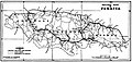 Jamaica rail map 1925.jpg 1,010 × 476; 195 KB
-

-

-


.jpg)


_(14595966328).jpg)
_(14782610595).jpg)
_(14802468893).jpg)