Category:20th-century maps of Rwanda
Countries of Africa: Algeria · Angola · Benin · Botswana · Burkina Faso · Burundi · Cameroon · Cape Verde · Central African Republic · Chad · Comoros · Democratic Republic of the Congo · Republic of the Congo · Djibouti · Egypt‡ · Equatorial Guinea · Eritrea · Eswatini · Ethiopia · Gabon · The Gambia · Ghana · Guinea · Guinea-Bissau · Ivory Coast · Kenya · Lesotho · Liberia · Libya · Madagascar · Malawi · Mali · Mauritania · Morocco · Mozambique · Namibia · Niger · Nigeria · Rwanda · São Tomé and Príncipe · Senegal · Sierra Leone · Somalia · South Africa · South Sudan · Sudan · Tanzania · Togo · Tunisia · Uganda · Zambia · Zimbabwe
Limited recognition: Somaliland – Other areas: Madeira · Western Sahara
‡: partly located in Africa
Limited recognition: Somaliland – Other areas: Madeira · Western Sahara
‡: partly located in Africa
Media in category "20th-century maps of Rwanda"
The following 8 files are in this category, out of 8 total.
-
 1967 data of Eastern African countries.jpg 2,144 × 2,888; 911 KB
-
 Rwanda and Burundi. LOC 2005631066.jpg 2,182 × 3,088; 671 KB
-
 Rwanda and Burundi. LOC 2005631066.tif 2,182 × 3,088; 19.28 MB
-
 Rwanda and Burundi. LOC 2005631067.jpg 2,413 × 3,128; 754 KB
-
 Rwanda and Burundi. LOC 2005631067.tif 2,413 × 3,128; 21.59 MB
-
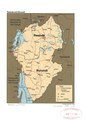
 Rwanda and Burundi. LOC 96685360.jpg 1,776 × 2,736; 695 KB
-
 Rwanda and Burundi. LOC 96685360.tif 1,776 × 2,736; 13.9 MB
-
 Rwanda location 1914.svg 829 × 425; 1.34 MB


