Category:20th-century maps of Tibet
Media in category "20th-century maps of Tibet"
The following 58 files are in this category, out of 58 total.
-
-
-
 1903 Routes between Tibet and India by O'Connor.jpg 6,340 × 4,888; 1.56 MB
-
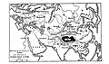
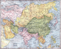 1904 map of Asia.png 3,927 × 3,172; 32.7 MB
-
 Lhasa and its mysteries.jpg 2,617 × 1,555; 656 KB
-
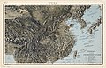
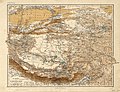 1906 RGS map of Tibet and the Surrounding Regions.jpg 7,750 × 5,968; 53.22 MB
-

-

-
 1912 China map from National Geographic.jpg 6,980 × 5,326; 10.65 MB
-
 STANFORD(1917) p49-50 PLATE15. SZECHWAN (14783836675).jpg 4,831 × 3,809; 14.65 MB
-
 STANFORD(1917) p53-54 PLATE16. YUNNAN (14597193058).jpg 4,733 × 3,822; 9.85 MB
-
 STANFORD(1917) p61 PLATE19. SINKIANG (14597194848).jpg 3,712 × 2,302; 1.51 MB
-
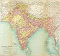 1922 Map of India by Bartholomew in Imperial Gazetteer of India.jpg 3,729 × 3,449; 4.79 MB
-
 China old map.jpg 1,868 × 1,380; 567 KB
-
 1930 Map of the Republic of China.JPG 1,171 × 817; 272 KB
-
 Asia 1932.jpg 8,315 × 9,984; 12.4 MB
-
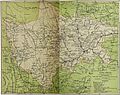
 1936 Survey of India map of Highlands of Tibet and Surrounding Regions.jpg 16,605 × 11,925; 17.46 MB
-
 1944 China (30583362020).jpg 10,678 × 6,834; 10.39 MB
-

-

-

-
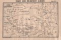
 1949 Survey of India's map of Tibet and adjacent lands from Pranavananda's book-2.jpg 4,267 × 2,979; 2.23 MB
-
 1949 Survey of India's map of Tibet and adjacent lands from Pranavananda's book.jpg 4,064 × 2,692; 704 KB
-
 1963 South Asia (30249403993).jpg 4,500 × 4,811; 12.22 MB
-
 A map of part of Tibet 1904 50601846.jpg 12,051 × 8,091; 15.4 MB
-
 China, National Geographic Series, 1945.jpg 10,688 × 7,659; 6.26 MB
-

-
 Map illustrating Edward Amundsen's journey in Sechuen, East Tibet and Yunnan.webp 1,025 × 1,600; 268 KB
-
 Map of Szechwan for the China Inland Mission.jpg 10,065 × 7,041; 25.67 MB
-
 Map of Szechwan showing stations of CIM, CMS and BCMS.png 1,638 × 1,426; 4.73 MB
-
 Mission du Thibet 1.jpg 3,154 × 2,625; 2.55 MB
-
 Mission du Thibet 2.jpg 3,739 × 2,599; 3.11 MB
-
 Mount Kailas, Tibet map in 1907 (cropped).jpg 638 × 793; 449 KB
-

-
 Pacific Area - The Imperial Powers 1939 - Map.jpg 1,202 × 917; 615 KB
-
 Pacific War - American Carrier OP 1941-42 - Map.jpg 1,260 × 961; 210 KB
-
 Pacific War - Japanese Carrier OP 1941-42 - Map.jpg 1,260 × 961; 212 KB
-
 Preliminary map of Mount Everest Expedition, 1921. Map I.jpg 6,284 × 3,900; 2.22 MB
-

-
 Simla Accord Treaty 1914 Map1.jpg 800 × 629; 151 KB
-
 Sketch Map of the glaciers of Kangchenjunga by Edmund J. Garwood, 1903 (cropped).jpg 2,125 × 2,038; 1,008 KB
-
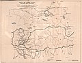
 Sketcm map of battle at Gyantse Zhong and Gompa in 1904.png 3,623 × 2,457; 8.46 MB
-
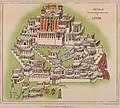
 Tashilhunpo 1902.jpg 1,670 × 2,107; 793 KB
-
-
-

-
 Tibet 1900.jpg 7,970 × 6,018; 8.24 MB
-
 Tibet 1904.jpg 20,850 × 10,109; 23.98 MB
-
 TIbet 1955 CIA.jpg 10,480 × 8,945; 10.25 MB
-

-

-
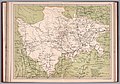
 Tilted, 1914 Survey of India map of Tibet and Adjacent Countries (cropped).jpg 4,860 × 3,915; 1.2 MB
-
 Txu-pclmaps-oclc-181831961-91-c-kangri-karpo-la-1917.jpg 3,602 × 4,779; 1.43 MB
-
 Txu-pclmaps-oclc-181831961-91-h-rima-1918.jpg 3,733 × 4,738; 1.68 MB
-
 Txu-pclmaps-oclc-181831961-91-h-rima-1925.jpg 3,916 × 4,830; 2.27 MB
-
 Txu-pclmaps-oclc-181831961-91-h-rima-1942.jpg 3,640 × 5,085; 1.91 MB
-
 West China (Szechwan) Diocese map.png 7,952 × 5,304; 34.76 MB
-
 World around 1900.jpg 2,880 × 2,078; 1.11 MB
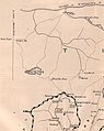
%22_%22Khamba_Jong_(Dzong)%22_%22Thuna_(Tuna)%22_%22Dechem%22_%22Guru%22_%22Ammo_Chu%22_%22Sakya_My.%22-_Sakya_Monastery,_Tibet_in_1903,_from-_1903_Routes_between_Tibet_and_India_by_O%27Connor_(cropped).jpg)
.jpg)


_vol_1_(page_7_crop)_(cropped).jpg)

_p49-50_PLATE15._SZECHWAN_(14783836675).jpg)
_p53-54_PLATE16._YUNNAN_(14597193058).jpg)
_p61_PLATE19._SINKIANG_(14597194848).jpg)


.jpg)


.jpg)


.jpg)


.jpg)
_(cropped).jpg)


_(14587198197).jpg)

.jpg)


_(14576990459).jpg)
_(14776461552).jpg)
_(14796674583).jpg)


.jpg)
.jpg)
.jpg)


_Diocese_map.png)
