Category:20th-century maps of the British Isles
Media in category "20th-century maps of the British Isles"
The following 27 files are in this category, out of 27 total.
-
 Great Britain 1900.jpg 1,276 × 1,719; 291 KB
-
 Europe and other continents (1901) (14763679725).jpg 1,682 × 2,498; 748 KB
-
 Angevindominionsfrommedandmodhismyers1905.jpg 2,256 × 3,615; 4.72 MB
-
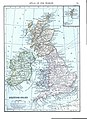
 Britische Inseln 1905.png 1,358 × 2,000; 1.42 MB
-
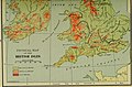
 Public Schools Historical Atlas - England 878.jpg 801 × 1,194; 336 KB
-
 The Harmsworth atlas and Gazetter 1908 (135848391).jpg 9,592 × 12,711; 98.99 MB
-
 The Harmsworth atlas and Gazetter 1908 (135848414).jpg 9,592 × 12,576; 133.09 MB
-
 The Harmsworth atlas and Gazetter 1908 British Isles population density map.jpg 1,776 × 2,129; 5.15 MB
-
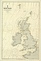
 British Isles (1909).jpg 863 × 1,185; 805 KB
-

-
 Ontario High School History of England (1912) (14756769396).jpg 1,840 × 2,450; 570 KB
-
 Ca. 1914 World War I propaganda, pictorial map of the British Isles.jpg 7,867 × 7,750; 10.69 MB
-
 Democratic Ideals and Reality, 1919 Fig 2 p 43.jpg 531 × 1,136; 30 KB
-
 1939 Post Office Wireless Stations - MacDonald Gill.png 18,371 × 14,611; 409.74 MB
-
 Great Britain and Ireland old german map.jpg 876 × 1,454; 490 KB
-
 A short history of England and the British Empire (1915) (14580507139).jpg 3,104 × 2,148; 910 KB
-
 A short history of England and the British Empire (1915) (14787026643).jpg 1,920 × 2,848; 988 KB
-
 Admiralty Chart No 1 Portsmouth to Canary Islands, Published 1914.jpg 8,752 × 15,120; 12.56 MB
-
 Admiralty Chart No 2 The British Islands, Published 1913 02.jpg 8,616 × 12,553; 10.08 MB
-
 Admiralty Chart No 2 The British Islands, Published 1913.jpg 8,315 × 12,302; 11.98 MB
-
 An atlas of commercial geography (1913) (14781072932).jpg 2,304 × 2,806; 1.18 MB
-
 An atlas of commercial geography (1913) (14781428495).jpg 2,338 × 2,822; 1.52 MB
-

-
-
 Hand-drawn view of the British Isles showing enemy attacks between 1915 and 1916 in World War I.jpg 10,987 × 7,365; 16.37 MB
-
 Physical map british isles ref 1926 clear.png 1,101 × 1,601; 1.65 MB
-
 Physical map british isles ref 1926.png 1,101 × 1,768; 3.09 MB

_(14763679725).jpg)


.jpg)
.jpg)

.jpg)
.jpg)
_(14756769396).jpg)


_(14580507139).jpg)
_(14787026643).jpg)


_(14781072932).jpg)
_(14781428495).jpg)
_(1905)_(14598191269).jpg)
_(1905)_(14598203688).jpg)

