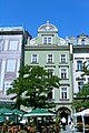
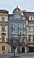
Category:28 Old Town Market Square in Kraków
| Object location | | View all coordinates using: OpenStreetMap |
|---|
 | |||||
| Upload media | |||||
| Instance of | |||||
|---|---|---|---|---|---|
| Location | Kraków, Lesser Poland Voivodeship, Poland | ||||
| Street address |
| ||||
| Heritage designation |
| ||||
| Inception |
| ||||
 | |||||
Polski: Kamienica Pod Jagnięciem
| Address |
|
Media in category "28 Old Town Market Square in Kraków"
The following 9 files are in this category, out of 9 total.
-
 01Kraków.JPG 1,360 × 2,048; 872 KB
-
 02Kraków.JPG 2,048 × 1,360; 432 KB
-
 Krakow - panoramio (26).jpg 3,632 × 5,456; 7.1 MB
-
 Krakow OldMarketSquare28 6737.JPG 2,592 × 3,549; 6.59 MB
-
 Krakow Rynek Glowny kamienice.jpg 1,600 × 1,200; 1.23 MB
-
 L.Ak IIka32Kr Kamienica Pod Jagnięciem Kraków Rynek Główny 28 MM.JPG 1,944 × 2,896; 1.6 MB
-
 Pod Jagnięciem tenement house, 28 Main Market square, Old Town, Kraków, Poland.jpg 3,320 × 5,564; 16.69 MB
-
 Pod Jagnięciem, Kraków.JPG 2,592 × 3,872; 2.28 MB
-
 Rynek Główny 27-30 Kraków.jpg 4,000 × 3,000; 2.84 MB


.jpg)


