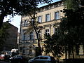
Category:28 Szlak Street in Kraków
| Object location | | View all coordinates using: OpenStreetMap |
|---|
 | |||||
| Upload media | |||||
| Instance of | |||||
|---|---|---|---|---|---|
| Location | Kraków, Lesser Poland Voivodeship, Poland | ||||
| Street address |
| ||||
| Heritage designation |
| ||||
| Inception |
| ||||
 | |||||
| Address |
|
Media in category "28 Szlak Street in Kraków"
The following 5 files are in this category, out of 5 total.
-
 Kamienica-UlicaSzlak28-POL, Kraków.jpg 4,000 × 3,700; 6.76 MB
-
 Kamienica. Kraków ul. Szlak 28 1.jpg 2,048 × 1,536; 643 KB
-
 Kamienica. Kraków ul. Szlak 28 2.jpg 2,048 × 1,536; 643 KB
-
 Kamienica. Kraków ul. Szlak 28 3.jpg 2,048 × 1,536; 655 KB
-
 Kamienica. Kraków ul. Szlak 28 4.jpg 2,048 × 1,536; 681 KB


