Category:A274 road (England)
Road in Kent, England  | |||||
| Upload media | |||||
| Instance of | |||||
|---|---|---|---|---|---|
| Location | Kent, South East England, England | ||||
| Transport network |
| ||||
| Length |
| ||||
 | |||||
Media in category "A274 road (England)"
The following 45 files are in this category, out of 45 total.
-

-

-
 Bus in a front garden^ - geograph.org.uk - 695450.jpg 640 × 480; 109 KB
-
 Church of St Mary, Langley - geograph.org.uk - 68157.jpg 640 × 480; 127 KB
-
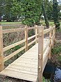
 Damaged footbridge in Langley Park Farm - geograph.org.uk - 1130949.jpg 640 × 481; 143 KB
-
 Farm road to Heron Cottage - geograph.org.uk - 1388328.jpg 640 × 480; 97 KB
-
 Fishing Lake in Gladwish Farm land - geograph.org.uk - 1196069.jpg 640 × 481; 102 KB
-
 Five Wents - geograph.org.uk - 68177.jpg 640 × 480; 98 KB
-
 Footbridge near Gladwish Bungalow - geograph.org.uk - 1180972.jpg 481 × 640; 115 KB
-
 Footbridge near Sparks Hall Farm - geograph.org.uk - 1261762.jpg 640 × 480; 112 KB
-
 Footpath with blossom - geograph.org.uk - 1220523.jpg 480 × 640; 166 KB
-
 Frittenden Road junction, Lashenden - geograph.org.uk - 1524192.jpg 640 × 427; 68 KB
-

-
 Golfers on 18th Tee - geograph.org.uk - 1222753.jpg 640 × 480; 96 KB
-
 Greenway Farm - geograph.org.uk - 1261794.jpg 640 × 480; 107 KB
-
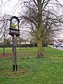 Headcorn Village Sign - geograph.org.uk - 1220732.jpg 480 × 640; 137 KB
-
 Lane junction on Ayleswade Lane - geograph.org.uk - 1389494.jpg 640 × 480; 77 KB
-
 Moatenden Farm Oast - geograph.org.uk - 1220761.jpg 640 × 480; 56 KB
-

-

-

-
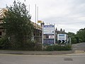
 Petrol Station, A274, Sutton Valence - geograph.org.uk - 1157455.jpg 640 × 430; 89 KB
-

-
 Road junction on Hareplain Road - geograph.org.uk - 1388342.jpg 640 × 480; 87 KB
-

-
 Rumswood Green Farm - geograph.org.uk - 1130942.jpg 640 × 481; 75 KB
-

-
 Smarden Road - geograph.org.uk - 1619990.jpg 640 × 427; 62 KB
-
 Smarden Road bridge - geograph.org.uk - 1619993.jpg 640 × 427; 73 KB
-

-
 The King's Head pub, Sutton Valence - geograph.org.uk - 1180998.jpg 640 × 481; 75 KB
-
 The Manse Building Site, Headcorn - geograph.org.uk - 1418324.jpg 640 × 480; 66 KB
-
 The New Oast, Lashenden Farm on the A274 - geograph.org.uk - 1206806.jpg 640 × 480; 136 KB
-
 The Old Rectory (2) - geograph.org.uk - 1220519.jpg 640 × 480; 100 KB
-
 The Old Rectory - geograph.org.uk - 1220514.jpg 640 × 480; 82 KB
-
 The Plough Public House, Five Wents - geograph.org.uk - 1220510.jpg 640 × 480; 89 KB
-

-
 Two stiles and footbridge - geograph.org.uk - 1261767.jpg 640 × 480; 135 KB
-
 UK road A274.PNG 597 × 184; 7 KB
-
 Weald of Kent Golf Clubhouse - geograph.org.uk - 1222749.jpg 640 × 480; 76 KB
-
 Crown and Horseshoes, Langley - geograph.org.uk - 68445.jpg 640 × 480; 85 KB
-
 Maidstone Rd - geograph.org.uk - 214832.jpg 640 × 426; 110 KB
-
 New Barn Rd - geograph.org.uk - 214815.jpg 640 × 426; 141 KB
-
 The fifth went - geograph.org.uk - 68180.jpg 640 × 416; 77 KB
-
 The Wheatsheaf - geograph.org.uk - 85492.jpg 640 × 427; 89 KB


_-_geograph.org.uk_-_1220519.jpg)


