Category:A483 road (Great Britain)

road in the United Kingdom   | |||||
| Upload media | |||||
| Instance of | |||||
|---|---|---|---|---|---|
| Location | |||||
| Transport network |
| ||||
| Length |
| ||||
 | |||||
Subcategories
This category has the following 3 subcategories, out of 3 total.
Media in category "A483 road (Great Britain)"
The following 127 files are in this category, out of 127 total.
-
 A 483 T goes over the Afon Dyfrdwy - geograph.org.uk - 69293.jpg 640 × 480; 97 KB
-
 A bend in the A483 - geograph.org.uk - 154485.jpg 640 × 480; 109 KB
-
 A483 - geograph.org.uk - 219430.jpg 640 × 480; 57 KB
-

-
 A483 at Llanbadarn Fynydd - geograph.org.uk - 992531.jpg 640 × 480; 59 KB
-
 A483 at Rhiwabon - geograph.org.uk - 2874235.jpg 1,600 × 1,200; 303 KB
-

-
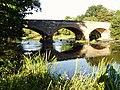
 A483 bridge over the Dee - geograph.org.uk - 1145336.jpg 640 × 480; 60 KB
-
 A483 descends to Tycroes - geograph.org.uk - 71128.jpg 640 × 463; 58 KB
-
 A483 Irfon Bridge - geograph.org.uk - 1042219.jpg 640 × 428; 380 KB
-

-
 A483 near Llewelyn's Monument - geograph.org.uk - 1046430.jpg 640 × 428; 367 KB
-
 A483 road map.png 250 × 425; 48 KB
-
 A483 towards Beulah - geograph.org.uk - 1048956.jpg 640 × 480; 85 KB
-
 A483 towards Llanwrtyd Wells - geograph.org.uk - 1048951.jpg 640 × 480; 53 KB
-
-

-
 Arddleen station site geograph-3235023-by-Ben-Brooksbank.jpg 2,347 × 1,414; 4.88 MB
-
 B5445-A483 Junction - geograph.org.uk - 1477998.jpg 640 × 480; 128 KB
-
 Bendy main road - geograph.org.uk - 968929.jpg 640 × 480; 119 KB
-
 Boundary stone north of Llanymynech.jpg 4,000 × 3,000; 1.88 MB
-
 Bridge 131, Garthmyl - geograph.org.uk - 632592.jpg 640 × 480; 70 KB
-
 Bridge 17 on Llangollen Canal - geograph.org.uk - 1067115.jpg 640 × 480; 77 KB
-
 Bridge over the A483 - geograph.org.uk - 329123.jpg 640 × 426; 118 KB
-
 Broadway junction - geograph.org.uk - 1042309.jpg 640 × 428; 336 KB
-
 Builth Wells bridge - geograph.org.uk - 1332002.jpg 640 × 480; 60 KB
-
 Builth Wells-Garth Road Junction.jpg 640 × 428; 285 KB
-

-
 Cambrian Woollen Mills, Llanwrtyd Wells - geograph.org.uk - 354249.jpg 640 × 454; 105 KB
-
 Canal in Llanymynech - geograph.org.uk - 836014.jpg 640 × 480; 69 KB
-
 Catholic Church - geograph.org.uk - 1042358.jpg 640 × 428; 378 KB
-
 Cefnbronllys, lay-by - geograph.org.uk - 1244575.jpg 640 × 480; 81 KB
-
 Chapel on the A483, Four Crosses - geograph.org.uk - 843594.jpg 640 × 480; 68 KB
-
 Cilmery Lodge - geograph.org.uk - 1111449.jpg 640 × 480; 95 KB
-
 Cottage on the A483 west of Cilmery - geograph.org.uk - 1566755.jpg 640 × 480; 127 KB
-
 Driving on the A483 - geograph.org.uk - 1470639.jpg 640 × 480; 140 KB
-
 Ffairfach geograph-3755011-by-Ben-Brooksbank.jpg 2,237 × 1,370; 2.89 MB
-
 Ffairfach railway station - geograph.org.uk - 2925146.jpg 640 × 471; 95 KB
-
 From The Sugar Loaf - geograph.org.uk - 1459763.jpg 640 × 480; 72 KB
-
 Gateway to Ammanford - geograph.org.uk - 915214.jpg 640 × 480; 96 KB
-
 Gateway to Caer Beris - geograph.org.uk - 1042227.jpg 640 × 428; 488 KB
-

-
 Golden Lion, Four Crosses - geograph.org.uk - 833143.jpg 640 × 480; 54 KB
-
 Grosvenor Road and the HQ site - geograph.org.uk - 673961.jpg 640 × 480; 152 KB
-
 Heart of Wales railway - geograph.org.uk - 786482.jpg 640 × 427; 80 KB
-
 Hotel Metropole - geograph.org.uk - 1195565.jpg 640 × 480; 107 KB
-
 Hotel Metropole, Llandrindod Wells - geograph.org.uk - 1195669.jpg 640 × 480; 84 KB
-
 Irfon Bridge - girder work - geograph.org.uk - 1042211.jpg 640 × 428; 373 KB
-
 Joining the A483 - geograph.org.uk - 1393435.jpg 640 × 466; 76 KB
-
 Junction on the bend - geograph.org.uk - 1584588.jpg 640 × 480; 72 KB
-
 Kings Road level crossing, Llandybie - geograph.org.uk - 4445226.jpg 800 × 622; 111 KB
-
 Llandovery Road, Llanwrtyd Wells - geograph.org.uk - 3163525.jpg 640 × 537; 85 KB
-
 Llanwrtyd Wells - geograph.org.uk - 1752986.jpg 1,280 × 830; 211 KB
-
 Lodge to Pencerrig - geograph.org.uk - 829979.jpg 640 × 426; 89 KB
-
 Milestone on the A483 near Builth Wells - geograph.org.uk - 829993.jpg 426 × 640; 101 KB
-
 Missing canal - geograph.org.uk - 1324888.jpg 640 × 480; 55 KB
-

-
-
 New Bridge installed - geograph.org.uk - 149102.jpg 640 × 480; 138 KB
-
 Not so des res - geograph.org.uk - 795727.jpg 640 × 480; 153 KB
-
 Nuns Road - geograph.org.uk - 1344015.jpg 640 × 457; 305 KB
-

-

-
 Old quarry - geograph.org.uk - 646634.jpg 640 × 427; 88 KB
-
 Old quarry near Cwmyrhiwdre - geograph.org.uk - 646701.jpg 640 × 427; 78 KB
-
 On the track of the railway - geograph.org.uk - 1470668.jpg 640 × 480; 196 KB
-
 Pen-y-banc Wood - geograph.org.uk - 646492.jpg 640 × 427; 71 KB
-
 Penybanc near Ammanford - geograph.org.uk - 71131.jpg 640 × 465; 67 KB
-
 Prince Llewelyn Inn, Cilmery - geograph.org.uk - 1391632.jpg 640 × 480; 53 KB
-
 Railway to Llanelli - geograph.org.uk - 508194.jpg 600 × 450; 102 KB
-
 Railway viaducts over New Cut Road, Swansea (geograph 2733383).jpg 1,280 × 1,024; 360 KB
-

-
 River Severn, Cilgwrgan Bridge - geograph.org.uk - 721176.jpg 640 × 480; 134 KB
-
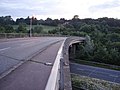
 River Severn,Abermule bypass bridge - geograph.org.uk - 923427.jpg 640 × 480; 80 KB
-

-
 Slip Road between A483 and A5152 - geograph.org.uk - 1241092.jpg 640 × 480; 63 KB
-

-
 Southbound A483 - geograph.org.uk - 2485651.jpg 2,592 × 1,944; 2.35 MB
-
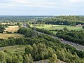
 Start of the M4 - geograph.org.uk - 573380.jpg 640 × 379; 59 KB
-

-
 Stone walled entry to Builth - geograph.org.uk - 1042204.jpg 640 × 428; 411 KB
-
 Sugar Loaf - geograph.org.uk - 1219917.jpg 640 × 426; 61 KB
-
 Sweeney Hall Hotel from entrance on A483 - geograph.org.uk - 1600377.jpg 640 × 480; 127 KB
-
 The A483 - geograph.org.uk - 3185631.jpg 1,024 × 680; 219 KB
-
 The A483 at Broadoak - geograph.org.uk - 1508436.jpg 640 × 480; 83 KB
-
 The A483 south of Glog - geograph.org.uk - 1438282.jpg 640 × 428; 124 KB
-
 The A483 towards the A55 - geograph.org.uk - 1478036.jpg 640 × 480; 121 KB
-
 The Lord Rhys, Llandovery - geograph.org.uk - 2545886.jpg 640 × 515; 61 KB
-
 The Police Station - geograph.org.uk - 1040354.jpg 640 × 422; 410 KB
-
 The White Lion, Llynclys in 2006.jpg 640 × 480; 79 KB
-
 The Wrecsam By-pass. A483 - geograph.org.uk - 160560.jpg 640 × 480; 105 KB
-
 Top of Cwm Lane - geograph.org.uk - 1482447.jpg 640 × 426; 120 KB
-
 Top of the bridge - geograph.org.uk - 1356773.jpg 640 × 480; 66 KB
-
 Tree filled quarry - geograph.org.uk - 795157.jpg 640 × 480; 189 KB
-
 Tregeyb Arms, Ffairfach - geograph.org.uk - 2548385.jpg 640 × 480; 48 KB
-
 Turn right at the A483 (NCR 81) - geograph.org.uk - 941830.jpg 640 × 480; 56 KB
-
 Ty-Croes, Llanymynech.jpg 4,000 × 3,000; 943 KB
-
 UK road A483.PNG 568 × 184; 8 KB
-
 Underpass for the A483 at Rossett - geograph.org.uk - 1469901.jpg 640 × 480; 136 KB
-
 Ungated level crossing - geograph.org.uk - 511073.jpg 600 × 450; 55 KB
-
 View east of Newbridge Viaduct (A483) - geograph.org.uk - 507503.jpg 427 × 640; 110 KB
-
 Welcome to Wales - geograph.org.uk - 1570147.jpg 640 × 480; 91 KB
-
 Wern junction on A483 - geograph.org.uk - 1350078.jpg 640 × 426; 70 KB
-
 Wrexham Road roundabout A483 - geograph.org.uk - 1595742.jpg 640 × 480; 33 KB
-
-
 The A483 Trunk Road (Welshpool Bypass, Powys) (Temporary Prohibition of Vehicles) Order 2013 (WSI 2013-2817 en).pdf 1,239 × 1,754, 2 pages; 20 KB
-
 The A483 Trunk Road (Welshpool Bypass, Powys) (Temporary Prohibition of Vehicles) Order 2013 (WSI 2013-2817 we).pdf 1,239 × 1,754, 2 pages; 30 KB
-
 The A483 Trunk Road (Tremont Road, Llandrindod Wells) (Part-time 20 mph Speed Limit) Order 2018 (WSI 2018-516 we).pdf 1,239 × 1,754, 2 pages; 27 KB
-
 A483 - geograph.org.uk - 589353.jpg 640 × 480; 155 KB
-
 A483 in Four Crosses - geograph.org.uk - 833171.jpg 640 × 480; 65 KB
-
 A483 lay-by - geograph.org.uk - 786434.jpg 640 × 427; 79 KB
-
 A483, Pen-y-bont - geograph.org.uk - 748736.jpg 640 × 480; 101 KB
-
 A5 (A483) Oswestry by-pass - geograph.org.uk - 204085.jpg 640 × 480; 106 KB
-
 Approaching Newtown on the A483 - geograph.org.uk - 1470630.jpg 640 × 480; 127 KB
-
 Cutting on the A483 - geograph.org.uk - 646875.jpg 640 × 427; 57 KB
-
 Drain under the A483 - geograph.org.uk - 654789.jpg 480 × 640; 107 KB
-
 Grosvenor Bridge Abutment - geograph.org.uk - 290847.jpg 480 × 640; 208 KB
-
 Pont Abraham Services - geograph.org.uk - 573375.jpg 640 × 480; 88 KB
-
 Quay Parade, Swansea - geograph.org.uk - 190879.jpg 640 × 480; 68 KB
-
 Rhiw Bridge - geograph.org.uk - 611824.jpg 640 × 480; 130 KB
-

-
 Road to Llaithddu - geograph.org.uk - 395630.jpg 640 × 480; 72 KB
-

-

-
 The Travelodge at Rhostyllen - geograph.org.uk - 207930.jpg 640 × 480; 103 KB
-
 Visteon Plant - geograph.org.uk - 117787.jpg 640 × 480; 59 KB
-
 Wrexham bypass - geograph.org.uk - 175242.jpg 640 × 477; 67 KB


.jpg)


.jpg)


.jpg)


_-_geograph.org.uk_-_941830.jpg)


_-_geograph.org.uk_-_507503.jpg)


_Oswestry_by-pass_-_geograph.org.uk_-_204085.jpg)


