Category:A614 road (England)

road in England  | |||||
| Upload media | |||||
| Instance of | |||||
|---|---|---|---|---|---|
| Location |
| ||||
| Transport network |
| ||||
| Has part(s) |
| ||||
| Length |
| ||||
 | |||||
Subcategories
This category has the following 2 subcategories, out of 2 total.
A
B
- Boothferry Bridge, River Ouse (24 F)
Media in category "A614 road (England)"
The following 117 files are in this category, out of 117 total.
-
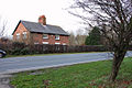 A cottage near Eastburn.jpg 640 × 427; 382 KB
-
 A quiet moment on the A614 Blyth Road - geograph.org.uk - 894697.jpg 640 × 480; 89 KB
-
 A White House - geograph.org.uk - 821201.jpg 640 × 427; 69 KB
-
 A614 (geograph 5429799).jpg 640 × 426; 47 KB
-
 A614 - geograph.org.uk - 252095.jpg 640 × 480; 109 KB
-
 A614 approaching Red Hill Roundabout - geograph.org.uk - 1760116.jpg 640 × 480; 65 KB
-
 A614 at junction of B6386 - geograph.org.uk - 35000.jpg 640 × 480; 96 KB
-
 A614 Burland Common - geograph.org.uk - 1299040.jpg 640 × 480; 59 KB
-
 A614 Caville Bridge - geograph.org.uk - 1299037.jpg 640 × 441; 58 KB
-
 A614 Junction - geograph.org.uk - 1263506.jpg 640 × 480; 65 KB
-
 A614 junction, Airmyn - geograph.org.uk - 412876.jpg 640 × 455; 92 KB
-
 A614 Middleton Wold - geograph.org.uk - 252094.jpg 640 × 480; 107 KB
-
 A614 Near Bessingby - geograph.org.uk - 1223468.jpg 640 × 481; 131 KB
-
 A614 near Holme - geograph.org.uk - 1600743.jpg 640 × 480; 73 KB
-

-

-
 A614 Passing High Plantation - geograph.org.uk - 236889.jpg 640 × 426; 117 KB
-
 A614 Railway Bridge Near Cavil - geograph.org.uk - 235977.jpg 640 × 426; 139 KB
-
 A614 road.jpg 640 × 480; 98 KB
-
 A614 Roundabout - geograph.org.uk - 1299030.jpg 640 × 395; 37 KB
-
 A614 Tanglewood roundabout - geograph.org.uk - 1287197.jpg 640 × 480; 42 KB
-
 A614 Through Haisthorpe.jpg 640 × 480; 42 KB
-
 A614 to Thorne. - geograph.org.uk - 509059.jpg 640 × 480; 85 KB
-
 A614 Towards Carnaby - geograph.org.uk - 1241037.jpg 640 × 480; 59 KB
-
 A614 Towards Carnaby - geograph.org.uk - 1241045.jpg 640 × 480; 60 KB
-
 A614 Towards Driffield - geograph.org.uk - 1301451.jpg 640 × 480; 75 KB
-
 A614 towards Driffield - geograph.org.uk - 1351300.jpg 640 × 480; 69 KB
-
 A614 Towards Goole.jpg 640 × 480; 87 KB
-
 A614 towards Holme - geograph.org.uk - 1600709.jpg 640 × 480; 75 KB
-
 A614 towards Howden (geograph 2024000).jpg 640 × 480; 54 KB
-
 A614 towards Howden - geograph.org.uk - 1541063.jpg 640 × 480; 87 KB
-
 A614 towards Howden - geograph.org.uk - 1541072.jpg 640 × 480; 58 KB
-
 A614 towards Howden - geograph.org.uk - 1563328.jpg 640 × 480; 38 KB
-
 A614 towards Howden - geograph.org.uk - 1563350.jpg 640 × 480; 39 KB
-
 A614 towards Market Weighton - geograph.org.uk - 1351268.jpg 640 × 480; 77 KB
-
 A614 towards Middleton - geograph.org.uk - 1496189.jpg 640 × 480; 51 KB
-
 A614 towards Middleton - geograph.org.uk - 1496224.jpg 640 × 480; 46 KB
-
 A614 towards Middleton - geograph.org.uk - 1496245.jpg 640 × 480; 55 KB
-
 A614 towards Nottingham - geograph.org.uk - 1760112.jpg 640 × 480; 62 KB
-
 A614, Howden - geograph.org.uk - 1633182.jpg 640 × 480; 54 KB
-
 A614, Woodside, near Market Weighton - geograph.org.uk - 120105.jpg 640 × 480; 113 KB
-

-
 Airmyn A614 Roundabout - geograph.org.uk - 1214868.jpg 640 × 480; 66 KB
-

-
 Arglam Lane from Bursea Lane Ends - geograph.org.uk - 174904.jpg 640 × 480; 64 KB
-
 Bainton Roundabout - geograph.org.uk - 541955.jpg 640 × 480; 77 KB
-
 Bawtry Station - geograph.org.uk - 194741.jpg 640 × 480; 108 KB
-
 Bilsthorpe MMB 01 A614 Old Rufford Road.jpg 4,095 × 2,232; 4.14 MB
-
 Blaxton Roundabout - geograph.org.uk - 1261397.jpg 640 × 404; 44 KB
-
 Bracey Bridge - geograph.org.uk - 142903.jpg 640 × 480; 131 KB
-
 Burton Agnes Duck Pond.jpg 640 × 480; 99 KB
-
 Bus stop on the A614, Thornholme (geograph 4356367).jpg 640 × 480; 74 KB
-
 Caville Hall Farm and Cottages - geograph.org.uk - 1299311.jpg 640 × 480; 41 KB
-
 Checker House station site geograph-3433720-by-Ben-Brooksbank.jpg 2,394 × 1,332; 2.07 MB
-
 Entering Bainton from the south - geograph.org.uk - 1046047.jpg 640 × 427; 296 KB
-
 Entering Rawcliffe - geograph.org.uk - 1255157.jpg 640 × 480; 48 KB
-
 Eventually To Bridlington. - geograph.org.uk - 302512.jpg 634 × 479; 97 KB
-
 Farm Shop - geograph.org.uk - 827529.jpg 640 × 409; 53 KB
-
 Fields to NW of A614 Portington Junction - geograph.org.uk - 234396.jpg 640 × 426; 104 KB
-
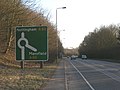
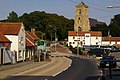
 Front Street, Middleton-on-the-Wolds - geograph.org.uk - 582510.jpg 640 × 480; 78 KB
-

-
 Green and serene, Little Driffield - geograph.org.uk - 1614841.jpg 640 × 427; 310 KB
-
 Green Lane - geograph.org.uk - 72570.jpg 640 × 480; 46 KB
-
 Howdendyke Roundabout - geograph.org.uk - 1248600.jpg 640 × 305; 30 KB
-
 Junction 36 roundabout - geograph.org.uk - 1287194.jpg 640 × 480; 36 KB
-
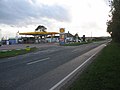 Kirkburn Filling Station - geograph.org.uk - 73590.jpg 640 × 480; 72 KB
-
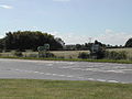
 Lakeside restaurants - geograph.org.uk - 676573.jpg 640 × 239; 38 KB
-
 Lay-by on the A614 - geograph.org.uk - 1563341.jpg 640 × 480; 94 KB
-
 Lay-by on the A614 Blyth Road - geograph.org.uk - 1512936.jpg 640 × 480; 61 KB
-
 Lay-by on the Driffield bypass - geograph.org.uk - 2098546.jpg 1,024 × 768; 114 KB
-
 Londsborough Pet Supplies - geograph.org.uk - 236905.jpg 640 × 426; 115 KB
-
 Longs Corner Roundabout - geograph.org.uk - 1248575.jpg 640 × 399; 36 KB
-

-
 Middleton on the Wolds.jpg 640 × 426; 122 KB
-
 Near the A614 - geograph.org.uk - 122128.jpg 640 × 480; 57 KB
-
 New Inn Farm, Ruston Parva - geograph.org.uk - 697128.jpg 640 × 428; 83 KB
-
-

-

-
 Pumping Station - geograph.org.uk - 72568.jpg 640 × 480; 44 KB
-
 Railway underpass - geograph.org.uk - 1255125.jpg 640 × 480; 71 KB
-
 Rawcliffe Near Goole Cuckoo Park Farm - geograph.org.uk - 122558.jpg 640 × 480; 173 KB
-
 Rawcliffe St James' church - geograph.org.uk - 1255056.jpg 640 × 480; 62 KB
-
 River Don - geograph.org.uk - 193254.jpg 640 × 480; 94 KB
-
 Road Junction - A614 - geograph.org.uk - 142905.jpg 640 × 480; 119 KB
-
 Road Junction Near Portington - geograph.org.uk - 234178.jpg 640 × 426; 101 KB
-
 Road Junction, Holme Common - geograph.org.uk - 128975.jpg 640 × 480; 83 KB
-
 Road to the Coast A614 - geograph.org.uk - 1153396.jpg 640 × 480; 101 KB
-
 Robin Hood Way towards Duncan Wood - geograph.org.uk - 1421215.jpg 640 × 480; 93 KB
-
 Roundabout, A614 - geograph.org.uk - 1761699.jpg 640 × 480; 48 KB
-
 Sign at A614 Portington Junction - geograph.org.uk - 234400.jpg 426 × 640; 108 KB
-
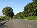
 The A614 - geograph.org.uk - 121953.jpg 640 × 480; 87 KB
-
 The A614 - geograph.org.uk - 248001.jpg 640 × 480; 100 KB
-
 The A614 - geograph.org.uk - 302526.jpg 640 × 480; 109 KB
-
 The A614 at Howden Kitchens - geograph.org.uk - 1247281.jpg 640 × 480; 87 KB
-
 The A614 at Sutton Lodge Farm - geograph.org.uk - 1255043.jpg 640 × 503; 71 KB
-
 The A614 At Welham Bridge - geograph.org.uk - 218604.jpg 640 × 480; 100 KB
-
 The A614 Junction - geograph.org.uk - 1247266.jpg 640 × 480; 30 KB
-
-
 The A614 Roundabout - geograph.org.uk - 1255144.jpg 640 × 480; 34 KB
-
 The A614 Towards Howden - geograph.org.uk - 218596.jpg 640 × 480; 99 KB
-
 The Anlaby to Beverley road. - geograph.org.uk - 63732.jpg 640 × 480; 95 KB
-
 The Blue Bell, Burton Agnes - geograph.org.uk - 720221.jpg 640 × 458; 141 KB
-
 The Driffield Bypass (A614) - geograph.org.uk - 1301509.jpg 640 × 480; 80 KB
-
 The road to Ruston Parva - geograph.org.uk - 122133.jpg 640 × 480; 90 KB
-

-

-
 Thorpe Road - geograph.org.uk - 217814.jpg 640 × 480; 93 KB
-
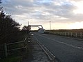
 Torne Bridge - geograph.org.uk - 676541.jpg 640 × 393; 89 KB
-
 Towthorpe Corner picnic site - geograph.org.uk - 1229148.jpg 640 × 426; 213 KB
-
 Towthorpe Lane - geograph.org.uk - 631414.jpg 640 × 403; 97 KB
-
 Turn here for rest area - geograph.org.uk - 1334067.jpg 481 × 640; 119 KB
-
 UK road A614.PNG 568 × 184; 7 KB
-
 View from Bracey Bridge - geograph.org.uk - 1256908.jpg 640 × 480; 139 KB
-
 Woodside Roundabout, A614 - geograph.org.uk - 1563376.jpg 640 × 480; 55 KB
-

-
 Sunday on the A614 - geograph.org.uk - 60296.jpg 640 × 480; 88 KB


.jpg)


.jpg)


.jpg)


,_heading_north_east_out_of_Haisthorpe_-_geograph.org.uk_-_4172376.jpg)


_-_geograph.org.uk_-_1301509.jpg)


