Category:A62 road in West Yorkshire
Subcategories
This category has the following 16 subcategories, out of 16 total.
C
- Castlegate, Huddersfield (9 F)
D
- Dumb Steeple, Liversedge (6 F)
G
- Gelderd Road, Birstall (10 F)
H
- Huddersfield Road, Birstall (2 F)
L
M
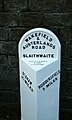
- Manchester Road, Linthwaite (13 F)
- Manchester Road, Slaithwaite (17 F)
S
- Southgate, Huddersfield (8 F)
Media in category "A62 road in West Yorkshire"
The following 72 files are in this category, out of 72 total.
-
 "Great Western" - geograph.org.uk - 485544.jpg 640 × 480; 130 KB
-
 4 Mile Post, A62 road.jpg 2,000 × 1,479; 986 KB
-
 5 Mile Post, A62 road.jpg 308 × 512; 66 KB
-
 6 Miles Post, A62 road.jpg 480 × 640; 318 KB
-
 7 Miles Post, A62 road.jpg 308 × 512; 75 KB
-
 A62 Huddersfield Road at April Court - geograph.org.uk - 5218052.jpg 640 × 480; 49 KB
-
 A62 Huddersfield Road, Liversedge - geograph.org.uk - 5218053.jpg 640 × 480; 38 KB
-
 A62 Leeds Road heading east - geograph.org.uk - 5218050.jpg 640 × 513; 47 KB
-
 A62 Leeds Road heading east - geograph.org.uk - 5218051.jpg 640 × 480; 62 KB
-
 A62 Marsden to Manchester - geograph.org.uk - 949648.jpg 640 × 480; 78 KB
-
 Boundary stone, Hartshead - Mirfield - geograph.org.uk - 1930050.jpg 2,000 × 1,479; 852 KB
-
 Boundary stone, Hartshead - Mirfield - geograph.org.uk - 1930074.jpg 1,722 × 2,000; 987 KB
-
 Boundary stone, Huddersfield Road - geograph.org.uk - 2418401.jpg 1,500 × 2,000; 1.31 MB
-
 Boundary Stone, Leeds Road (A62) - geograph.org.uk - 6409937.jpg 2,000 × 1,428; 1.2 MB
-
 Boundary Stone, Leeds Road.jpg 1,396 × 2,000; 1.57 MB
-
 Boundary Stone, Mirfield.jpg 600 × 800; 162 KB
-
 Bridge MVW2-182 - Cooper Bridge Road - geograph.org.uk - 762549.jpg 640 × 434; 59 KB
-
 Bridge over the Spen Valley Ringway - geograph.org.uk - 6152280.jpg 2,000 × 1,500; 3.14 MB
-
 Castlegate - geograph.org.uk - 762660.jpg 640 × 480; 39 KB
-
 Cooper Bridge - Leeds Road - geograph.org.uk - 762557.jpg 640 × 409; 45 KB
-
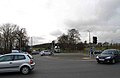 Cooper Bridge roundabout - geograph.org.uk - 737992.jpg 640 × 414; 48 KB
-
 Crags on Pule Hill ^ A62 over Standedge - geograph.org.uk - 6083967.jpg 5,184 × 2,920; 4.87 MB
-

-
 Double decker bus filter, Marsden. - geograph.org.uk - 145692.jpg 640 × 480; 96 KB
-

-

-

-

-

-
 Halifax Road - Huddersfield Road - geograph.org.uk - 1426608.jpg 640 × 480; 258 KB
-
 Huddersfield Broad Canal - geograph.org.uk - 2229.jpg 480 × 360; 32 KB
-

-

-
 Huddersfield Road, Liversedge - geograph.org.uk - 2418407.jpg 2,000 × 1,499; 813 KB
-
 Leeds Road (A62), looking west - geograph.org.uk - 6203372.jpg 2,000 × 1,227; 1.8 MB
-

-

-

-
-

-
 Leeds Road Bridge 22 - geograph.org.uk - 2537438.jpg 800 × 493; 157 KB
-
 Leeds Road, Liversedge - geograph.org.uk - 744743.jpg 640 × 529; 62 KB
-
 Linfit Fold, Slaithwaite - geograph.org.uk - 883619.jpg 640 × 480; 98 KB
-
 Lumb Lane - Huddersfield Road - geograph.org.uk - 1427592.jpg 640 × 480; 240 KB
-
 Manchester Road - Linthwaite - geograph.org.uk - 915077.jpg 640 × 462; 173 KB
-

-
 Marsden Edge - geograph.org.uk - 899832.jpg 640 × 480; 46 KB
-
 Milepost, Leeds Road, Mirfield (geograph 6409736).jpg 1,361 × 2,000; 1.35 MB
-
 Milepost, Leeds Road, Mirfield (geograph 6409738).jpg 2,000 × 1,086; 856 KB
-

-
 Motorman Cafe - geograph.org.uk - 511046.jpg 640 × 276; 68 KB
-
 Old Milepost by the A62, Leeds Road, Mirfield (geograph 5784745).jpg 720 × 960; 151 KB
-

-
 Old Milestone by the A62, Leeds Road, Heckmondwike (geograph 6056086).jpg 1,330 × 1,704; 455 KB
-
 Old Toll House (geograph 6115149).jpg 600 × 450; 55 KB
-
 Pennine Way Crossing - geograph.org.uk - 2463905.jpg 1,280 × 960; 533 KB
-
 Road Information Board, Leeds Road - geograph.org.uk - 510850.jpg 480 × 640; 67 KB
-
 Service station on Leeds Road (A62) - geograph.org.uk - 6409790.jpg 800 × 476; 81 KB
-
 Six Lanes End - geograph.org.uk - 282829.jpg 640 × 480; 65 KB
-
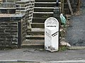
 Slaithwaite, milepost - geograph.org.uk - 1548688.jpg 640 × 480; 93 KB
-

-

-
 Standedge Cutting - geograph.org.uk - 5211.jpg 640 × 361; 35 KB
-
 Standedge Cutting - geograph.org.uk - 523942.jpg 640 × 426; 58 KB
-
 Standedge from Pule Hill.jpg 640 × 470; 116 KB
-

-

-
 The Fountain - geograph.org.uk - 3913081.jpg 640 × 480; 57 KB
-
 Tunnel Exit, Ring Road, Huddersfield - geograph.org.uk - 862262.jpg 640 × 443; 51 KB
-
 Whiteleys Garden Centre - geograph.org.uk - 938810.jpg 640 × 480; 159 KB
-

-
 Leeds Road, Deighton, Huddersfield - geograph.org.uk - 381625.jpg 640 × 409; 66 KB


_-_geograph.org.uk_-_6409937.jpg)


,_Manchester_Road_A62,_Milnsbridge,_Linthwaite_-_geograph.org.uk_-_766601.jpg)


,_looking_west_-_geograph.org.uk_-_6203372.jpg)


.jpg)
.jpg)


.jpg)
.jpg)
.jpg)
.jpg)


_-_geograph.org.uk_-_6409790.jpg)


_-_geograph.org.uk_-_862693.jpg)
