Category:A65 road (England)

road in England   | |||||
| Upload media | |||||
| Instance of | |||||
|---|---|---|---|---|---|
| Location |
| ||||
| Transport network |
| ||||
| Length |
| ||||
 | |||||
Subcategories
This category has the following 15 subcategories, out of 15 total.
A
B
C
- Coutances Way, Ilkley (4 F)
I
- Ilkley Road, Otley (5 F)
K
L
- Leeds Road, Rawdon (24 F)
N
O
R
S
- Skipton Road, Ilkley (4 F)
- Stanley Bridge, Kirkby Lonsdale (32 F)
Media in category "A65 road (England)"
The following 85 files are in this category, out of 85 total.
-
 A58(M) Slip Road, Leeds - geograph.org.uk - 624818.jpg 640 × 480; 314 KB
-
 A65 in Hellifield - geograph.org.uk - 960068.jpg 640 × 480; 81 KB
-
 A65 Junction - geograph.org.uk - 48675.jpg 640 × 480; 157 KB
-
 A65 Junction - geograph.org.uk - 48677.jpg 640 × 480; 136 KB
-
 A65 junction - geograph.org.uk - 48694.jpg 640 × 480; 146 KB
-
 A65 just north of Addingham - geograph.org.uk - 71315.jpg 640 × 480; 110 KB
-
 A65 road map.png 250 × 425; 48 KB
-
 A65 through Yeadon - geograph.org.uk - 12105.jpg 640 × 480; 139 KB
-

-
 A65, Long Preston - geograph.org.uk - 1554651.jpg 640 × 480; 70 KB
-
 A65, Long Preston - geograph.org.uk - 1554665.jpg 640 × 480; 88 KB
-
 A65, Long Preston - geograph.org.uk - 1753731.jpg 640 × 480; 111 KB
-
 Abbey Road, Hawksworth, Leeds (geograph 6584416).jpg 3,732 × 2,643; 2.3 MB
-
 Bridge over the Lune - geograph.org.uk - 632960.jpg 640 × 480; 97 KB
-
 Busy road for bunnies - geograph.org.uk - 970460.jpg 640 × 480; 89 KB
-
 Carrot Countdown - geograph.org.uk - 283138.jpg 640 × 480; 220 KB
-
 Cattle underpass - geograph.org.uk - 236563.jpg 640 × 480; 180 KB
-
 Clapham cum Newby milestone - geograph.org.uk - 1396973.jpg 640 × 425; 128 KB
-
 Clapham, North Yorkshire geograph-3475477-by-Ben-Brooksbank.jpg 2,396 × 1,403; 2.78 MB
-
 Coniston Cold A65 - geograph.org.uk - 696397.jpg 640 × 427; 67 KB
-
 Emergency phone on the A65 at Thorlby - geograph.org.uk - 1397222.jpg 640 × 480; 233 KB
-
 Esso Filling Station - New Road Side - geograph.org.uk - 694657.jpg 640 × 408; 45 KB
-

-
 Field at A65 - Ring Road junction - geograph.org.uk - 850637.jpg 640 × 480; 102 KB
-
 Gargrave Milepost - geograph.org.uk - 1331010.jpg 480 × 640; 119 KB
-
 Gargrave Post Office - geograph.org.uk - 879293.jpg 640 × 473; 78 KB
-
 Gargrave, High Street - geograph.org.uk - 512809.jpg 640 × 492; 70 KB
-
-
 Hellifield Milestone on A65 Keighley & Kendal Road.jpg 831 × 1,400; 663 KB
-
 High Street (A65) - geograph.org.uk - 968276.jpg 640 × 388; 50 KB
-
 High Street A65 - geograph.org.uk - 968259.jpg 640 × 480; 84 KB
-
 Holme House bridge - geograph.org.uk - 1397326.jpg 640 × 480; 106 KB
-
 Ilkley 01.jpg 2,816 × 2,112; 1.45 MB
-
 K Sharp, Dry Stone Waller - geograph.org.uk - 1046608.jpg 640 × 476; 142 KB
-

-
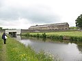
 Leeds-Liverpool Canal at Gargrave - geograph.org.uk - 520131.jpg 640 × 480; 195 KB
-
 Lupton Village - geograph.org.uk - 124889.jpg 640 × 480; 83 KB
-
 Main Road, Hellifield.jpg 640 × 460; 67 KB
-
 Milepost near Hollin Hall.jpg 489 × 665; 79 KB
-
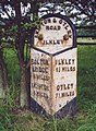
 Milepost, Leeds Road, Ilkley.jpg 1,423 × 2,048; 857 KB
-
 Milepost, Natland.jpg 485 × 640; 110 KB
-
 Milestone on A 65, Cumbria.jpg 480 × 640; 212 KB
-
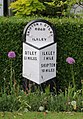
 Milestone, Skipton Road, Addingham.jpg 480 × 640; 390 KB
-
 New Road Side and Clarence Road - geograph.org.uk - 149535.jpg 640 × 445; 192 KB
-
 Newby, road junction on A65 - geograph.org.uk - 1396890.jpg 640 × 425; 91 KB
-
 Old Boundary Marker opposite Ellenber Farm on the A65 Skipton Road (geograph 7323637).jpg 3,264 × 2,448; 3.48 MB
-
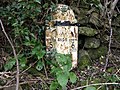 Old Milepost by the A65, Endmoor, Preston Richard (geograph 6045428).jpg 640 × 480; 176 KB
-

-
 Old Milestone, A65, Menston (geograph 6746577).jpg 561 × 477; 55 KB
-

-
 Old railway bridge, Menston - geograph.org.uk - 49055.jpg 640 × 480; 188 KB
-
 Old Swan Inn, Gargrave - geograph.org.uk - 748528.jpg 640 × 426; 57 KB
-
 River Ribble below A65 - geograph.org.uk - 1351609.jpg 640 × 480; 58 KB
-
 Road junction - geograph.org.uk - 759849.jpg 640 × 480; 170 KB
-
 Road junction - geograph.org.uk - 798969.jpg 640 × 480; 237 KB
-
 Road junction - geograph.org.uk - 863137.jpg 640 × 480; 212 KB
-
 Road junction near Goat Gap - geograph.org.uk - 272860.jpg 640 × 480; 69 KB
-
 Roadsign A65 - geograph.org.uk - 401321.jpg 640 × 363; 68 KB
-
 Roundabout A65-B6480 - geograph.org.uk - 137785.jpg 640 × 474; 96 KB
-

-

-
 St Peter's Church, Coniston Cold - geograph.org.uk - 102103.jpg 640 × 480; 166 KB
-
 Stanley Bridge, Kirkby Lonsdale, Cumbria - geograph.org.uk - 52754.jpg 640 × 480; 128 KB
-
 Stile and gate by the A65. - geograph.org.uk - 152706.jpg 640 × 480; 111 KB
-
 The A65 near Mearbeck, Settle - geograph.org.uk - 1450637.jpg 640 × 480; 104 KB
-
 The A65 Skipton to Kendal road - geograph.org.uk - 3553641.jpg 4,592 × 1,813; 6.27 MB
-
 The Dalesman Cafe - geograph.org.uk - 520060.jpg 481 × 640; 119 KB
-
 The M6 crossing the A65, Crooklands - geograph.org.uk - 957562.jpg 640 × 480; 72 KB
-

-
 The Yorkshire Rose - Leeds Road - geograph.org.uk - 688952.jpg 640 × 456; 64 KB
-

-
 Traffic lights for cattle on the A65 - geograph.org.uk - 1397212.jpg 640 × 480; 134 KB
-
 UK road A65.PNG 568 × 184; 7 KB
-
 View from footpath tunnel under the A65 - geograph.org.uk - 483772.jpg 640 × 480; 126 KB
-
 A65 near Rawlinshaw - geograph.org.uk - 615476.jpg 640 × 480; 61 KB
-
 A65 Settle Bypass - geograph.org.uk - 155421.jpg 640 × 480; 71 KB
-
 Bridge over the A65, Settle - geograph.org.uk - 1450811.jpg 640 × 424; 93 KB
-
 Cutting in the rock, New Road Side - geograph.org.uk - 383472.jpg 640 × 480; 136 KB
-
 Draughton Bypass (A65) - geograph.org.uk - 75789.jpg 640 × 480; 103 KB
-

-

-
 The A65 at Nook. - geograph.org.uk - 495424.jpg 640 × 427; 208 KB
-
 The A65 through Ingleton - geograph.org.uk - 48726.jpg 640 × 480; 124 KB
-
 The River Wharfe and the A65 - geograph.org.uk - 60827.jpg 640 × 480; 163 KB
-
 Westhouse and the A65 - geograph.org.uk - 45573.jpg 640 × 480; 133 KB
_Slip_Road,_Leeds_-_geograph.org.uk_-_624818.jpg)


.jpg)


_-_geograph.org.uk_-_968276.jpg)


.jpg)
.jpg)
.jpg)
.jpg)
.jpg)


,_Giggleswick_-_geograph.org.uk_-_1445231.jpg)


_-_geograph.org.uk_-_75789.jpg)


