Category:A69 road (England)
major trunk road in northern England   | |||||
| Upload media | |||||
| Instance of | |||||
|---|---|---|---|---|---|
| Part of | |||||
| Location |
| ||||
| Transport network |
| ||||
| Connects with | |||||
| Maintained by |
| ||||
| Has part(s) |
| ||||
| Length |
| ||||
| Terminus | |||||
| Partially coincident with | |||||
 | |||||
Subcategories
This category has the following 4 subcategories, out of 4 total.
Media in category "A69 road (England)"
The following 42 files are in this category, out of 42 total.
-

-
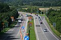 A69 - geograph.org.uk - 1463876.jpg 640 × 420; 98 KB
-
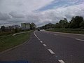
 A69 - geograph.org.uk - 426080.jpg 640 × 480; 130 KB
-
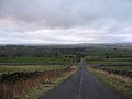
 A69 above Low Row.jpg 600 × 450; 234 KB
-
 A69 at Redburn - geograph.org.uk - 1617877.jpg 600 × 450; 282 KB
-
 A69 at Redburn - geograph.org.uk - 1617880.jpg 600 × 450; 206 KB
-
 A69 at Thornbrough - geograph.org.uk - 935614.jpg 640 × 480; 91 KB
-
 A69 at Whitechapel Farm - geograph.org.uk - 637874.jpg 640 × 480; 74 KB
-
 A69 east, before Hexham - geograph.org.uk - 1311935.jpg 640 × 480; 47 KB
-
 A69 near Crow Hall - geograph.org.uk - 1616981.jpg 600 × 450; 261 KB
-
 A69 near Crow Hall - geograph.org.uk - 1616984.jpg 600 × 450; 251 KB
-
 A69 westbound - geograph.org.uk - 497619.jpg 640 × 427; 272 KB
-
 Brampton town rail station 1884680 aeb8355d.jpg 640 × 355; 65 KB
-
 Footbridge over the A69 - geograph.org.uk - 3318465.jpg 640 × 480; 59 KB
-
 Footpath off the A69 - geograph.org.uk - 3210043.jpg 640 × 480; 117 KB
-
 Gapshield, on the A69 - geograph.org.uk - 3209874.jpg 1,024 × 673; 99 KB
-
 Gated track off the A69 - geograph.org.uk - 3209866.jpg 640 × 455; 72 KB
-
 Lay-by on the A69 - geograph.org.uk - 426073.jpg 640 × 480; 99 KB
-
 Milestone and the A69 - geograph.org.uk - 3209842.jpg 640 × 480; 92 KB
-
 Path between A69 & old Hexham Road, Blucher - geograph.org.uk - 3801862.jpg 1,024 × 768; 319 KB
-
 Rough pasture off the A69 - geograph.org.uk - 3209883.jpg 640 × 480; 79 KB
-
 The A69 heading east - geograph.org.uk - 3209853.jpg 640 × 480; 71 KB
-
 The A69 heading east - geograph.org.uk - 3209862.jpg 640 × 504; 55 KB
-
 The A69 heading east - geograph.org.uk - 3209868.jpg 640 × 480; 60 KB
-
 The A69 heading east - geograph.org.uk - 3209879.jpg 640 × 375; 36 KB
-
 The A69 heading east - geograph.org.uk - 3209915.jpg 640 × 480; 67 KB
-
 The A69 heading east - geograph.org.uk - 3209921.jpg 640 × 480; 58 KB
-
 The A69 heading east - geograph.org.uk - 3210022.jpg 640 × 480; 71 KB
-
 The A69 heading east, Low Closegill - geograph.org.uk - 3209849.jpg 640 × 480; 109 KB
-
 The A69 heading towards Haltwhistle - geograph.org.uk - 3209943.jpg 640 × 480; 64 KB
-
 The A69 heading towards Haltwhistle - geograph.org.uk - 3209954.jpg 640 × 480; 72 KB
-
 UK road A69.PNG 568 × 184; 8 KB
-
 Woodland beside the A69 - geograph.org.uk - 3210017.jpg 640 × 480; 61 KB
-
 A69 - geograph.org.uk - 261107.jpg 640 × 480; 55 KB
-
 A69 - geograph.org.uk - 261110.jpg 480 × 640; 71 KB
-
 A69 near Whittle Farm - geograph.org.uk - 189952.jpg 640 × 480; 73 KB
-
 A69, Warwick Bridge - geograph.org.uk - 207727.jpg 640 × 480; 75 KB
-
 Junction A69 - geograph.org.uk - 325079.jpg 640 × 480; 50 KB
-
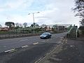
 Junction for Wetheral - geograph.org.uk - 342977.jpg 640 × 480; 115 KB
-
 Junction with A69 near Ovington - geograph.org.uk - 345710.jpg 640 × 426; 114 KB
-
 Roadside crucifix - geograph.org.uk - 342979.jpg 480 × 640; 166 KB
-


