Category:A736 road (Scotland)
road in Scotland | |||||
| Upload media | |||||
| Instance of | |||||
|---|---|---|---|---|---|
| Location |
| ||||
| Transport network |
| ||||
| |||||
Media in category "A736 road (Scotland)"
The following 16 files are in this category, out of 16 total.
-
 A736 at Torranyard - geograph.org.uk - 1427322.jpg 640 × 366; 40 KB
-
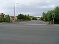
 A736, Lugton to Barrhead road - geograph.org.uk - 1579944.jpg 640 × 480; 76 KB
-
 A736, Lugton to Barrhead road - geograph.org.uk - 1580018.jpg 640 × 480; 71 KB
-
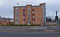 Apartments Leverndale Road (geograph 2848297).jpg 3,669 × 2,278; 5.39 MB
-
 Caldwell Golf Club House - geograph.org.uk - 95621.jpg 640 × 481; 98 KB
-
 Dalmellington Road - geograph.org.uk - 1319344.jpg 640 × 480; 109 KB
-
 Former site of Howford Primary School (geograph 6160459).jpg 1,024 × 640; 151 KB
-
 Houses on Crookston Road - geograph.org.uk - 1319341.jpg 640 × 480; 114 KB
-
 Lugton from the West - geograph.org.uk - 1412289.jpg 640 × 480; 101 KB
-
 Lugton1.JPG 2,288 × 1,712; 1.33 MB
-
 Shillford filling station - geograph.org.uk - 95637.jpg 640 × 480; 74 KB
-
 Shops on Barrhead Road - geograph.org.uk - 1318790.jpg 640 × 480; 118 KB
-

-
 The A736 Lochlibo Road - geograph.org.uk - 1650046.jpg 640 × 480; 135 KB
-
 The A736 to Irvine - geograph.org.uk - 4923324.jpg 1,920 × 1,280; 1.2 MB
-
 Torranyard Inn.jpg 2,288 × 1,712; 1.29 MB


.jpg)


.jpg)


