Category:Aberdulais
village in Wales _-_James_Ward.jpg) Darlun olew o felin a dynnwys yn 1847 | |||||
| Upload media | |||||
| Instance of | |||||
|---|---|---|---|---|---|
| Location | Neath Port Talbot, Wales | ||||
 | |||||
Cymraeg: Pentref ym mwrdeistref sirol Castell-nedd Port Talbot yw Aberdulais. Saif ym mhen isaf Cwm Dulais, lle mae Afon Dulais yn llifo i mewn i Afon Nedd, a ger cyffordd y priffyrdd A465 ac A4109, i'r gogledd-ddwyrain o dref Castell Nedd.
English: Aberdulais ( Aber confluence (with the River Neath) or mouth (of the river) & Dulais) is a village in Neath Port Talbot, Wales, lying on the River Neath.
Subcategories
This category has the following 4 subcategories, out of 4 total.
A
- Aberdulais Aqueduct (6 F)
- Aberdulais Tin Works (53 F)
- Aberdulais water mill (6 F)
Media in category "Aberdulais"
The following 41 files are in this category, out of 41 total.
-

-
 Aber Dillas bridge, sth. Wales.jpeg 700 × 409; 131 KB
-
 Aberdulais Basin Tonna. - geograph.org.uk - 444935.jpg 640 × 480; 167 KB
-
 Aberdulais brick chimney - panoramio.jpg 1,536 × 2,048; 789 KB
-
 Aberdulais visitor center Taking TEA and scones - panoramio.jpg 2,048 × 1,536; 1.04 MB
-
 Aberdulais whaterwheel. how i would like this to run my house - panoramio.jpg 2,048 × 1,536; 1.1 MB
-
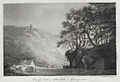
 Aberdylis, vale of Neath.jpeg 700 × 511; 160 KB
-
 Afon Nedd - geograph.org.uk - 380603.jpg 640 × 480; 107 KB
-
 An Overshot Mill in Wales (Aberdulais) - James Ward.jpg 11,812 × 5,365; 15.89 MB
-
 Bridges over the Neath and Dulais - geograph.org.uk - 501852.jpg 640 × 480; 161 KB
-
 Bridges over the river Neath - geograph.org.uk - 376925.jpg 640 × 454; 52 KB
-
 Cefn Saeson Comprehensive School - geograph.org.uk - 223167.jpg 640 × 430; 219 KB
-
 Craft on the Neath Canal - geograph.org.uk - 444950.jpg 640 × 480; 128 KB
-
 Dry stone walls in Cwm Gwenffrwd - geograph.org.uk - 227975.jpg 640 × 430; 162 KB
-
 End of the line for the Tennant Canal - geograph.org.uk - 501857.jpg 480 × 640; 140 KB
-
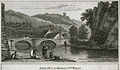
 From the mill at Abberdalish in Glamorganshire.jpeg 700 × 478; 117 KB
-
 JMW Turner - Aberdulais Mill TW1575 9.jpg 730 × 571; 88 KB
-
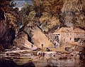
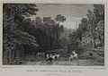 Mill at Aber-Dylais, vale of Neath, Glamorganshire (1133759).jpg 1,000 × 711; 218 KB
-
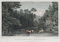 Mill at Aber-Dylais, vale of Neath, Glamorganshire.jpeg 700 × 492; 142 KB
-

-
 River crossings at Aberdulais - geograph.org.uk - 1339760.jpg 640 × 480; 72 KB
-
 Site of Roman Camp at Blaencwmbach - geograph.org.uk - 227959.jpg 640 × 430; 208 KB
-

-
 The Tennant Canal - geograph.org.uk - 378369.jpg 640 × 480; 129 KB
-
 Tonna Hospital - geograph.org.uk - 218117.jpg 640 × 480; 138 KB
-

-

-
 Afon Nedd - geograph.org.uk - 378473.jpg 640 × 443; 134 KB
-
 Cefn Y Don trig point - geograph.org.uk - 172920.jpg 640 × 480; 192 KB
-
 Crossroads on B4287 at Cefn Saeson. - geograph.org.uk - 206300.jpg 640 × 475; 174 KB
-
 Gelli-march Farm - geograph.org.uk - 378560.jpg 639 × 400; 128 KB
-
 Neath Golf Course trig point - geograph.org.uk - 172908.jpg 640 × 480; 114 KB
-
 Path bend and stream in Mosshouse Wood - geograph.org.uk - 226291.jpg 640 × 430; 169 KB
-
 Railway viaduct over the River Dulais - geograph.org.uk - 594436.jpg 640 × 428; 146 KB
-
 River Dulais, Vale of Neath - geograph.org.uk - 241486.jpg 640 × 480; 122 KB
-
 Ruin of Blaencwmbach Farm - geograph.org.uk - 227739.jpg 640 × 430; 179 KB
-
 The 'Rock and Fountain' at Ynysgollen - geograph.org.uk - 201435.jpg 640 × 430; 164 KB
-
 The Clubhouse at Neath Golf Club - geograph.org.uk - 243253.jpg 640 × 430; 187 KB
-

-
 The Lake at Gnoll Country Park - geograph.org.uk - 155497.jpg 640 × 426; 158 KB
-
 The remains of 'Parson's Folly Tramroad' - geograph.org.uk - 227920.jpg 640 × 430; 165 KB


.jpg)


