Category:Abernethy, Perth and Kinross (civil parish)
Scottish parish | |||||
| Upload media | |||||
| Instance of | |||||
|---|---|---|---|---|---|
| Part of |
| ||||
| Named after | |||||
| Location |
| ||||
| Population |
| ||||
| Area |
| ||||
 | |||||
Media in category "Abernethy, Perth and Kinross (civil parish)"
The following 200 files are in this category, out of 259 total.
(previous page) (next page)-
 A Binn Farm recycling installation - geograph.org.uk - 4006123.jpg 2,815 × 2,261; 1.38 MB
-
 A garden exhibit at Abernethy Museum - geograph.org.uk - 4619508.jpg 4,608 × 3,456; 3.07 MB
-
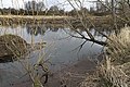
 A New Pond - geograph.org.uk - 2152636.jpg 4,288 × 3,216; 6.74 MB
-
 A salmon coble, Emma - geograph.org.uk - 4619498.jpg 3,447 × 3,305; 1.92 MB
-
 A view from the top of the round tower (1) - geograph.org.uk - 4619536.jpg 4,608 × 3,456; 3.03 MB
-
 A view from the top of the round tower (2) - geograph.org.uk - 4619551.jpg 4,608 × 3,456; 2.95 MB
-
 A view from the top of the round tower (3) - geograph.org.uk - 4619568.jpg 4,608 × 3,456; 2.98 MB
-
 A view from the top of the round tower (4) - geograph.org.uk - 4619577.jpg 4,608 × 3,456; 3.2 MB
-
 A view from the top of the round tower (5) - geograph.org.uk - 4619587.jpg 4,608 × 3,456; 3.29 MB
-
 Abernethy - geograph.org.uk - 4095959.jpg 640 × 360; 236 KB
-
 Abernethy churchyard and tower - geograph.org.uk - 6099860.jpg 640 × 480; 47 KB
-
 Abernethy Cross - geograph.org.uk - 2155147.jpg 640 × 427; 53 KB
-
 Abernethy Cross - geograph.org.uk - 2672080.jpg 1,600 × 1,200; 371 KB
-
 Abernethy Glen - geograph.org.uk - 2677173.jpg 2,000 × 1,500; 504 KB
-
 Abernethy Glen signpost - geograph.org.uk - 933105.jpg 640 × 480; 159 KB
-
 Abernethy Parish Church - geograph.org.uk - 1895950.jpg 640 × 480; 71 KB
-
 Abernethy Round Tower - geograph.org.uk - 2685764.jpg 873 × 1,024; 114 KB
-
 Abernethy Round Tower - geograph.org.uk - 3531276.jpg 466 × 640; 52 KB
-
 Abernethy Round Tower - geograph.org.uk - 3965683.jpg 427 × 640; 57 KB
-
 Abernethy Round Tower - geograph.org.uk - 4619463.jpg 3,456 × 4,608; 2.51 MB
-
 Abernethy Round Tower - geograph.org.uk - 5347796.jpg 480 × 640; 50 KB
-
 Abernethy Round Tower entrance - geograph.org.uk - 3531246.jpg 480 × 640; 86 KB
-
 Abernethy Round Tower, School Wynd - geograph.org.uk - 3531245.jpg 480 × 640; 54 KB
-
 Abernethy view - geograph.org.uk - 2215786.jpg 1,600 × 1,200; 278 KB
-
 Abernethy War Memorial - geograph.org.uk - 5347784.jpg 480 × 640; 54 KB
-
 Abernethy War Memorial and Cross - geograph.org.uk - 3531266.jpg 640 × 480; 52 KB
-

-
 Abernethy, Tower and Cross - geograph.org.uk - 2951117.jpg 1,680 × 2,520; 361 KB
-
 Advertising hoarding by traffic lights - geograph.org.uk - 4702689.jpg 4,603 × 3,451; 4.54 MB
-
 An interior view of Abernethy Museum - geograph.org.uk - 4619522.jpg 4,608 × 3,456; 2.92 MB
-
 Approaching Pitmedden Farm - geograph.org.uk - 6099872.jpg 640 × 480; 68 KB
-
 Approaching Raemore Farm - geograph.org.uk - 6099874.jpg 640 × 480; 53 KB
-
 Ayton House - geograph.org.uk - 1151371.jpg 640 × 480; 134 KB
-
 Balvaird Castle - geograph.org.uk - 2345686.jpg 3,084 × 2,054; 1.88 MB
-
 Balvaird Castle - geograph.org.uk - 2648224.jpg 1,000 × 669; 113 KB
-
 Balvaird Castle - geograph.org.uk - 2908329.jpg 640 × 480; 49 KB
-
 Balvaird Castle - geograph.org.uk - 2948663.jpg 1,759 × 1,330; 610 KB
-
 Balvaird Castle - geograph.org.uk - 3682061.jpg 640 × 480; 70 KB
-
 Balvaird Castle - geograph.org.uk - 3754853.jpg 640 × 480; 70 KB
-
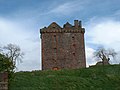 Balvaird Castle - geograph.org.uk - 3754856.jpg 640 × 480; 63 KB
-
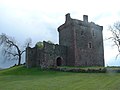 Balvaird Castle - geograph.org.uk - 3754859.jpg 640 × 480; 58 KB
-
 Balvaird Castle - geograph.org.uk - 3754866.jpg 640 × 480; 80 KB
-
 Balvaird Castle - geograph.org.uk - 5347802.jpg 640 × 480; 93 KB
-
 Balvaird Castle from the SE - geograph.org.uk - 2388053.jpg 3,729 × 1,802; 726 KB
-
 Balvaird House - geograph.org.uk - 2388114.jpg 4,005 × 1,699; 809 KB
-
 Bank of the River Tay - geograph.org.uk - 2415406.jpg 640 × 469; 106 KB
-
 Beins Law - geograph.org.uk - 3799697.jpg 640 × 300; 161 KB
-
 Bench with a view - geograph.org.uk - 1894559.jpg 640 × 480; 102 KB
-
 Bench, Carpow Hill - geograph.org.uk - 4261159.jpg 800 × 600; 423 KB
-
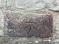 Benchmark on Abernethy Round Tower - geograph.org.uk - 6099858.jpg 640 × 480; 104 KB
-

-
 Benchmark on Mansefield, Abernethy - geograph.org.uk - 6099868.jpg 640 × 480; 137 KB
-
 Benchmark on wall, Kirkwynd, Abernethy - geograph.org.uk - 6099316.jpg 640 × 480; 127 KB
-
 Benchmark on wall, Kirkwynd, Abernethy - geograph.org.uk - 6099861.jpg 640 × 480; 140 KB
-
 Big puddles, Pitmedden Forest - geograph.org.uk - 4262623.jpg 800 × 600; 466 KB
-
 Bin lorry chassis cleansing spray - geograph.org.uk - 4004850.jpg 3,829 × 3,231; 2.9 MB
-
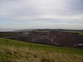 Binn Hill Landfill - geograph.org.uk - 1140981.jpg 640 × 480; 50 KB
-
 Binn Hill Landfill site - geograph.org.uk - 1140986.jpg 640 × 480; 65 KB
-
 Binn Hill Trig - geograph.org.uk - 1140974.jpg 640 × 480; 54 KB
-
 Binn road, bin lorry - geograph.org.uk - 3707824.jpg 640 × 480; 302 KB
-
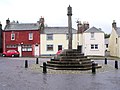
 Brass War Memorial plaques on the Market Cross, Abernethy - geograph.org.uk - 4619298.jpg 3,456 × 4,608; 3.26 MB
-
 Bridge over the River Farg - geograph.org.uk - 2367585.jpg 1,600 × 1,200; 875 KB
-
 Broadwell Farm to west of Abernethy - geograph.org.uk - 5092132.jpg 640 × 480; 46 KB
-
 Bus shelter on the A913 - geograph.org.uk - 4971254.jpg 800 × 600; 73 KB
-
 Carey - geograph.org.uk - 4096164.jpg 640 × 360; 210 KB
-
 Carey Stank - geograph.org.uk - 4413334.jpg 750 × 500; 557 KB
-
 Castle Law - geograph.org.uk - 2677166.jpg 2,000 × 1,500; 663 KB
-
 Castle Law from Abernethy Glen - geograph.org.uk - 2215730.jpg 2,049 × 2,781; 1.19 MB
-
 Castle Law near Abernethy - geograph.org.uk - 5092129.jpg 640 × 480; 47 KB
-
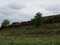
 Clear felled area, Binn Hill - geograph.org.uk - 3707823.jpg 640 × 480; 276 KB
-
 Cleared whins - geograph.org.uk - 4261188.jpg 800 × 600; 386 KB
-
 Coltsfoot - geograph.org.uk - 4415692.jpg 750 × 597; 526 KB
-
-
 Cottages at Glenfoot - geograph.org.uk - 4971249.jpg 800 × 600; 108 KB
-
 Craigden - geograph.org.uk - 2215710.jpg 1,429 × 1,600; 475 KB
-
 Cree's Inn - geograph.org.uk - 4210730.jpg 1,600 × 1,323; 823 KB
-
 Cree's Inn, Abernethy - geograph.org.uk - 2685762.jpg 768 × 1,024; 217 KB
-
 Crop field towards the A913 - geograph.org.uk - 5319891.jpg 640 × 416; 55 KB
-
 Douglas House, Abernethy - geograph.org.uk - 5017533.jpg 4,188 × 2,460; 1.55 MB
-
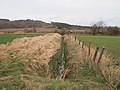 Drainage ditch, east of Elliothead - geograph.org.uk - 2367277.jpg 1,600 × 1,200; 620 KB
-
 Drooping power lines - geograph.org.uk - 1894834.jpg 480 × 640; 103 KB
-
 Duck Pond - geograph.org.uk - 1122582.jpg 640 × 480; 80 KB
-
 Dyke beside the River Earn - geograph.org.uk - 2367242.jpg 1,600 × 1,177; 421 KB
-
 Dyke repaired - geograph.org.uk - 2367646.jpg 1,600 × 1,200; 511 KB
-
 Earn - Tay confluence - geograph.org.uk - 4261164.jpg 800 × 600; 409 KB
-
 Eastbound train on the line from Perth to Ladybank - geograph.org.uk - 2367602.jpg 1,600 × 1,200; 606 KB
-
 Edge of Pitmedden Forest - geograph.org.uk - 4261205.jpg 800 × 600; 452 KB
-
 Embankment beside the River Earn - geograph.org.uk - 2338241.jpg 1,600 × 1,200; 571 KB
-
 Fallen trees, Pitmedden Forest - geograph.org.uk - 4262488.jpg 800 × 600; 529 KB
-
 Fargie Bridge - geograph.org.uk - 4413244.jpg 750 × 500; 737 KB
-
 Farm at West Greenside, Abernethy - geograph.org.uk - 5091923.jpg 640 × 451; 69 KB
-
 Farm road, Pittuncarty - geograph.org.uk - 4095956.jpg 640 × 360; 203 KB
-
 Farmland and forest above Glentarkie - geograph.org.uk - 5092100.jpg 640 × 480; 53 KB
-
 Farmland and forestry on Dumbarrow Hill - geograph.org.uk - 3391193.jpg 640 × 427; 280 KB
-
 Farmland at Carey - geograph.org.uk - 4413264.jpg 750 × 500; 518 KB
-
 Farmland at Pitmenzies - geograph.org.uk - 2055184.jpg 640 × 480; 53 KB
-
 Farmland east of Colzie - geograph.org.uk - 2055202.jpg 640 × 480; 77 KB
-
 Farmland near South Colzie, Fife - geograph.org.uk - 6099876.jpg 640 × 480; 48 KB
-
 Farmland on Binn Hill - geograph.org.uk - 3232733.jpg 640 × 419; 247 KB
-
 Farmland to west of Abernethy - geograph.org.uk - 5091920.jpg 640 × 480; 47 KB
-
 Felled area - geograph.org.uk - 4260220.jpg 800 × 600; 440 KB
-
 Field of dandelion clocks - geograph.org.uk - 1894839.jpg 640 × 480; 105 KB
-
 Field of rape - geograph.org.uk - 2948669.jpg 2,048 × 1,536; 987 KB
-
 Field of straw bales, near Abernethy - geograph.org.uk - 2672082.jpg 1,600 × 1,200; 467 KB
-
 Flooding, Easter Rhynd - geograph.org.uk - 4261167.jpg 800 × 600; 394 KB
-
 Forest edge - geograph.org.uk - 1591206.jpg 640 × 480; 50 KB
-

-
 Forestry entrance - geograph.org.uk - 1894583.jpg 640 × 480; 103 KB
-

-
 Gas tank and farm building at Pittuncarty - geograph.org.uk - 4965870.jpg 1,024 × 768; 102 KB
-
 Gattaway Hill - geograph.org.uk - 4262480.jpg 800 × 600; 394 KB
-
 Glen Farg - geograph.org.uk - 3707818.jpg 480 × 640; 359 KB
-
 Glen Farg - geograph.org.uk - 3707821.jpg 640 × 853; 580 KB
-
 Glen Farg - geograph.org.uk - 3707822.jpg 640 × 480; 316 KB
-

-
 Glen Tarkie Hill - geograph.org.uk - 1122589.jpg 640 × 480; 59 KB
-
 Glen Wood, Pitmedden Forest - geograph.org.uk - 4816340.jpg 1,024 × 683; 393 KB
-
 Glenfoot - geograph.org.uk - 1039723.jpg 640 × 480; 79 KB
-
 Glenfoot - geograph.org.uk - 4095385.jpg 640 × 360; 244 KB
-
 Historic Scotland, Abernethy Round Tower plaque - geograph.org.uk - 4619322.jpg 2,979 × 3,834; 2.49 MB
-
 Jamesfield - geograph.org.uk - 4261178.jpg 800 × 600; 417 KB
-
 Jamesfield Garden Centre near Abernethy - geograph.org.uk - 2670160.jpg 1,024 × 457; 74 KB
-
 Jamesfield Organic Centre - geograph.org.uk - 1134309.jpg 640 × 480; 101 KB
-
 Jougs and a Pictish Stone - geograph.org.uk - 4619337.jpg 3,089 × 4,019; 2.73 MB
-
 Kirklands, Kirk Wynd, Abernethy - geograph.org.uk - 6099864.jpg 480 × 640; 101 KB
-
 Landfill site - geograph.org.uk - 2677136.jpg 2,000 × 1,500; 483 KB
-
 Landfill site - geograph.org.uk - 2677151.jpg 2,000 × 1,500; 487 KB
-
 Larches, Pitmedden Forest - geograph.org.uk - 4261193.jpg 800 × 600; 547 KB
-
 Leden Urquhart Road - geograph.org.uk - 4965866.jpg 1,024 × 615; 84 KB
-
 Lochmill Loch - geograph.org.uk - 4261146.jpg 800 × 600; 437 KB
-

-

-

-
 Lumbennie Hill - geograph.org.uk - 4095971.jpg 2,560 × 1,920; 2.22 MB
-
 Main Street, Abernethy - geograph.org.uk - 1895922.jpg 640 × 480; 75 KB
-
 Main Street, Abernethy - geograph.org.uk - 5094761.jpg 640 × 480; 58 KB
-
 Mansefield, Station Road, Abernethy - geograph.org.uk - 6099869.jpg 640 × 480; 60 KB
-

-

-
 Marsh, Pitmedden Forest - geograph.org.uk - 4262613.jpg 800 × 600; 499 KB
-
 Masonic Lodge, Abernethy, Perthshire - geograph.org.uk - 3006268.jpg 3,008 × 2,000; 2.37 MB
-
 Mill Burn - geograph.org.uk - 3799668.jpg 640 × 480; 265 KB
-
 Minor road entering Fife - geograph.org.uk - 5092094.jpg 640 × 480; 123 KB
-

-
 Minor road through Abernethy Glen - geograph.org.uk - 5092109.jpg 640 × 480; 79 KB
-
 Muddy Track - geograph.org.uk - 1122987.jpg 640 × 480; 80 KB
-
 Mugdrum Island - geograph.org.uk - 4261174.jpg 800 × 600; 405 KB
-
 Mugdrum Island - geograph.org.uk - 4261175.jpg 800 × 600; 329 KB
-
 Museum of Abernethy - geograph.org.uk - 4619489.jpg 3,019 × 4,332; 2.24 MB
-
 Narrow ride, Turflundie Wood - geograph.org.uk - 4262486.jpg 800 × 1,067; 747 KB
-
 Newly sown field north of Elliothead - geograph.org.uk - 2367258.jpg 1,600 × 1,059; 413 KB
-
 Newly sown field, south of Culfargie - geograph.org.uk - 2367350.jpg 1,600 × 1,200; 688 KB
-
 Newly sown field, south of Elliothead - geograph.org.uk - 2367225.jpg 1,600 × 1,200; 576 KB
-
 No contour lines here - geograph.org.uk - 4413848.jpg 750 × 500; 547 KB
-
 Oilseed rape harvest - geograph.org.uk - 4095393.jpg 640 × 360; 234 KB
-
 Old water intake - geograph.org.uk - 3552346.jpg 530 × 800; 137 KB
-
 Open land, Pitmedden Forest - geograph.org.uk - 4261202.jpg 800 × 600; 426 KB
-
 Parish Church of Abernethy, Dron and Arngask - geograph.org.uk - 4619451.jpg 4,608 × 3,456; 3.01 MB
-
 Parking area at Pitmedden Wood - geograph.org.uk - 4967832.jpg 800 × 533; 148 KB
-
 Pictish symbol stone at Abernethy - geograph.org.uk - 3531252.jpg 462 × 640; 108 KB
-
 Pitcairlie Hill - geograph.org.uk - 4261152.jpg 800 × 600; 407 KB
-
 Pitcairlie Hill - geograph.org.uk - 4261155.jpg 800 × 600; 412 KB
-
 Pitcairlie Hill - geograph.org.uk - 4261156.jpg 800 × 600; 395 KB
-
 Pitmedden Forest - geograph.org.uk - 4260166.jpg 800 × 600; 371 KB
-
 Pitmedden Forest - geograph.org.uk - 4260192.jpg 800 × 600; 429 KB
-
 Pitmedden Forest - geograph.org.uk - 4260195.jpg 800 × 600; 514 KB
-
 Pitmedden Forest - geograph.org.uk - 4260199.jpg 800 × 600; 522 KB
-
 Pitmedden Forest - geograph.org.uk - 4261150.jpg 800 × 600; 435 KB
-
 Pitmedden Forest - geograph.org.uk - 4261184.jpg 800 × 600; 428 KB
-
 Pitmedden Forest - geograph.org.uk - 4261190.jpg 800 × 600; 490 KB
-
 Pitmedden Forest - geograph.org.uk - 4262619.jpg 800 × 600; 528 KB
-
 Pitmedden Forest - geograph.org.uk - 4262627.jpg 800 × 600; 540 KB
-
 Pitmedden Forest - geograph.org.uk - 4262630.jpg 800 × 600; 499 KB
-
 Pitmedden Wood - geograph.org.uk - 4260177.jpg 800 × 600; 404 KB
-
 Pitmedden Wood - geograph.org.uk - 4260181.jpg 800 × 600; 483 KB
-
 Pitmedden Wood - geograph.org.uk - 4260186.jpg 800 × 600; 519 KB
-
 Pitmedden Wood - geograph.org.uk - 4260188.jpg 800 × 600; 491 KB
-
 Pitmedden Wood - geograph.org.uk - 4260191.jpg 800 × 600; 526 KB
-
 Pittuncarty straw rows - geograph.org.uk - 4816203.jpg 1,024 × 683; 320 KB
-
 Pond below Big Garret - geograph.org.uk - 1591924.jpg 640 × 359; 89 KB
-
 Power line descends Pitcairlie Hill - geograph.org.uk - 1884999.jpg 1,280 × 1,280; 344 KB
-
 Power lines, Carpow - geograph.org.uk - 4095406.jpg 640 × 360; 226 KB
-
 Pylons, Lumbennie Hill - geograph.org.uk - 6099866.jpg 480 × 640; 57 KB
-
 Quarry above Abernethy - geograph.org.uk - 1039708.jpg 640 × 480; 164 KB
-
 River Earn - geograph.org.uk - 4095410.jpg 640 × 360; 219 KB
-
 River Farg - geograph.org.uk - 2367334.jpg 1,600 × 1,200; 946 KB
-
 Road east of Raemore - geograph.org.uk - 1884990.jpg 1,280 × 854; 232 KB
-
 Road from Barclayfield - geograph.org.uk - 3552351.jpg 530 × 800; 143 KB
-
 Road junction near Pittuncarty - geograph.org.uk - 4966100.jpg 1,024 × 768; 214 KB
-
 Road junction, Pitmedden Forest - geograph.org.uk - 4260211.jpg 800 × 600; 370 KB
-
 Road near Balvaird - geograph.org.uk - 4816668.jpg 1,024 × 683; 291 KB
-
 Road to Barclayfield - geograph.org.uk - 3552349.jpg 625 × 800; 169 KB
-
 Road to Cordon - geograph.org.uk - 4096172.jpg 640 × 360; 222 KB
-
 Road to Raemore - geograph.org.uk - 1894599.jpg 640 × 480; 102 KB
-
 Road, Carpow - geograph.org.uk - 4096174.jpg 640 × 360; 231 KB
-
 Road, Pitmedden Forest - geograph.org.uk - 4261197.jpg 800 × 600; 364 KB
-
 Roadside gorse - geograph.org.uk - 2388166.jpg 4,288 × 2,848; 2.94 MB
-
 Rocky North Side of Castle Law - geograph.org.uk - 1063499.jpg 640 × 480; 93 KB
-
 Rough Glen - geograph.org.uk - 2677191.jpg 2,000 × 1,500; 975 KB
-
 Rough road, Beins Hill - geograph.org.uk - 4816659.jpg 1,024 × 683; 398 KB


_-_geograph.org.uk_-_4619536.jpg)
_-_geograph.org.uk_-_4619551.jpg)
_-_geograph.org.uk_-_4619568.jpg)
_-_geograph.org.uk_-_4619577.jpg)
_-_geograph.org.uk_-_4619587.jpg)


&filefrom=Rough+road%2C+Beins+Hill+-+geograph.org.uk+-+4816661.jpg#mw-category-media)