Category:Aby with Greenfield
English: Aby with Greenfield is a civil parish in the East Lindsey district of Lincolnshire, England. It consists of the villages of Aby and Greenfield.
civil parish in Lincolnshire, UK | |||||
| Upload media | |||||
| Instance of | |||||
|---|---|---|---|---|---|
| Location | East Lindsey, Lincolnshire, East Midlands, England | ||||
 | |||||
Media in category "Aby with Greenfield"
The following 58 files are in this category, out of 58 total.
-
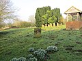
 A Graveyard - geograph.org.uk - 1950570.jpg 800 × 533; 127 KB
-
 Aby bridge through the trees - geograph.org.uk - 1960818.jpg 640 × 480; 105 KB
-
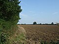
 Aby farmland - geograph.org.uk - 1738016.jpg 640 × 426; 83 KB
-
 Across the fields from Aby Grange - geograph.org.uk - 3854305.jpg 640 × 427; 62 KB
-

-

-
-
 Bend in Rye Lane at Mother Wood - geograph.org.uk - 2693198.jpg 1,280 × 960; 535 KB
-
 Buildings at Aby Grange Farm - geograph.org.uk - 3655514.jpg 640 × 427; 58 KB
-
 Burial Ground near Aby - geograph.org.uk - 6073108.jpg 3,716 × 2,787; 2.61 MB
-

-

-
 Crop field and Grange Plantation near Claythorpe - geograph.org.uk - 2693182.jpg 1,280 × 960; 230 KB
-
 Disused railway bridge - geograph.org.uk - 1950524.jpg 800 × 533; 129 KB
-
 Disused Railway bridge, near Aby - geograph.org.uk - 2693179.jpg 1,280 × 960; 498 KB
-
 Disused railway bridge, near Aby - geograph.org.uk - 4657910.jpg 640 × 480; 94 KB
-
 Farm track beside disused railway - geograph.org.uk - 4682914.jpg 640 × 480; 41 KB
-
 Farm Track off Rye Lane - geograph.org.uk - 2693186.jpg 1,280 × 960; 985 KB
-
 Field beside Grange Plantation - geograph.org.uk - 4657899.jpg 640 × 480; 87 KB
-
 Field near Aby Barn Farm - geograph.org.uk - 4657905.jpg 640 × 480; 93 KB
-
 Footbridge over stream - geograph.org.uk - 1950581.jpg 800 × 533; 195 KB
-

-
 Footpath running through cornfield - geograph.org.uk - 1950534.jpg 683 × 1,024; 356 KB
-
 Footpath to Aby across the field - geograph.org.uk - 3552571.jpg 2,256 × 1,504; 2.2 MB
-
 Footpath to Claythorpe - geograph.org.uk - 3655508.jpg 640 × 427; 103 KB
-
 Freshly cleared dyke by Mother Wood - geograph.org.uk - 3954254.jpg 640 × 427; 81 KB
-

-
 Greenfield Farm and hayfield - geograph.org.uk - 3552567.jpg 2,256 × 1,504; 1.73 MB
-
 Greenfield Lane - geograph.org.uk - 1738011.jpg 640 × 426; 57 KB
-
 Greenfield Lane - geograph.org.uk - 3070158.jpg 2,256 × 1,504; 2.32 MB
-
 Greenfield Lane approaching Greenfield Farm - geograph.org.uk - 6074990.jpg 4,000 × 3,000; 3.6 MB
-

-
 Heading south west near Claythorpe - geograph.org.uk - 4682912.jpg 640 × 480; 86 KB
-
 Junction of lanes at Devil's Square - geograph.org.uk - 6074985.jpg 4,000 × 3,000; 4.15 MB
-

-

-
 Mill Stream at Claythorpe - geograph.org.uk - 1960811.jpg 640 × 480; 120 KB
-
 Minor road near Aby Barn Farm - geograph.org.uk - 4682911.jpg 640 × 480; 76 KB
-
 Minor road towards Claythorpe - geograph.org.uk - 4682910.jpg 640 × 480; 66 KB
-

-
 Old railway course into Swinn Wood - geograph.org.uk - 3657469.jpg 640 × 427; 56 KB
-
-
 Pigeon holes, Aby Grange Farm - geograph.org.uk - 3655515.jpg 640 × 427; 81 KB
-
 Road junction at Claythorpe - geograph.org.uk - 1960803.jpg 640 × 480; 65 KB
-
 School Lane in Aby - geograph.org.uk - 6071225.jpg 4,000 × 3,000; 3.31 MB
-

-
 Stubble field near Trout Farm - geograph.org.uk - 4682915.jpg 640 × 480; 55 KB
-
 Swinn Wood - geograph.org.uk - 1738014.jpg 640 × 426; 128 KB
-
 Track into Swinn Wood - geograph.org.uk - 3359935.jpg 1,024 × 768; 208 KB
-
 Track into Swinn Wood - geograph.org.uk - 3552563.jpg 2,256 × 1,504; 3.05 MB
-
 View from Greenfield Lane - geograph.org.uk - 3359979.jpg 1,024 × 768; 92 KB
-

-

-

-
 Wetland at Belleau Bridge - geograph.org.uk - 3457962.jpg 640 × 427; 115 KB
-

-

-


