Category:Achnasheen
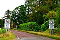
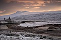
English: Achnasheen ( Gaelic Achadh na Sìne) is a small village in Ross-shire in the Highland council area of Scotland. Despite the size of the village, Achnasheen is also the name of a postal district which covers several much larger communities. This dates from the time when the village railway station was an important stop on the Kyle of Lochalsh Line, serving a large area of Wester Ross. The railway still operates but all freight and mail, and most passengers, now travel by road.
Nederlands: Achnasheen ( Schots-Gaelisch: Achadh na Sine) is een klein dorpje in Ross and Cromarty in de Schotse Hooglanden.
human settlement in Highland, Scotland, UK  | |||||
| Upload media | |||||
| Instance of | |||||
|---|---|---|---|---|---|
| Location |
| ||||
| Elevation above sea level |
| ||||
 | |||||
Subcategories
This category has the following 5 subcategories, out of 5 total.
A
- Achnasheen railway station (56 F)
C
- Loch a' Chroisg, Achnasheen (27 F)
F
- Fionn Bheinn (37 F)
G
- Loch Gowan (22 F)
L
Media in category "Achnasheen"
The following 134 files are in this category, out of 134 total.
-
 A 360 degree panoramic view from the Bealach a' Chomhla - panoramio.jpg 18,646 × 1,888; 3.46 MB
-
 A832 enters Achnasheen - geograph.org.uk - 2472195.jpg 3,648 × 2,317; 1.02 MB
-
 Achnasheen - geograph.org.uk - 1742063.jpg 800 × 600; 239 KB
-
 Achnasheen - geograph.org.uk - 1777970.jpg 640 × 480; 85 KB
-
 Achnasheen for Fionn Bheinn - geograph.org.uk - 2778954.jpg 1,024 × 685; 143 KB
-

-
 Achnasheen Post Office - geograph.org.uk - 832282.jpg 640 × 480; 86 KB
-
 Achnasheen Primary School - geograph.org.uk - 1380946.jpg 640 × 480; 60 KB
-
 Achnasheen Primary School - geograph.org.uk - 3647546.jpg 1,280 × 960; 794 KB
-
 Achnasheen R.O.C. Post - geograph.org.uk - 375246.jpg 640 × 373; 36 KB
-
 Achnasheen roundabout - geograph.org.uk - 3647648.jpg 1,280 × 885; 935 KB
-
 Achnasheen terraces - geograph.org.uk - 3636138.jpg 1,280 × 960; 1.18 MB
-
 Achnasheen.jpg 448 × 336; 81 KB
-
 Approaching Achnasheen Plantation - geograph.org.uk - 3001213.jpg 640 × 480; 239 KB
-
 Beinn a'Chearcaill summit - panoramio - SteveMi.jpg 2,560 × 1,920; 2.4 MB
-
 Beinn a'Chearcaill summit - panoramio.jpg 2,560 × 1,920; 2.36 MB
-
 Boggy Pass near Achnasheen - geograph.org.uk - 36996.jpg 640 × 480; 80 KB
-
 Closed Filling Station - geograph.org.uk - 1865931.jpg 638 × 450; 50 KB
-
 Coire Dubh Mhor, Torridon. - panoramio.jpg 1,726 × 762; 1.18 MB
-
 Coire Dubh Mhor, Torridons. - panoramio.jpg 2,048 × 1,536; 620 KB
-
 Deer on the 'back road' - geograph.org.uk - 518456.jpg 640 × 395; 73 KB
-
 Derelict cottage of Druimdhu near Achnasheen - geograph.org.uk - 3512667.jpg 4,000 × 3,000; 2.63 MB
-
 Descending from Fionn Bheinn - geograph.org.uk - 533870.jpg 800 × 561; 215 KB
-
 Disused petrol station at Achnasheen - geograph.org.uk - 4215789.jpg 1,600 × 1,064; 689 KB
-
 Entrance to Ledgowan Lodge Hotel - geograph.org.uk - 3647623.jpg 1,280 × 960; 1.25 MB
-
 'The Pipe' - geograph.org.uk - 1233890.jpg 640 × 480; 219 KB
-
 Foxglove v. Torridons. (Loch Clair). - panoramio.jpg 2,707 × 2,742; 7.58 MB
-
 Glaciated slabs, Toll Beag - geograph.org.uk - 49628.jpg 640 × 480; 285 KB
-
 Heather Covered Gully - geograph.org.uk - 248704.jpg 480 × 640; 118 KB
-
 Houses at Achnasheen - geograph.org.uk - 2213828.jpg 640 × 480; 93 KB
-
 Insbildvordrängler - panoramio (2).jpg 2,248 × 4,000; 3.1 MB
-
 Inver Croft House - geograph.org.uk - 618656.jpg 640 × 480; 95 KB
-
 Isolated House in the Scottish Highands - panoramio.jpg 4,320 × 3,240; 3.16 MB
-
 It Might Be Snow - panoramio.jpg 4,320 × 3,240; 4.84 MB
-
 Kyle Line, Achnasheen - geograph.org.uk - 9604.jpg 640 × 454; 50 KB
-
 Lady In Red - panoramio (18).jpg 4,000 × 3,000; 3.43 MB
-
 Lambs at Ledgowan - geograph.org.uk - 167036.jpg 640 × 426; 152 KB
-
 Late afternoon nearing Torridon village. - panoramio.jpg 1,536 × 826; 595 KB
-
 Ledgowan Lodge - geograph.org.uk - 3217373.jpg 640 × 480; 257 KB
-
 Ledgowan Lodge - geograph.org.uk - 3647611.jpg 1,280 × 960; 1.06 MB
-
 Ledgowan Lodge Hotel - geograph.org.uk - 3223033.jpg 640 × 360; 235 KB
-
 Lily pond at Achnasheen - geograph.org.uk - 937185.jpg 640 × 480; 224 KB
-
 Loch a'Chroisg's area on summer - panoramio (1).jpg 4,896 × 3,672; 3.31 MB
-
 Loch a'Chroisg's area on summer - panoramio.jpg 4,896 × 3,672; 6.79 MB
-
 Looking long the river Bran - geograph.org.uk - 955214.jpg 640 × 480; 174 KB
-
 Looking south from Achnasheen - geograph.org.uk - 955208.jpg 640 × 480; 176 KB
-
 Monster - panoramio (4).jpg 4,320 × 3,240; 4.64 MB
-
 My Best View From An Accommodation - panoramio.jpg 4,000 × 2,248; 1.68 MB
-
 Near Achnasheen - geograph.org.uk - 40112.jpg 640 × 480; 91 KB
-
 Old building and Telephone box - geograph.org.uk - 1380933.jpg 640 × 480; 114 KB
-
 Old Fence - geograph.org.uk - 248758.jpg 640 × 480; 106 KB
-
 Ordnance Survey One-Inch Sheet 26 Loch Maree & Achnasheen, Published 1947.jpg 12,252 × 9,346; 12.38 MB
-
 Ordnance Survey One-Inch Sheet 27 Strathpeffer, Published 1957.jpg 8,262 × 9,891; 11.61 MB
-
 Pond at Achnasheen - geograph.org.uk - 832299.jpg 640 × 480; 92 KB
-
 Recycling centre, Achnasheen - geograph.org.uk - 3755905.jpg 1,024 × 768; 110 KB
-
 Rock Pool, Sail an Tuim Bhain - geograph.org.uk - 49637.jpg 640 × 480; 319 KB
-
 Roundabout at Achnasheen - geograph.org.uk - 1381655.jpg 640 × 480; 72 KB
-
 Scotland190609 24C (6817647295).jpg 1,445 × 740; 194 KB
-
 Scotland190609 26C (6817647575).jpg 1,442 × 842; 208 KB
-
 Shed at Achnasheen - geograph.org.uk - 1214321.jpg 640 × 427; 175 KB
-
 Shed at Achnasheen - geograph.org.uk - 1777963.jpg 640 × 480; 95 KB
-
 Single Track Road With Passing Places - panoramio.jpg 3,240 × 4,320; 5.38 MB
-
 Snow covered pond at Achnasheen - geograph.org.uk - 2211172.jpg 640 × 480; 78 KB
-
 Telecoms Mast - geograph.org.uk - 247978.jpg 640 × 480; 78 KB
-
 The A832 at Achnasheen - geograph.org.uk - 4215785.jpg 1,600 × 1,064; 512 KB
-
 The road to Achnasheen - geograph.org.uk - 1380941.jpg 640 × 480; 89 KB
-
 The stables at Carnmore - geograph.org.uk - 504099.jpg 1,000 × 681; 388 KB
-
 Tin building, Achnasheen - geograph.org.uk - 3223048.jpg 640 × 480; 350 KB
-
 Welcome To Annat - panoramio.jpg 4,320 × 2,866; 5.5 MB
-
 West Over Loch Diabegas Airde - panoramio.jpg 6,452 × 3,589; 15.04 MB
-
 West to Achnasheen - geograph.org.uk - 1880118.jpg 800 × 600; 132 KB
-
 Abhainn a' Chomair, Achnasheen. - geograph.org.uk - 1066300.jpg 640 × 426; 69 KB
-
 Achnasheen - geograph.org.uk - 7583.jpg 640 × 339; 121 KB
-
 Allt a Chrosaich - geograph.org.uk - 484505.jpg 640 × 480; 144 KB
-
 Allt Achadh na Sine - geograph.org.uk - 49598.jpg 480 × 640; 152 KB
-
 Allt Mhartuin - geograph.org.uk - 537229.jpg 640 × 427; 70 KB
-
 Allt Mhartuin from the path to Scardroy - geograph.org.uk - 1004945.jpg 640 × 480; 117 KB
-
 Beinn na Ramh - geograph.org.uk - 9474.jpg 640 × 394; 47 KB
-

-
 Bog pool, Creagan nan Laogh - geograph.org.uk - 49606.jpg 640 × 480; 246 KB
-
 Bridge at Luib - geograph.org.uk - 315425.jpg 640 × 480; 82 KB
-
 Bridge on the old A832 - geograph.org.uk - 248658.jpg 640 × 480; 133 KB
-
 Bridge over the Allt Mor - geograph.org.uk - 167057.jpg 640 × 426; 187 KB
-
 Bunkhouse - geograph.org.uk - 623374.jpg 640 × 480; 143 KB
-
 Cairn, Creagan nan Laogh - geograph.org.uk - 49607.jpg 640 × 480; 251 KB
-
 Coire Mhic Fhearchair - geograph.org.uk - 248750.jpg 480 × 640; 91 KB
-
 Coire nan Laogh - geograph.org.uk - 624598.jpg 640 × 480; 122 KB
-
 Creagan nan Laogh - geograph.org.uk - 624595.jpg 640 × 480; 91 KB
-
 Double Crossing - geograph.org.uk - 167033.jpg 640 × 426; 148 KB
-
 Dramatic lighting at Achnasheen - geograph.org.uk - 358864.jpg 640 × 465; 66 KB
-
 Driveway to Lochrosque Lodge - geograph.org.uk - 247908.jpg 640 × 480; 142 KB
-
 Druim Duhb - geograph.org.uk - 49648.jpg 640 × 480; 259 KB
-
 Druimdhu - geograph.org.uk - 167052.jpg 640 × 426; 127 KB
-
 Duck pond, Achnasheen - geograph.org.uk - 49619.jpg 640 × 480; 251 KB
-
 Footbridge - geograph.org.uk - 248697.jpg 640 × 480; 114 KB
-
 Forest barrier - geograph.org.uk - 49634.jpg 480 × 640; 269 KB
-
 Forestry Plantation - geograph.org.uk - 247972.jpg 640 × 480; 107 KB
-
 Forestry Plantation above Loch Crann - geograph.org.uk - 266314.jpg 640 × 480; 108 KB
-
 Forestry plantations, Achnasheen - geograph.org.uk - 49621.jpg 640 × 480; 220 KB
-
 Frosty trees in Glen Carron - geograph.org.uk - 596146.jpg 640 × 481; 99 KB
-

-
 High Lochain - geograph.org.uk - 248799.jpg 640 × 480; 107 KB
-
 High Peatland - geograph.org.uk - 248730.jpg 640 × 480; 81 KB
-
-
 Indian Summer - geograph.org.uk - 248816.jpg 640 × 480; 116 KB
-
 Knockban Forestry Road - geograph.org.uk - 167062.jpg 640 × 426; 144 KB
-
 Large meander of the River Bran - geograph.org.uk - 431533.jpg 640 × 384; 55 KB
-
 Ledgowan Hotel - geograph.org.uk - 167050.jpg 640 × 426; 147 KB
-
 Loch Sgamhain, looking west - geograph.org.uk - 56689.jpg 640 × 439; 46 KB
-
 Mile Dubh - geograph.org.uk - 473370.jpg 640 × 480; 255 KB
-
 Mountain Stream - geograph.org.uk - 248716.jpg 480 × 640; 106 KB
-
 Narrow Road With Passing Places - geograph.org.uk - 99631.jpg 640 × 480; 96 KB
-
 Old Road at Ledgowan - geograph.org.uk - 484495.jpg 640 × 480; 120 KB
-
 Path to Strathconnon - geograph.org.uk - 138233.jpg 640 × 480; 112 KB
-
 Plateau of Meall a' Chaoruinn - geograph.org.uk - 26203.jpg 640 × 362; 58 KB
-
 River Bran - geograph.org.uk - 7585.jpg 640 × 432; 151 KB
-
 Ruined croft at Camashie - geograph.org.uk - 300562.jpg 640 × 481; 149 KB
-
 Ruins at Ledgowan - geograph.org.uk - 484477.jpg 640 × 480; 103 KB
-
 Southwest Slopes of Carn a Ghlinne - geograph.org.uk - 248604.jpg 640 × 480; 98 KB
-
 Strath Bran - geograph.org.uk - 630005.jpg 640 × 425; 135 KB
-
 Strath Bran looking east - geograph.org.uk - 56679.jpg 640 × 480; 89 KB
-
 Strathbran - geograph.org.uk - 268148.jpg 640 × 480; 67 KB
-
 Strathbran Plantation - geograph.org.uk - 268144.jpg 640 × 480; 60 KB
-
 Summit, Meall a' Chaoruinn. - geograph.org.uk - 26227.jpg 640 × 381; 55 KB
-

-
 Toll Mor - geograph.org.uk - 624578.jpg 640 × 480; 118 KB
-
 Torridon View - geograph.org.uk - 248781.jpg 640 × 480; 127 KB
-

-
 Track leading to Achnasheen Plantation - geograph.org.uk - 624563.jpg 640 × 480; 102 KB
-
 Trees on the Slopes of Aonach Dubh - geograph.org.uk - 247924.jpg 640 × 480; 102 KB
-
 Tropical Trig Point - geograph.org.uk - 248738.jpg 640 × 480; 95 KB
-

-
 Wall, Sail an Tuim Bhain - geograph.org.uk - 49623.jpg 640 × 480; 222 KB
-
 Waterfall, Feadan Duchairidh - geograph.org.uk - 26230.jpg 414 × 640; 88 KB


._-_panoramio.jpg)


.jpg)


.jpg)


.jpg)


.jpg)


.jpg)
.jpg)


