Category:Achter de Kerk 15, Gouda
| Object location | | View all coordinates using: OpenStreetMap |
|---|
 | |||||
| Upload media | |||||
| Instance of | |||||
|---|---|---|---|---|---|
| Location | Gouda, South Holland, Netherlands | ||||
| Street address |
| ||||
| Located on street | |||||
| Heritage designation |
| ||||
 | |||||
|
This is a category about rijksmonument number 16725
|
Media in category "Achter de Kerk 15, Gouda"
The following 5 files are in this category, out of 5 total.
-
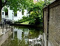 Achter de Kerk Gouda.jpg 924 × 708; 155 KB
-
 Exterieur RECHTER ZIJGEVEL - Gouda - 20272967 - RCE.jpg 1,200 × 1,192; 341 KB
-
 Exterieur TUINMUUR VAN ACHTER DE KERK 15 - Gouda - 20272969 - RCE.jpg 1,190 × 1,200; 415 KB
-
 Exterieur VOORGEVEL, RECHTER ZIJGEVEL - Gouda - 20272962 - RCE.jpg 1,192 × 1,200; 327 KB
-
 Voor- en zijgevel - Gouda - 20082230 - RCE.jpg 1,200 × 804; 228 KB


