Category:Aemilius Cool kapel
| Object location | | View all coordinates using: OpenStreetMap |
|---|
chapel in Gouda (Netherlands) | |||||
| Upload media | |||||
| Instance of | |||||
|---|---|---|---|---|---|
| Part of | |||||
| Named after |
| ||||
| Location | Gouda, South Holland, Netherlands | ||||
| Located on street | |||||
| Heritage designation | |||||
| Inception |
| ||||
 | |||||
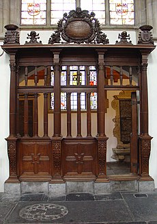
Nederlands: De grafkapel uit ongeveer 1516 bevindt zich aan de noordzijde van de Sint-Jankerk, onder glas nummer 11. De kapel is genoemd naar Aemilius Cool, hij was o.a. burgemeester van Gouda.
|
This is a category about rijksmonument number 16722
|
| Address |
|
Media in category "Aemilius Cool kapel"
The following 14 files are in this category, out of 14 total.
-
Coolkapel.jpg 1,824 × 2,592; 435 KB
-
Grafkapel van Cool - Gouda - 20081785 - RCE.jpg 951 × 1,200; 203 KB


